🗓️ February 10, 2026
🏁 Kilometers : 2361
Originally, the trail was unofficially supposed to take us across the Rakaia River, which is dangerous due to its strong current and flash floods; several people have lost their lives there. Officially therefore, crossing major rivers is no longer part of the official route, and shuttles can be arranged to bypass the main waterways—the shuttle we're taking this morning with Natalie and Yvan. The bridge that allows us to cross the river is located 30 kilometers downstream, so it's a 60-kilometer detour. In three days, we'll have to repeat the process with a second major waterway, this time with a 130-kilometer detour.
The Rakaia River mostly spreads out into several small branches within a very wide, rocky riverbed, sometimes reaching several kilometers in width. When not in flood, it has an average flow of 200 cubic meters per second, seemingly small compared to the Rhône river in France, which has a flow of 1,700 cubic meters per second. But during heavy rainfall, its flow can increase fifteenfold, becoming a monstrous, tumultuous torrent. Stretching 150 kilometers, it is spanned by only two bridges: a short one near a gorge and a second, lower one, two kilometers long—the longest in New Zealand.
After making the detour, the shuttle drops us off around noon, and we hike 21 kilometers that afternoon. The first sixteen kilometers are easy; the trail climbs gently at first and then continues across a kind of plateau surrounded by magnificent, treeless peaks covered only in yellowing grass and scree. The wind makes the grass dance, swaying in waves and taking on golden hues. However, the last five kilometers section are in a riverbed, which is fun but very technical and exhausting.
The weather was magnificent all day, and the sun is still shining when we set up camp around 7 p.m. on a small V-shaped platform where two small rivers meet. I take a dip in the icy water and dried off in the sun on a large, flat rock. We have dinner with other hikers who had joined us. Clouds begin to gather, and a light rain starts to fall just as I decide to go to bed.
Camping in such a stunning spot! What more could you ask for!?
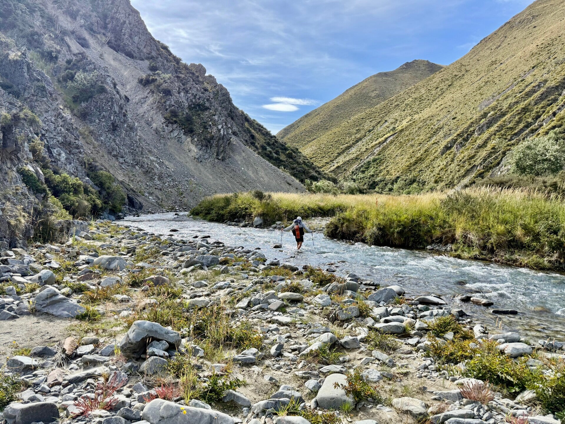
🗓️ February 11, 2026
🏁 Kilometers : 2397
We all experience the symptoms of having wet feet every day, and today will be no different. Within minutes, we have to cross the same river several times before the trail leads us uphill to a mountain pass, once again surrounded by breathtaking scenery. Even though we're only at 1500 meters altitude, the peaks resemble those of high mountains, like those in the French Alps above 3000 meters. We trek through long scree slopes and then descend, following a track through tall grass that's treacherous because of the holes it conceals. I fall victim a few times, taking grotesque tumbles or ending up knee-deep in mud.
The trail then levels out a bit, and we finish the day walking through fields of lush, yellowing grass, surrounded by grassy hills and a few rocky peaks.
I'm camping alone tonight, my hiking companions having stopped a few kilometers before me. But that's fine, I'm feeling very tired so I'm preparing my dinner and going to bed early!
🗓️ February 12, 2026
🏁 Kilometers : 2409
I woke up this morning to a bitterly cold morning and ate breakfast snuggled up in my sleeping bag. Stepping out of the tent, I am treated to a magnificent sunrise, alone in this vast expanse of grass. As I start walking, I am struck by the silence, so I stop, even holding my breath to concentrate on every sound, but it is complete silence! Not a sound, no wind, no running water, no birds, no insects, no roads, no planes, no machinery… it's rare to find yourself in such a profound silence! Fascinating!
As I near the end of the section, I find myself at the top of a hill that I have to descend. Before me stretches an entire valley that had been used in the Lord of the Rings films to represent Rohan, with the small hill on which Edoras Castle stood, the River Rangitata branching into multiple streams, and the high, snow-capped peaks in the background. Fans of the saga will understand the joy of contemplating this view!
Upon reaching the gravel road that provides tourists access to the site, I start hitchhiking, but it is only 10:30 a.m., and cars are scarce. I have to wait almost three hours before being picked up by a vehicle, and luckily, it is heading directly to my destination: the town of Geraldine, where I will spend the night and stock up on supplies for the coming days.
Pictures from February 10, 2026


Pictures from February 11, 2026


Pictures from February 12, 2026


Add comment
Comments