🗓️ December 31, 2025
🏁 Kilometers : 1631
We're starting early today because we have a long day ahead, not so much in terms of distance—we're only covering about twenty kilometers—but in terms of elevation gain, with approximately 1,300 meters of muddy, poorly maintained trails to climb. We're planning a four-day trek, five if the weather is bad.
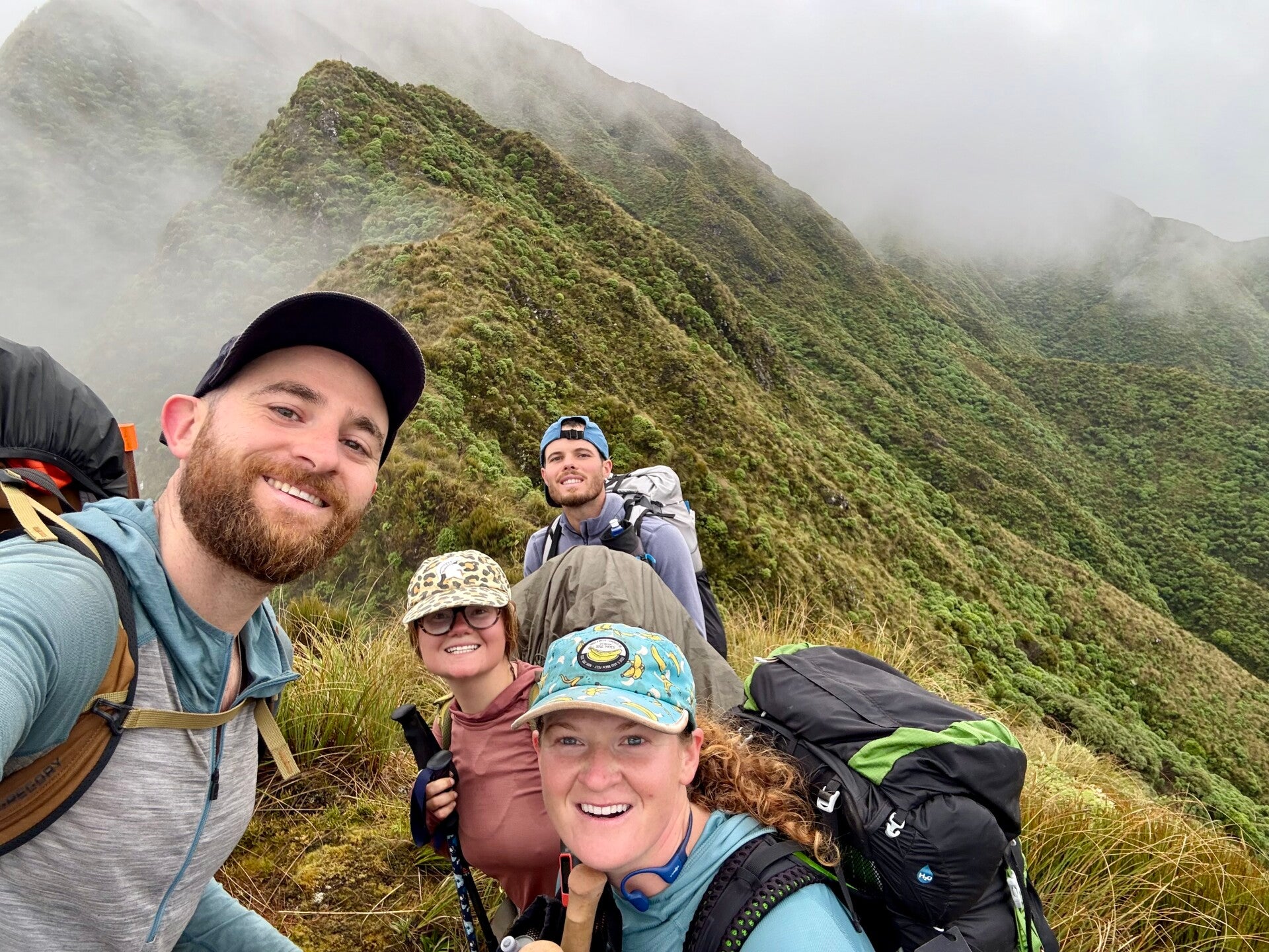
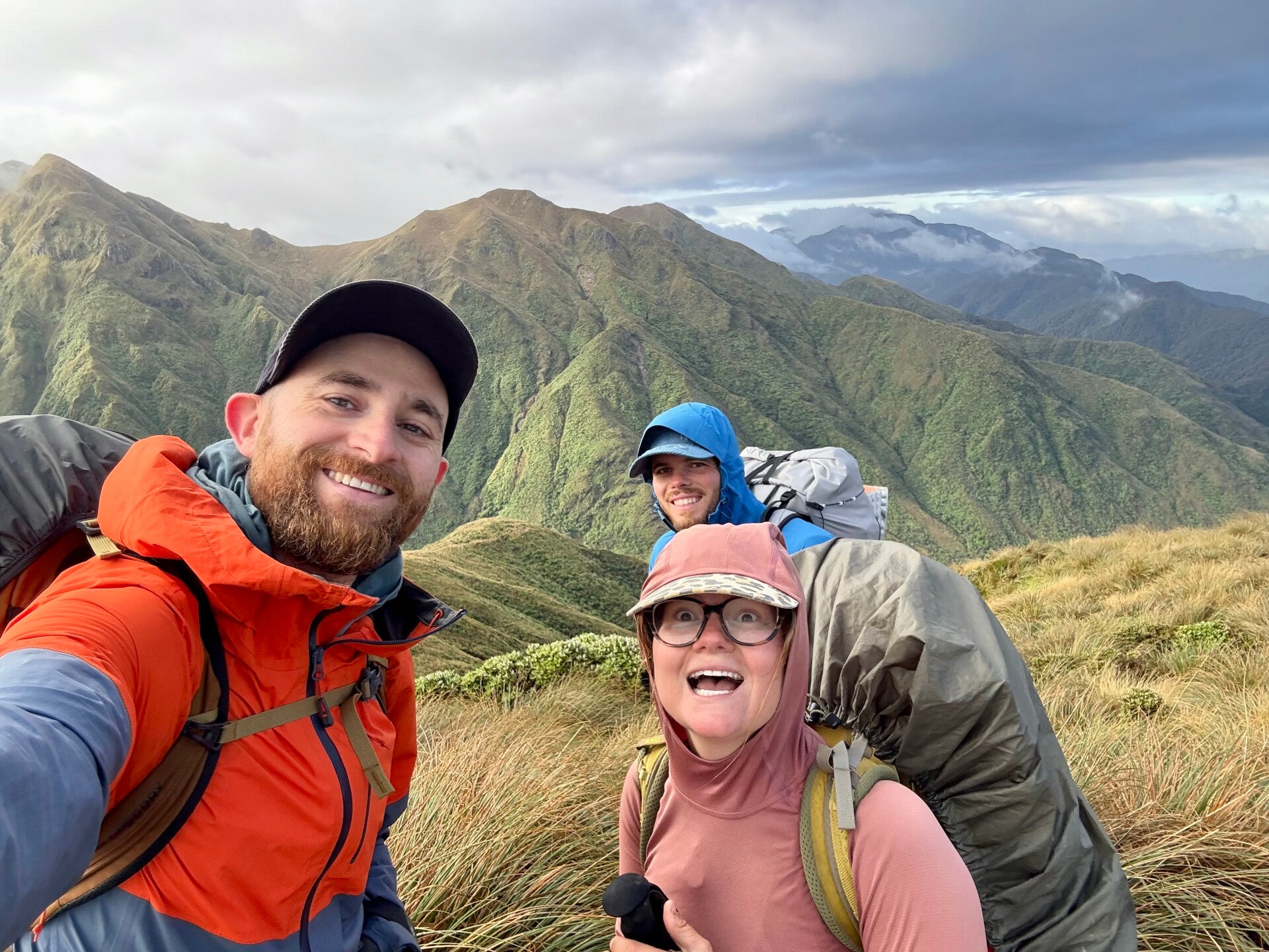
I'm accompanied by Natalie, Jolly, and Matteo for this section. We're walking along a flat track for a few kilometers before turning off across fields. Ahead of us, we can see the forested mountains rising from the ground, a stark contrast to the flat expanse of grass we're crossing. At their base, the trail climbs steeply, and it will take us four hours to reach the first hut on the route, where we'll have our lunch break.
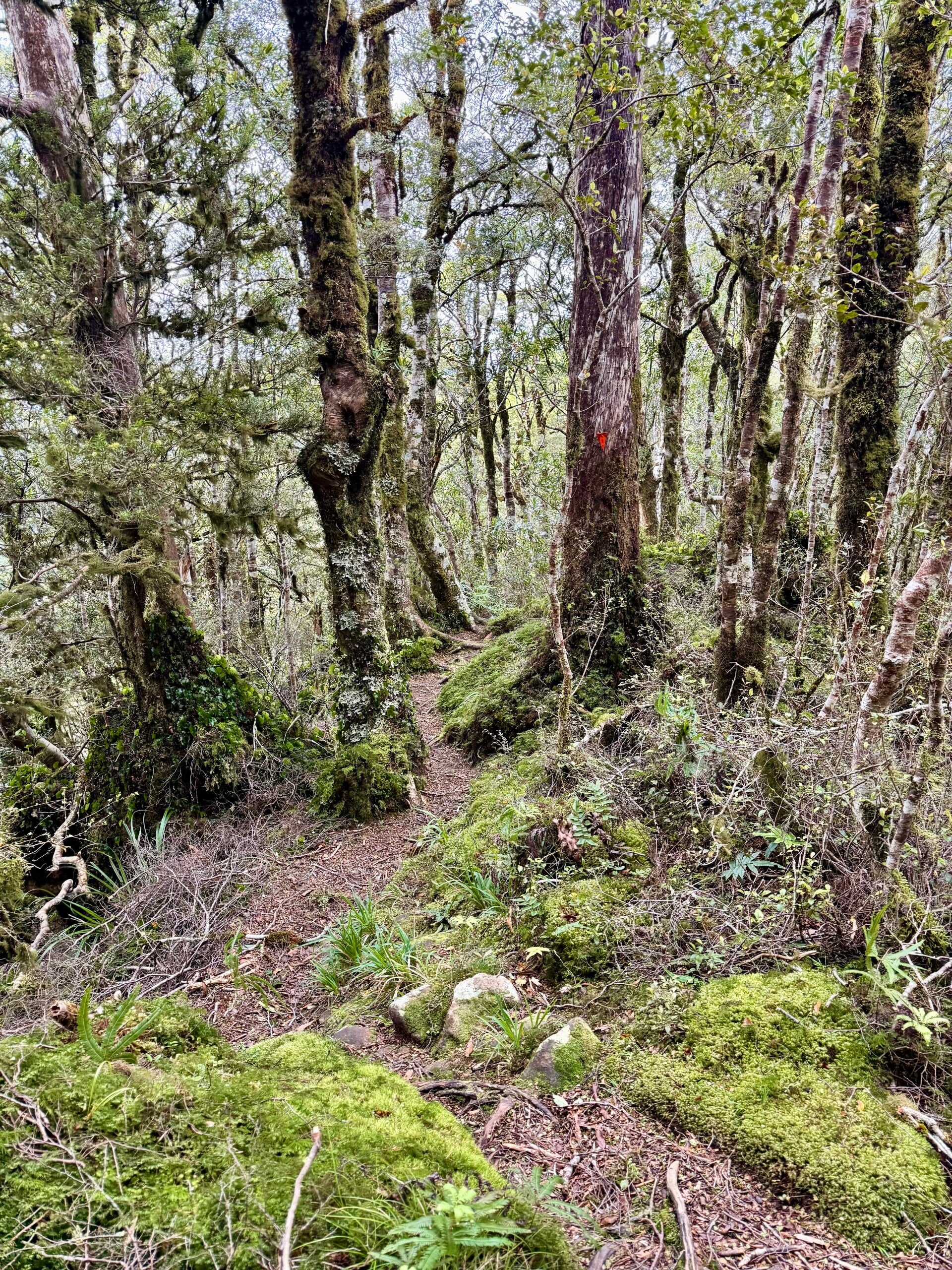
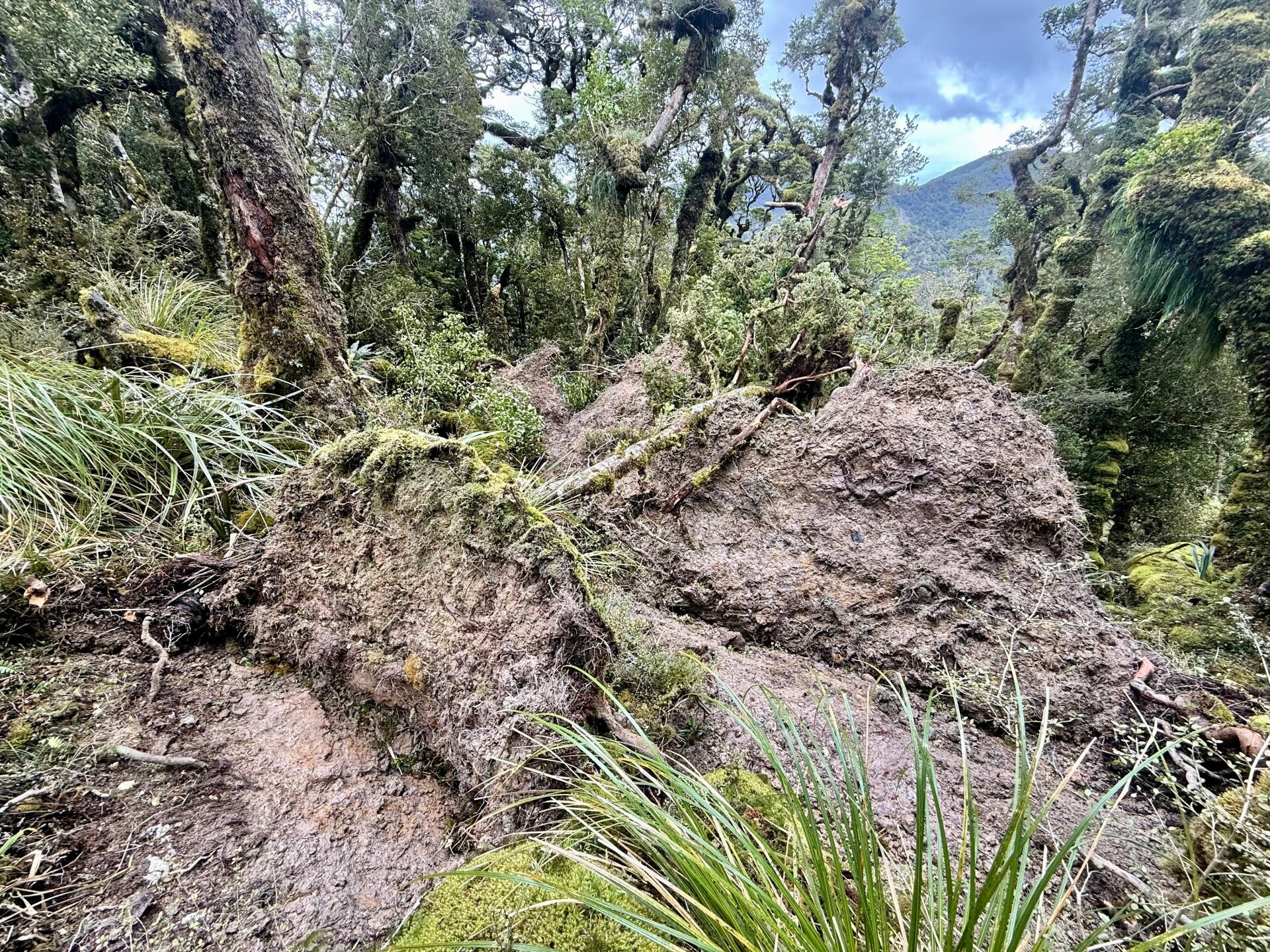
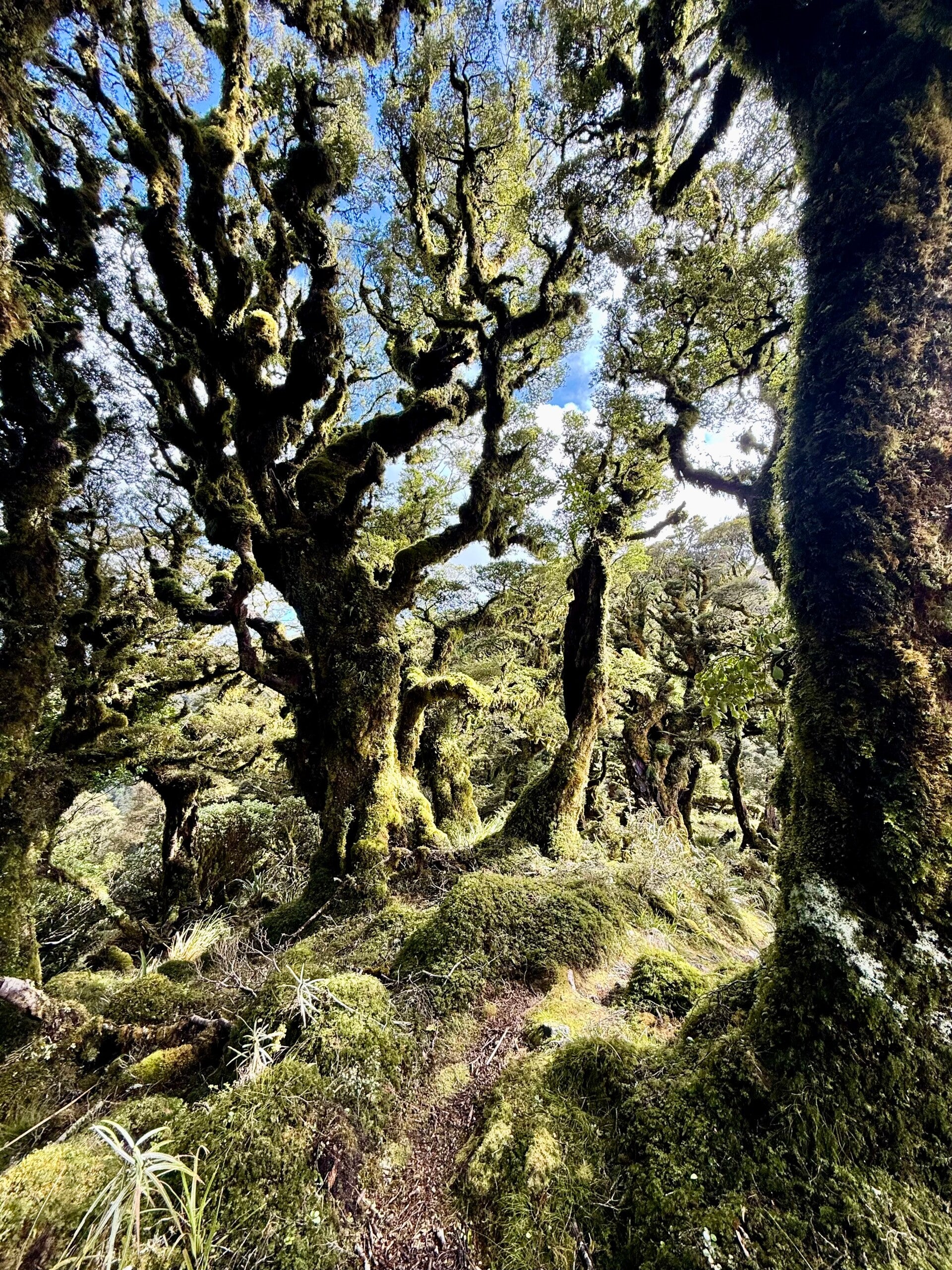
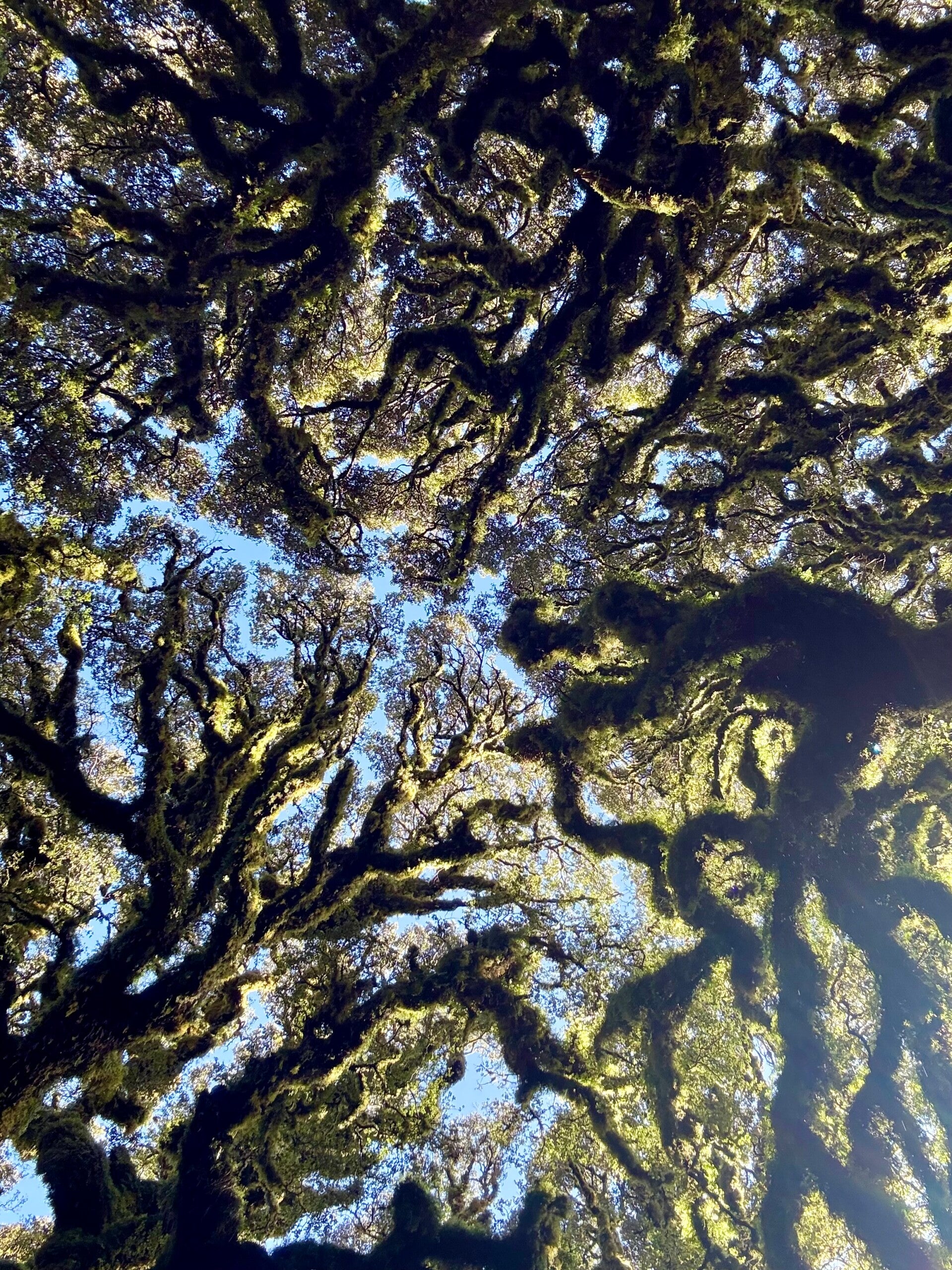
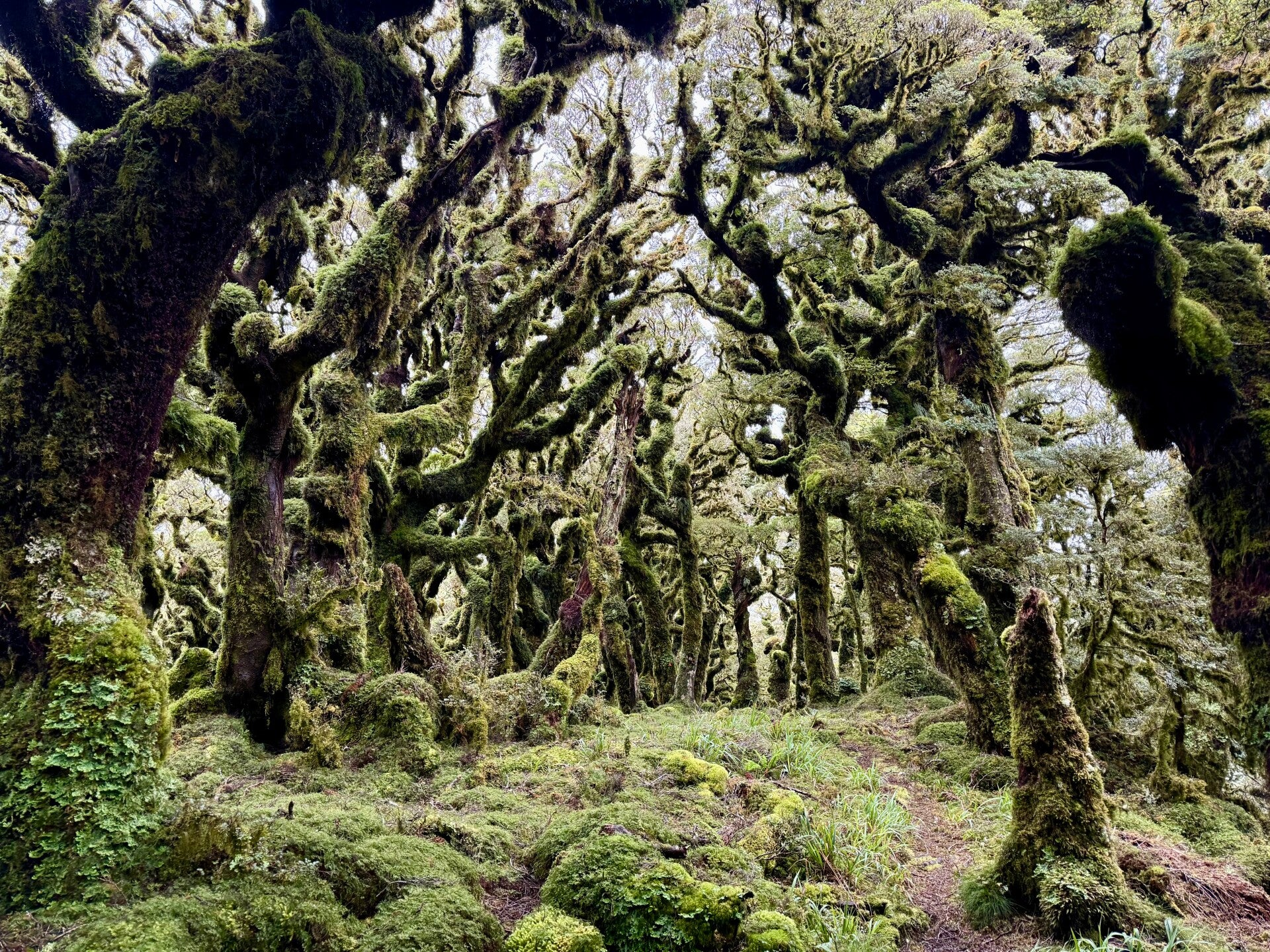
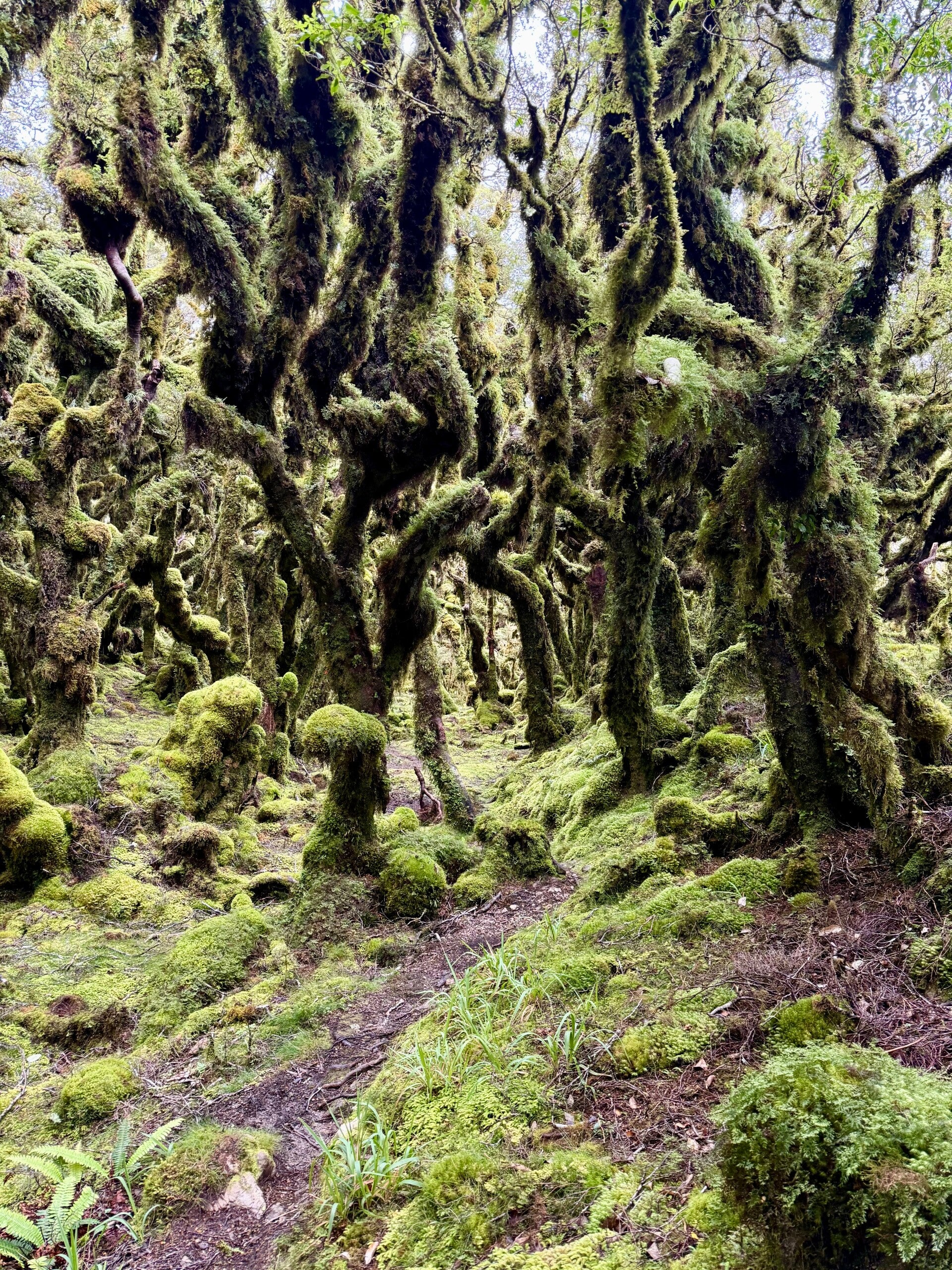
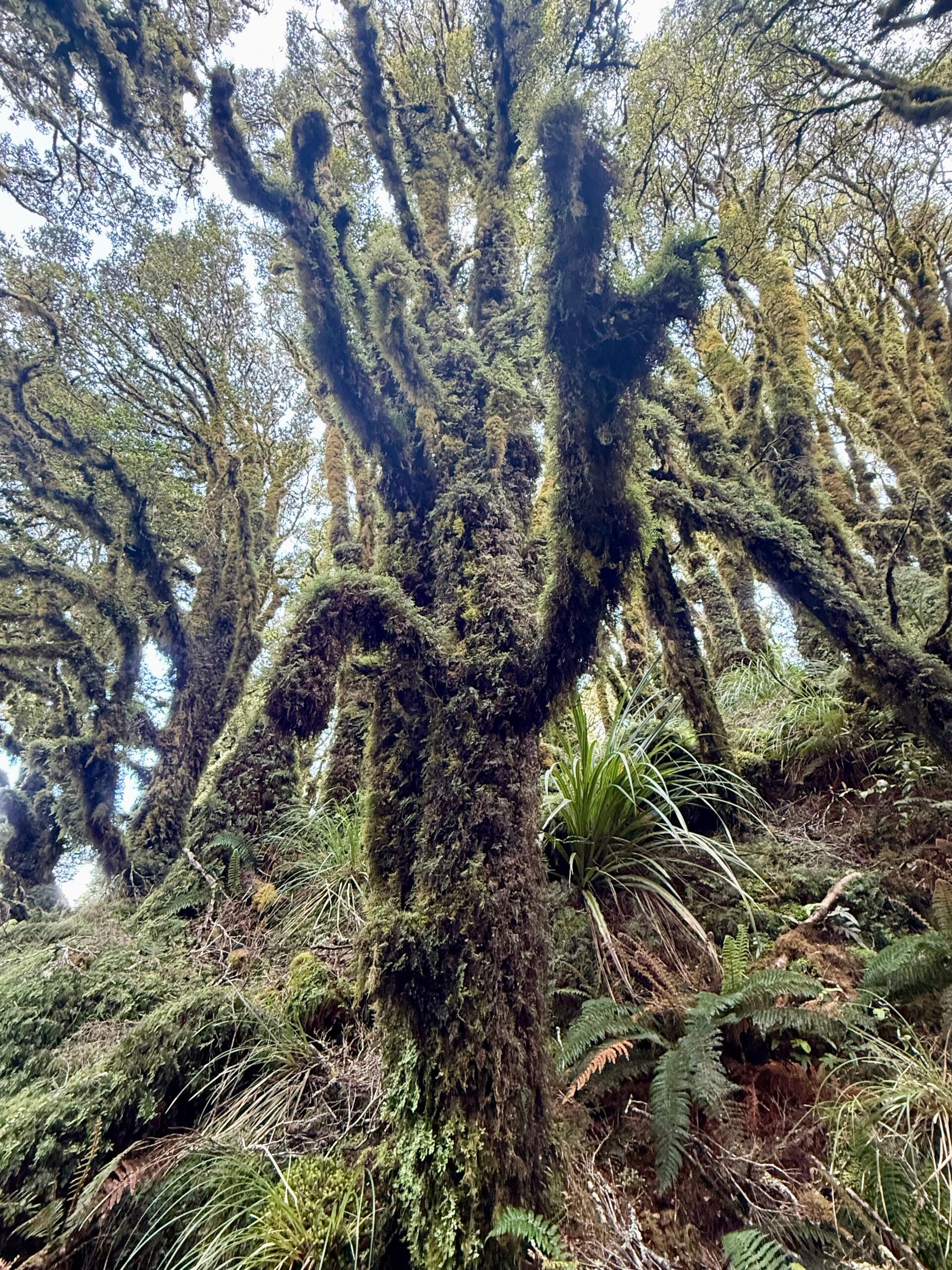
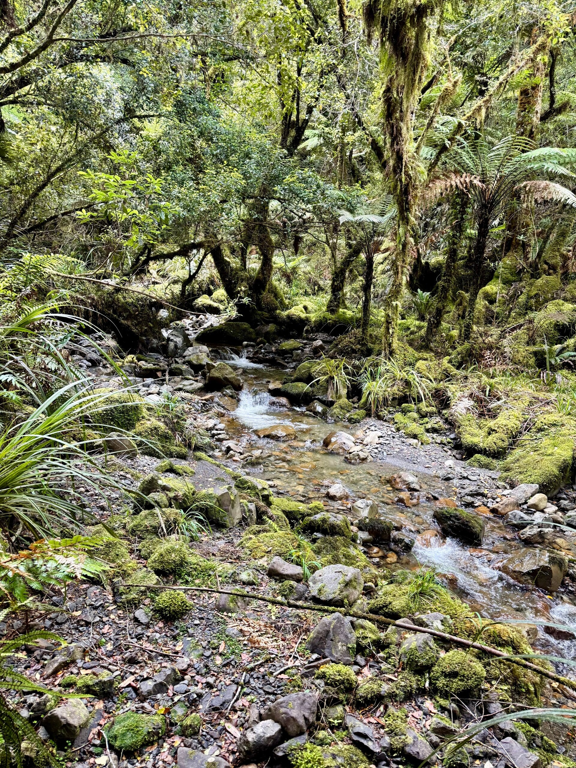
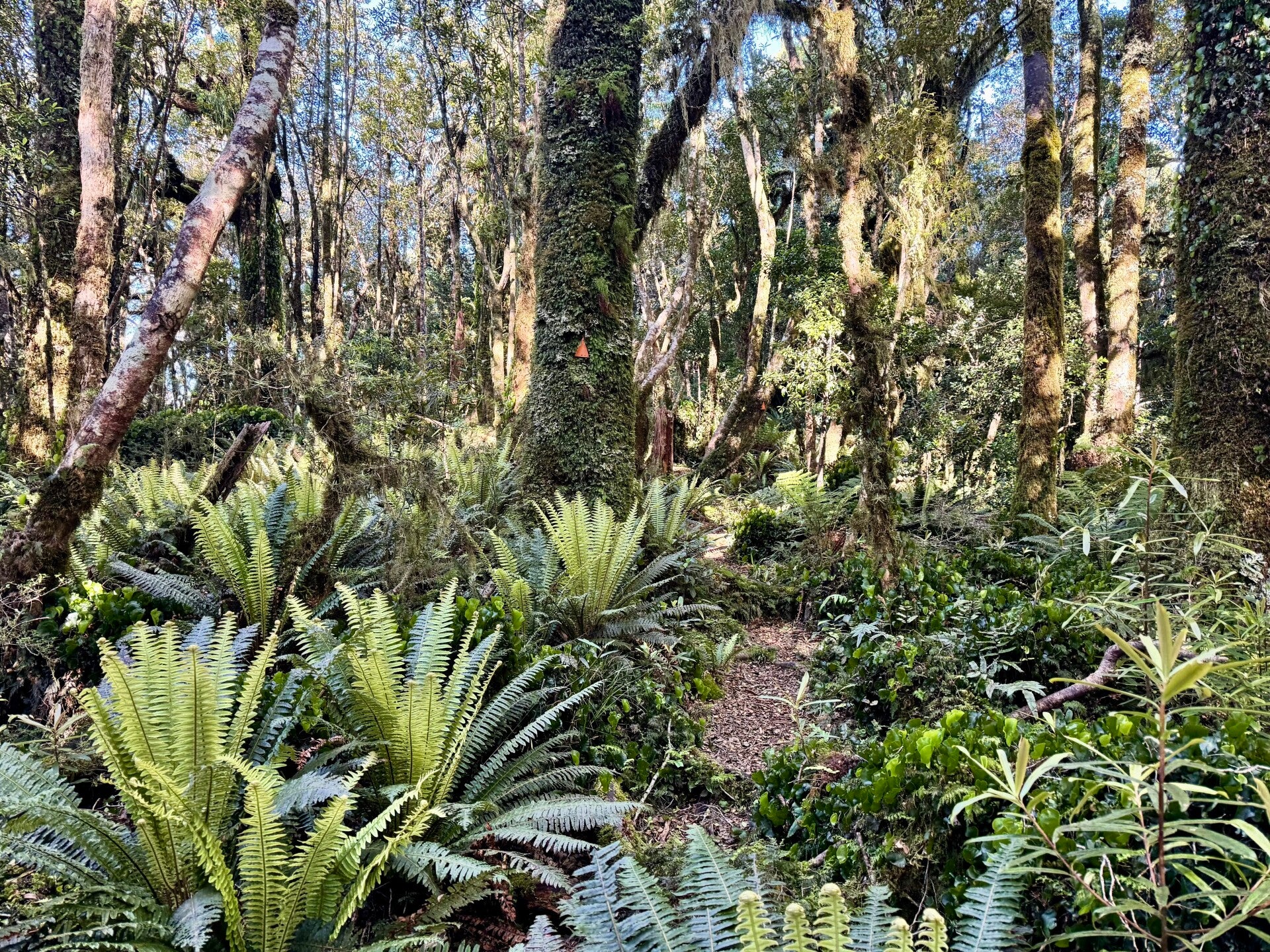
The second part of the day is spent on the ridges, still covered in dense forests. The trees ooze clumps of moss and lichen, giving them a bearded appearance, and the wind that regularly buffets their slopes batters their trunks and branches, forcing them to grow in crooked shapes. Many lie on the ground, their powerful roots unable to withstand the force of the previous storm, blocking the path and forcing us to make small detours or straddle them.
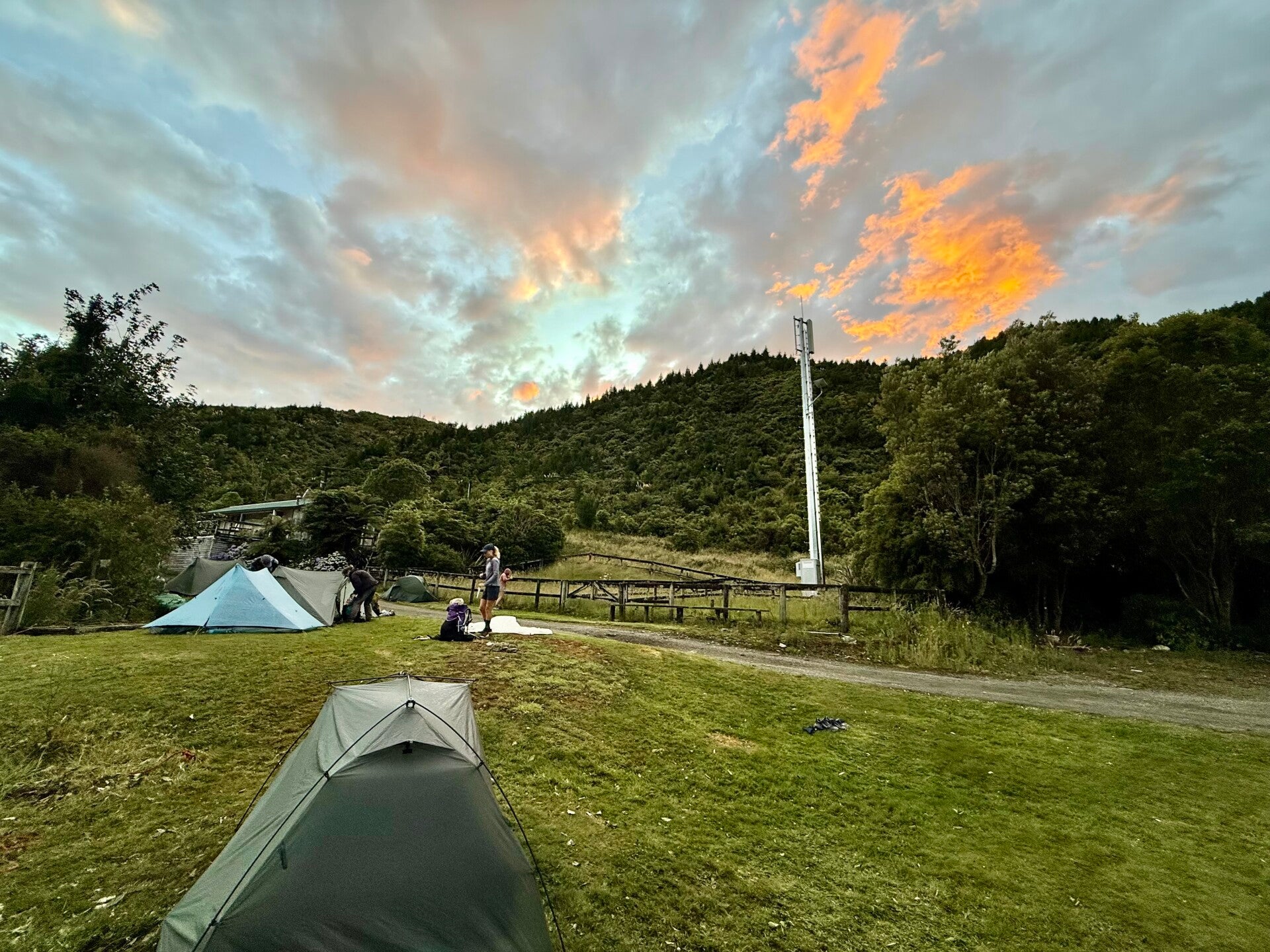
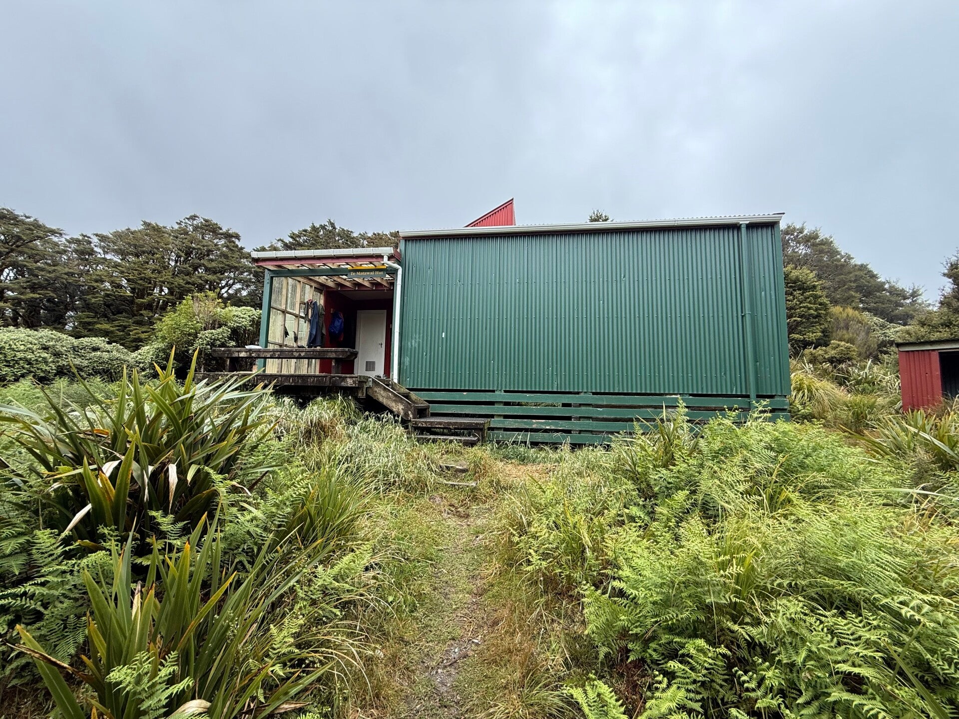
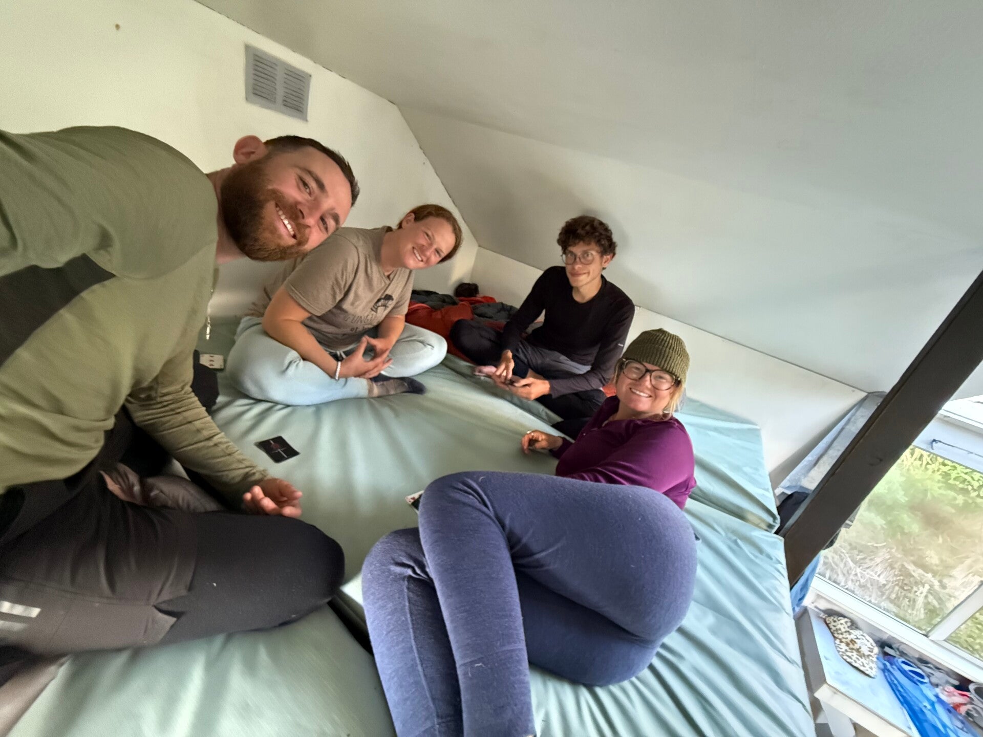
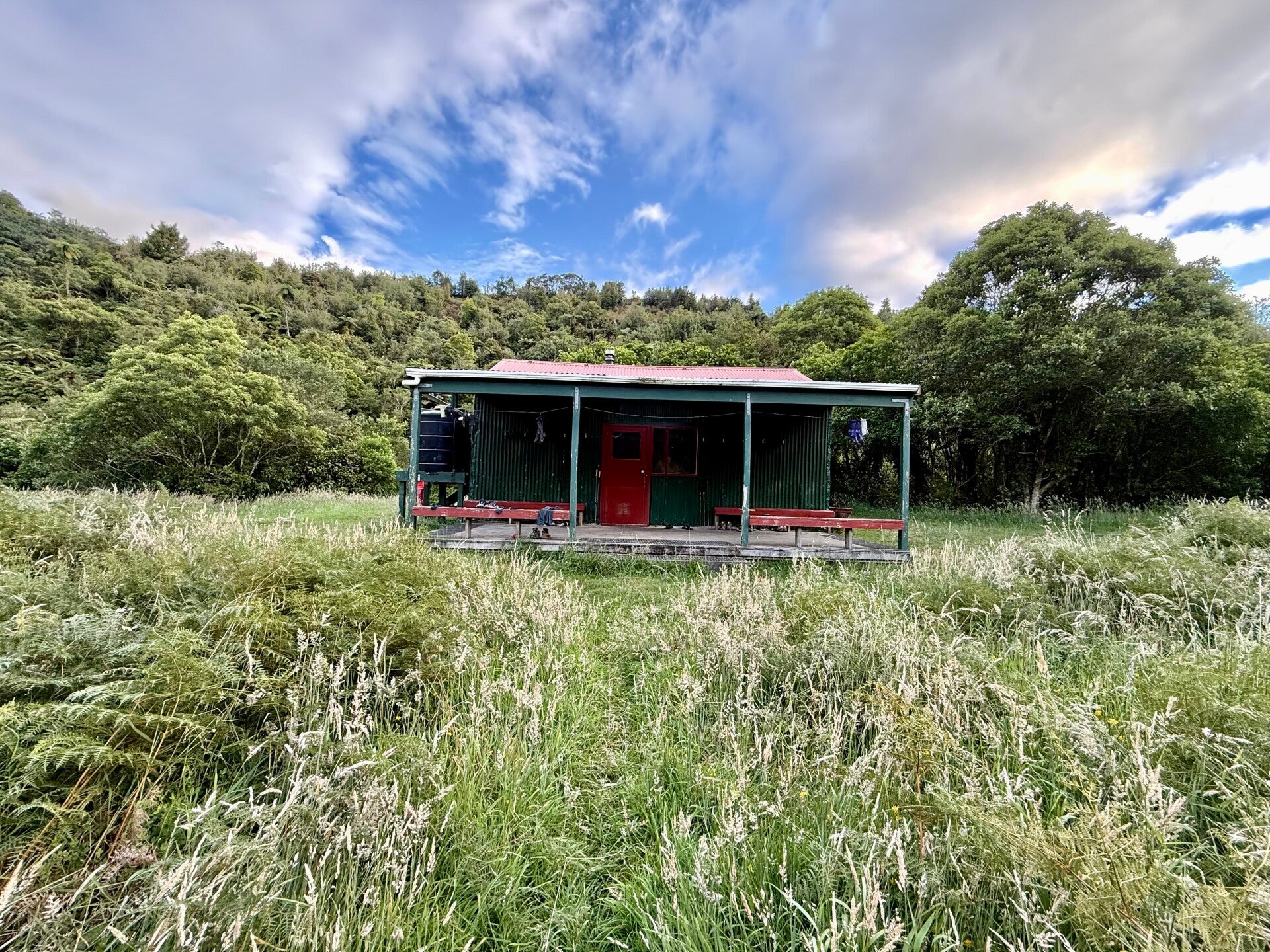
I arrive at the evening hut, lacking charm but adequate enough to shelter us for the night. We decide to "celebrate" the arrival of the new year like weary hikers, that is, at 8 p.m. instead of midnight. Around 7 p.m., we are delighted to see our friend Yvan arrive. He has had a long day to reach us and surprised us by opening the door in a flash. Feeling very tired and a bit disoriented, we informed him that it was December 31st and that we would soon be entering a new year… it's true that the concept of dates and days of the week is rather relative on the trek; it doesn't really matter much.
With four Americans in the hut, we decide to adapt one of their midnight countdown traditions by performing a "ball drop"... I am very skeptical, as I had never heard of this strange custom, apparently very famous in the United States (a crystal ball dropped from a few meters during the last ten seconds of the year in Times Square, New York). Natalie, who always has wacky ideas, stands on a bench in front of the hut, facing us, starts the countdown, and drops a plastic ball on the ground at exactly 8:00 PM, to everyone's amusement.
It certainly made an impression and brought us all together!
🗓️ January 01st, 2026 (day off trail)
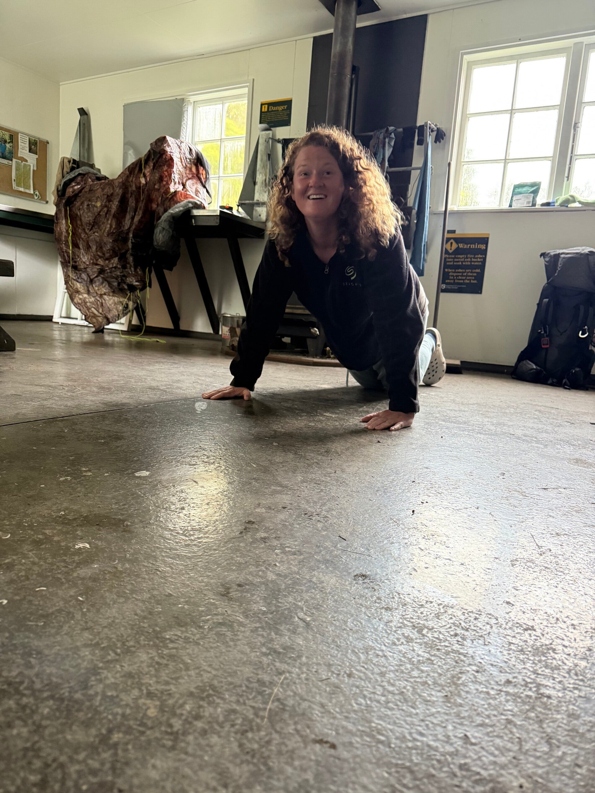
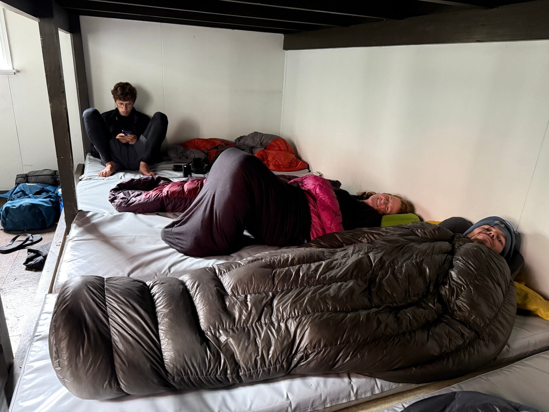
We spend the first day of the year in this cold, damp hut, as the weather doesn’t allow us to continue due to the very strong winds on the ridges. However, the company is good, laughters fill the air, and we play cards—the perfect combination to pass the time. We make a bet with Jolly that we both lost, resulting in having to do 50 push-ups a day until the end of the trail, which is to say, until about mid-March!
🗓️ January 02, 2026
🏁 Kilometers : 1644
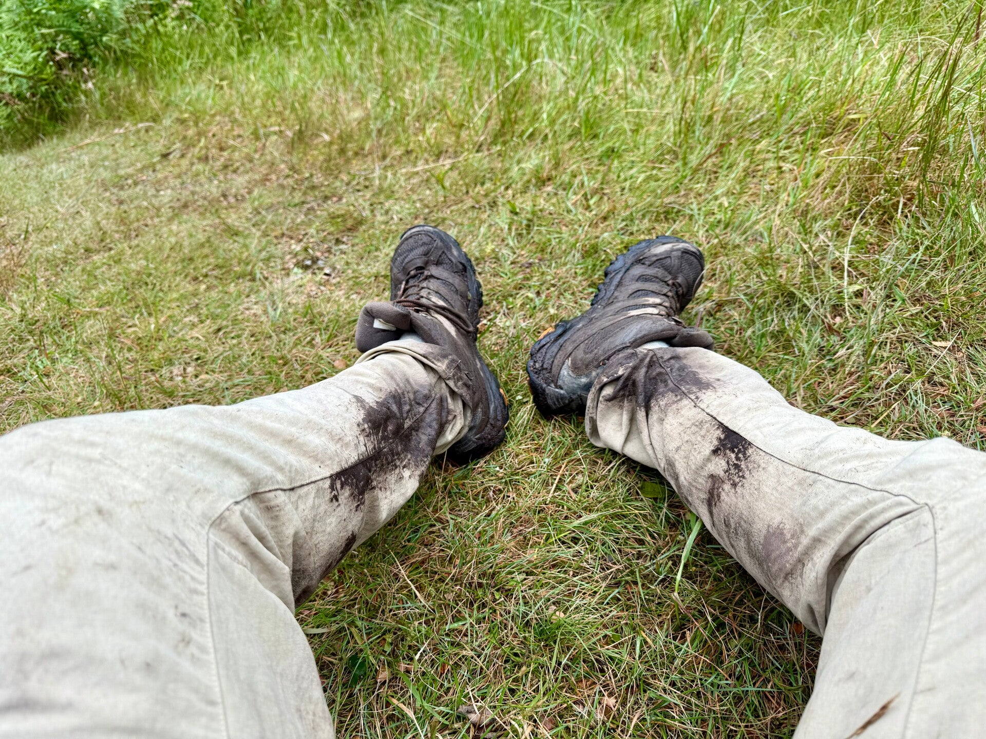
We wake up at 5:00 a.m. this morning in our damp hut, everyone deciding to set off at the same time. It is in the dark, amidst a general mess, that we gather our things and get ready to start the day's hike. The plan is to do only 13 kilometers, a short day's hike it seems, but with an elevation gain of 1300 meters and, above all, a trail that is still in very poor condition. I hate putting on my hiking t-shirt, which smells so bad I can barely stand the odor, and putting on my damp, smelly socks is a real turn-off.
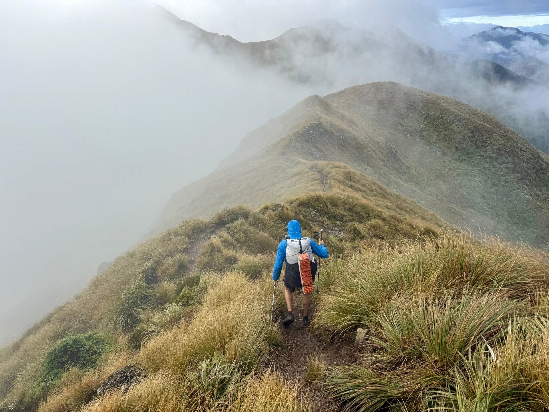
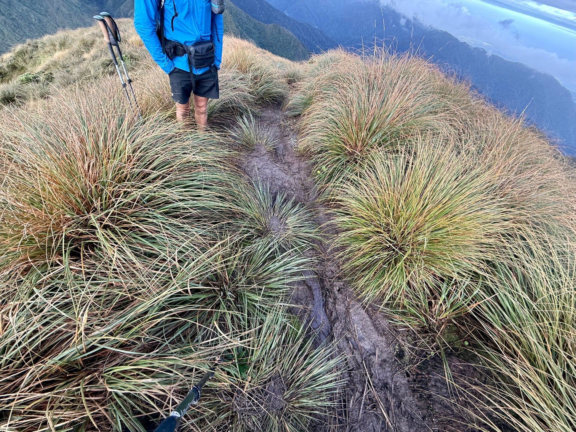
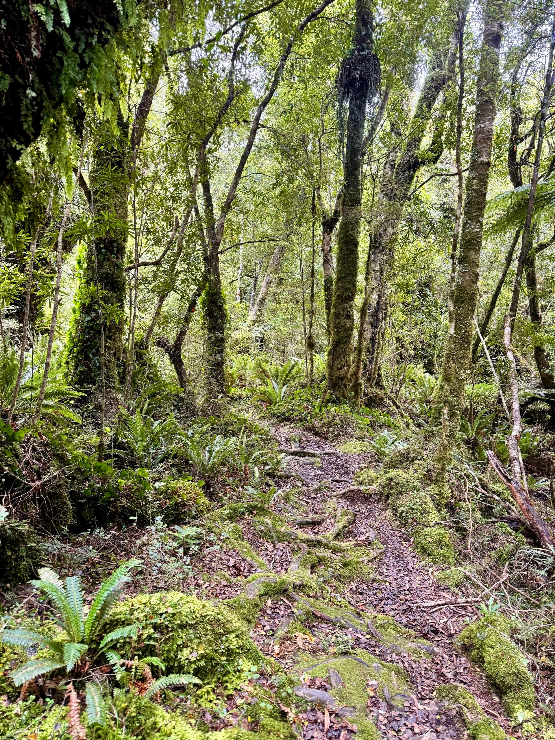
From the moment we leave the hut, we are walking through mud that won’t leave us all day. Usually, when hiking along the ridges, the ground is firm and rocky… but it seems New Zealand is an exception. It's worth noting that the Tararua Mountains can receive up to 500 cm of rain annually, which helps explain why everything is so damp and the omnipresence of mud.
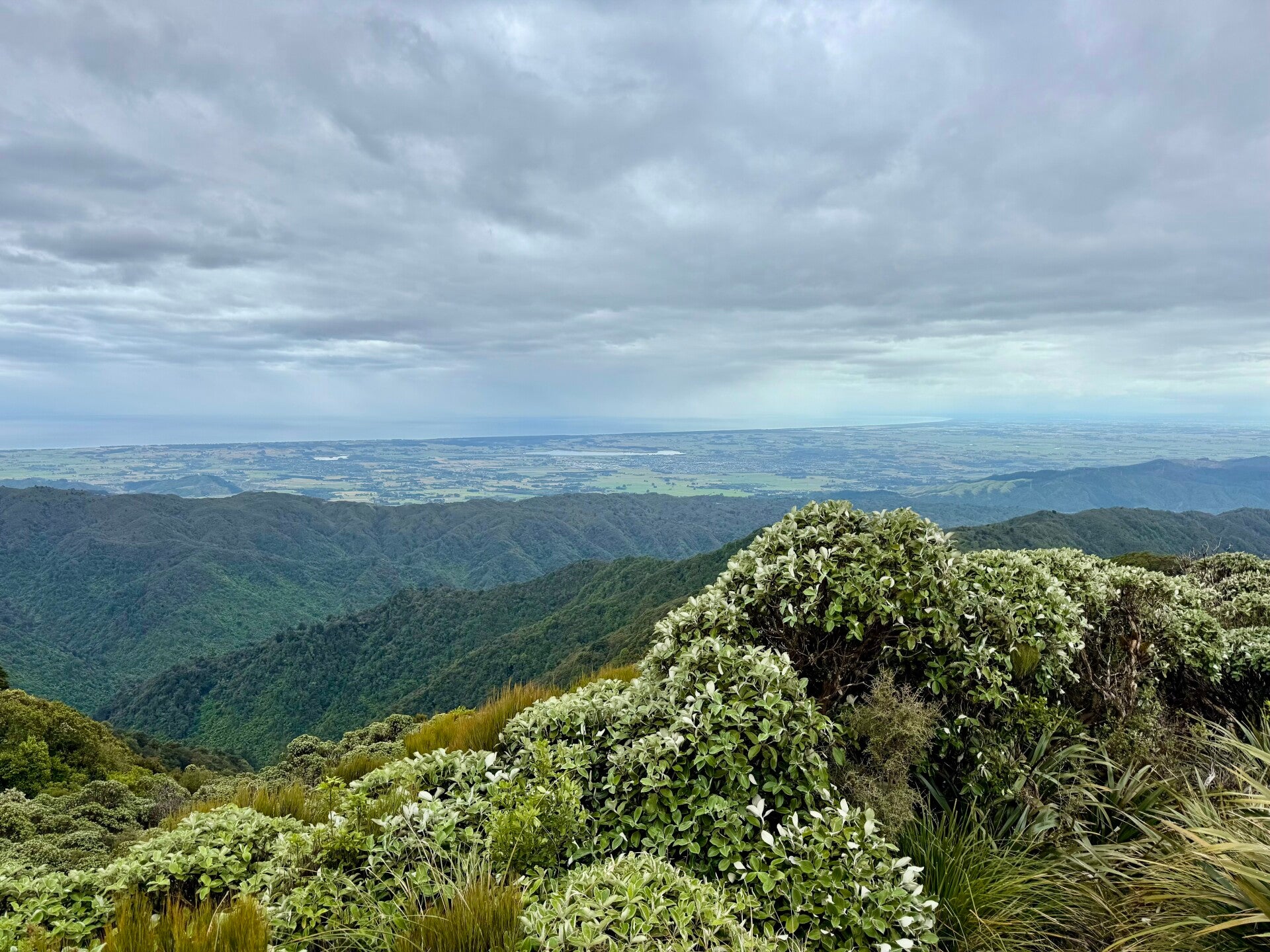
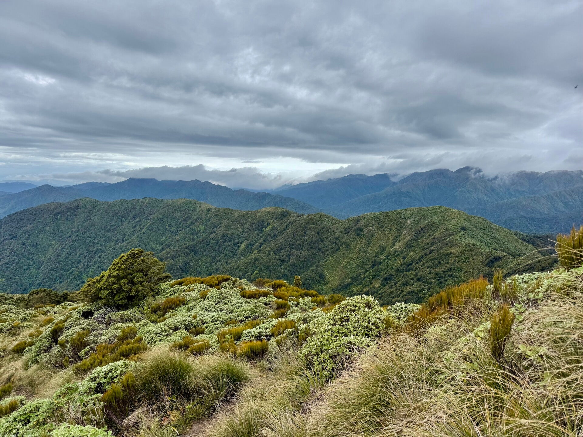
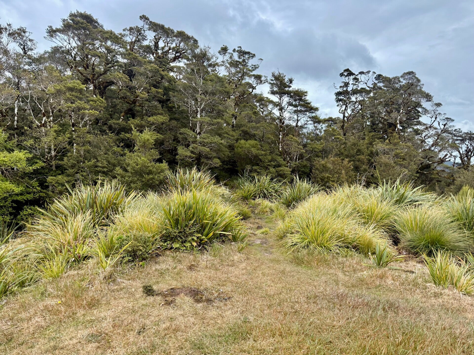
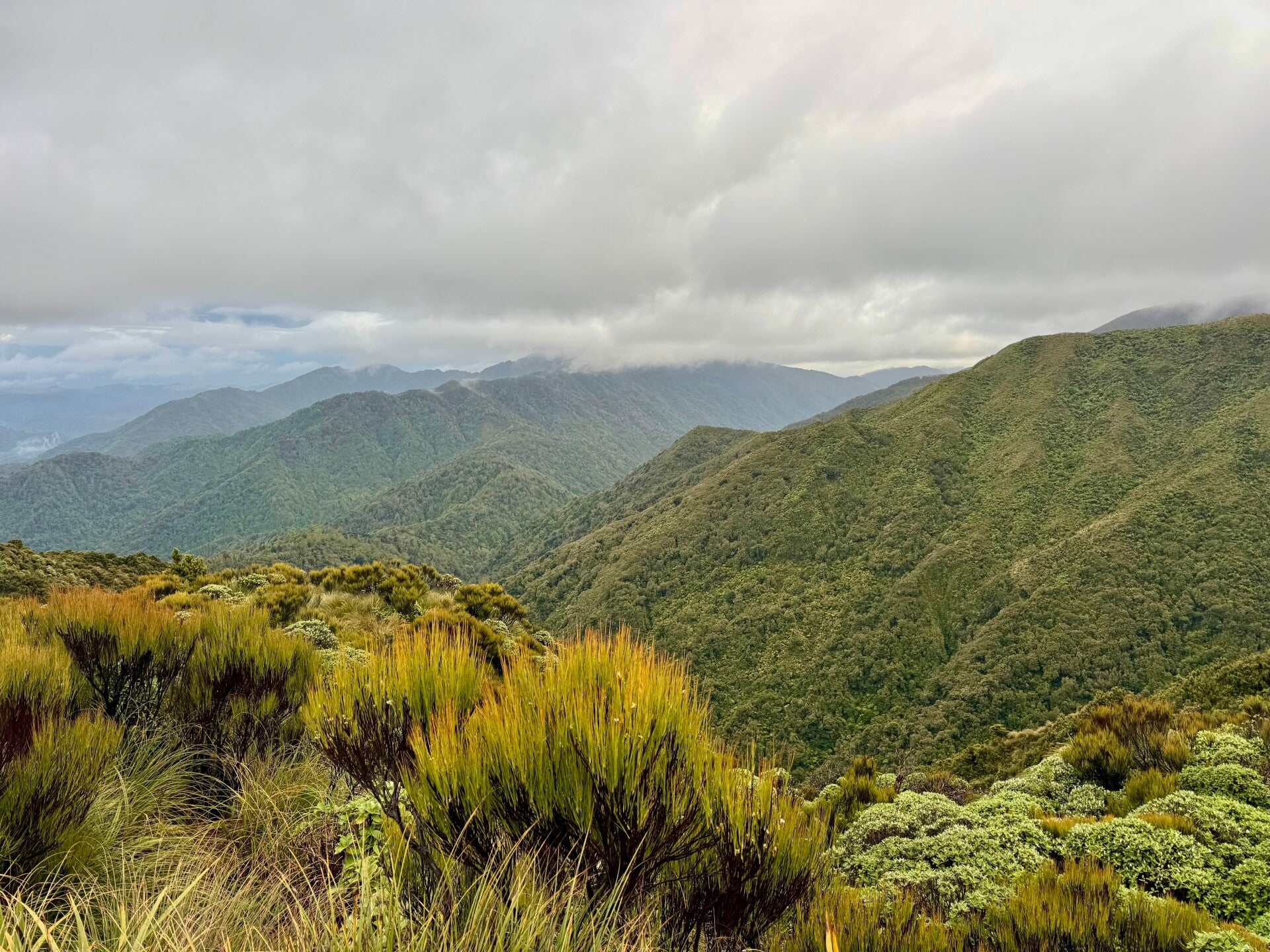
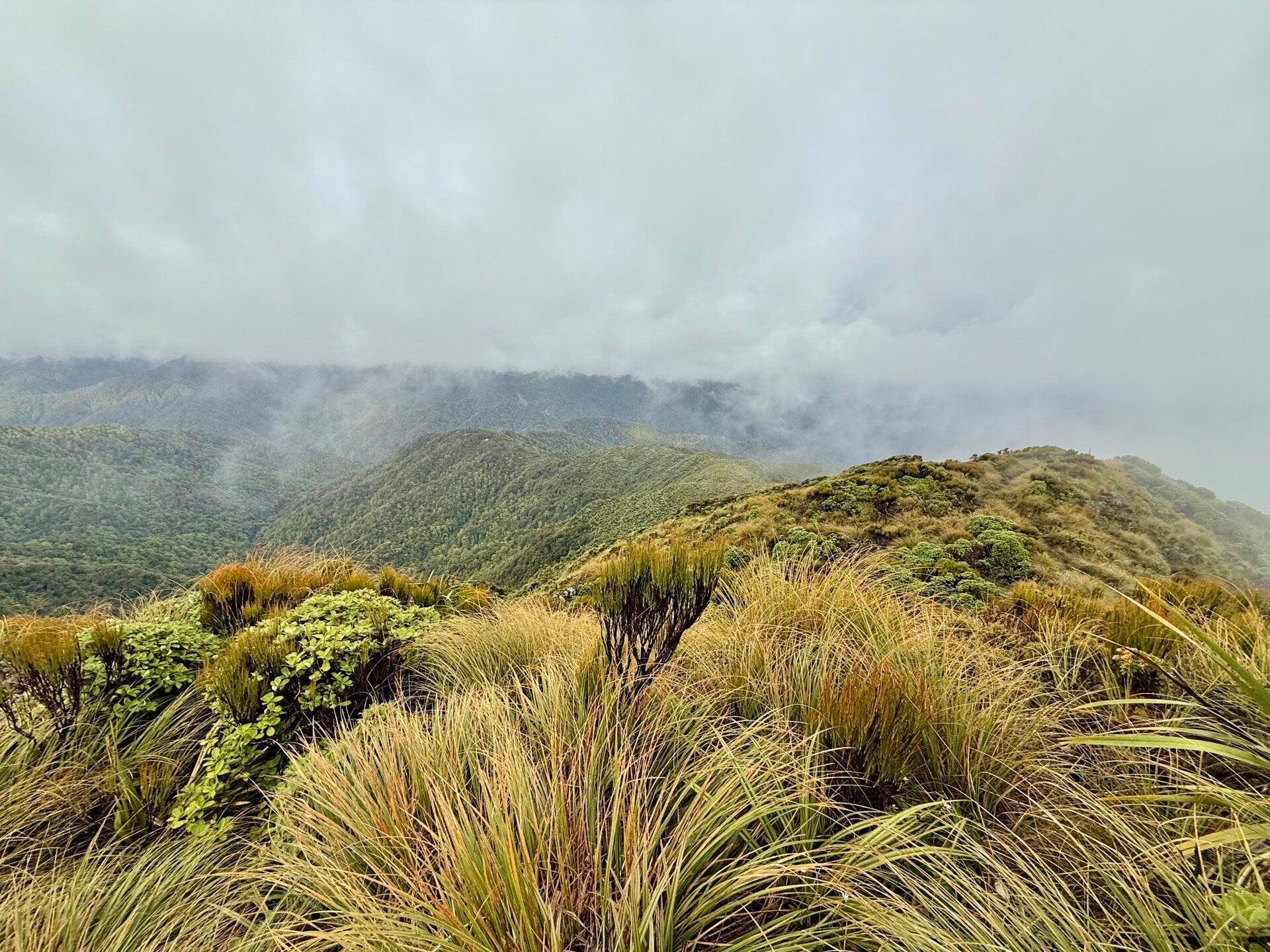
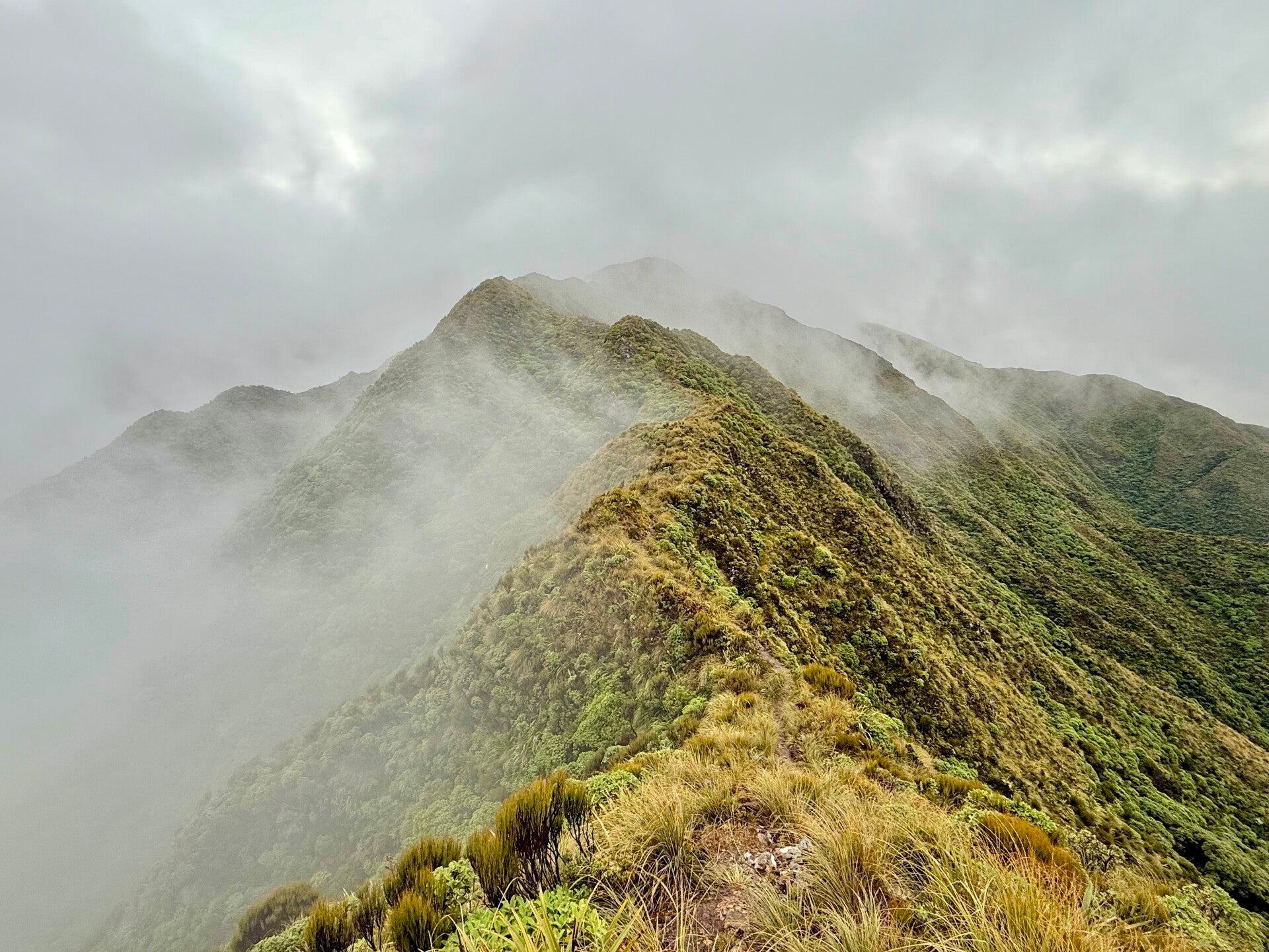
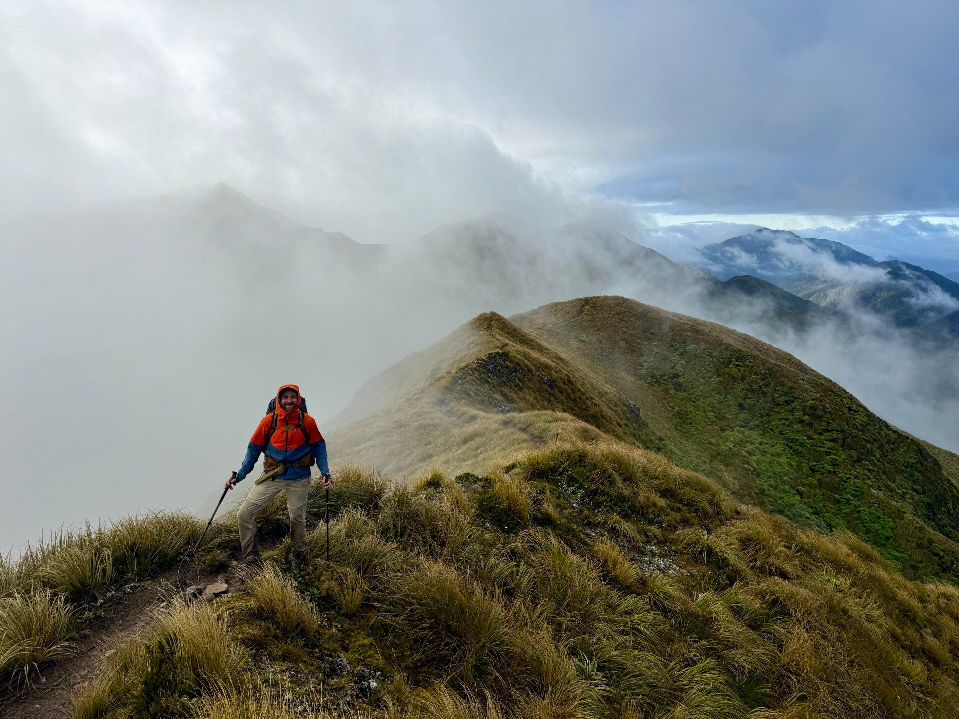
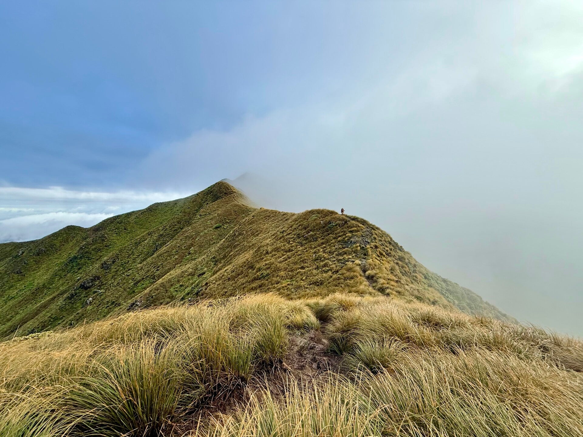
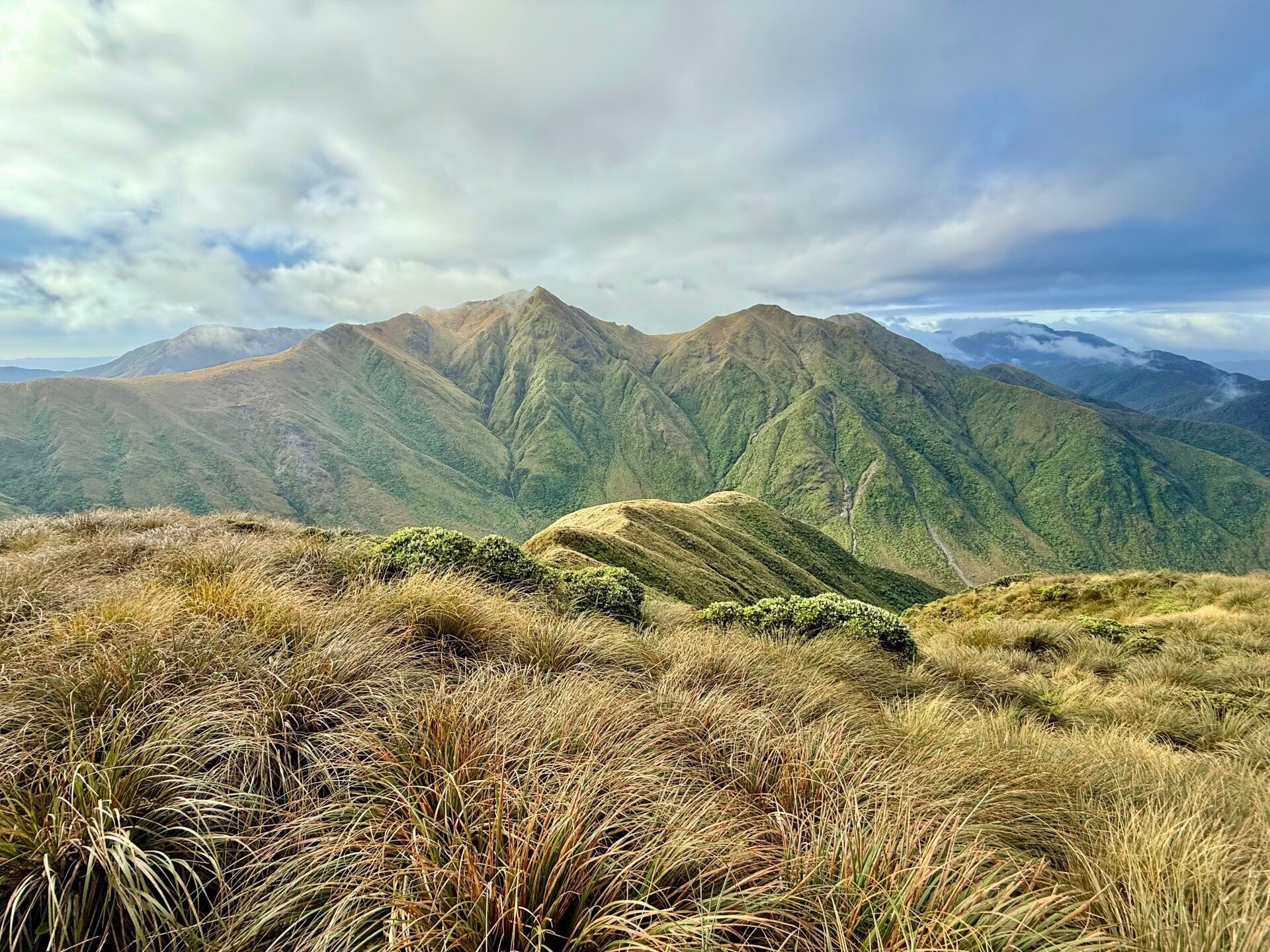
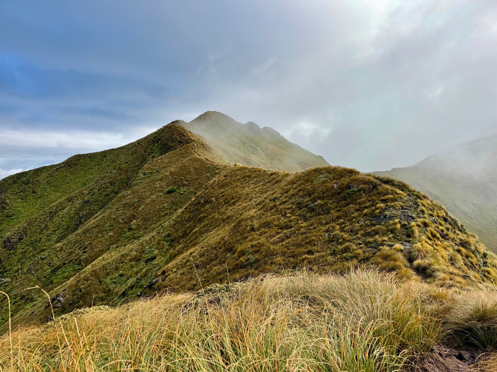
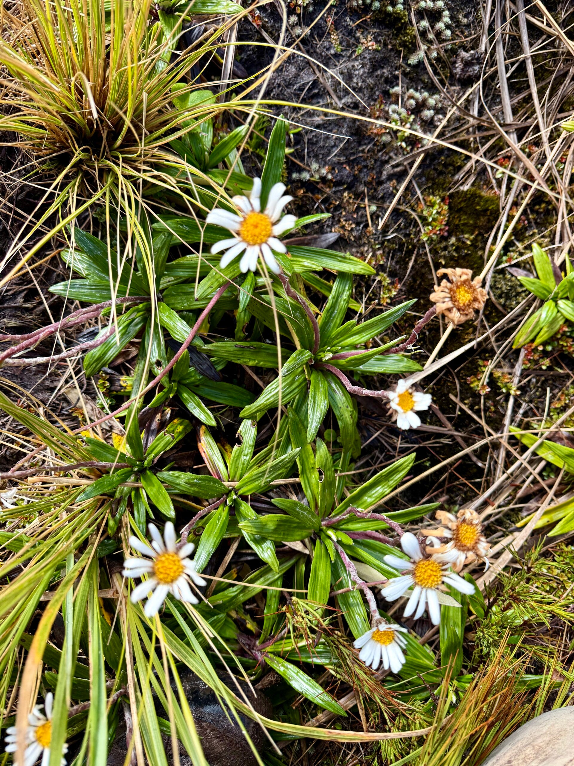
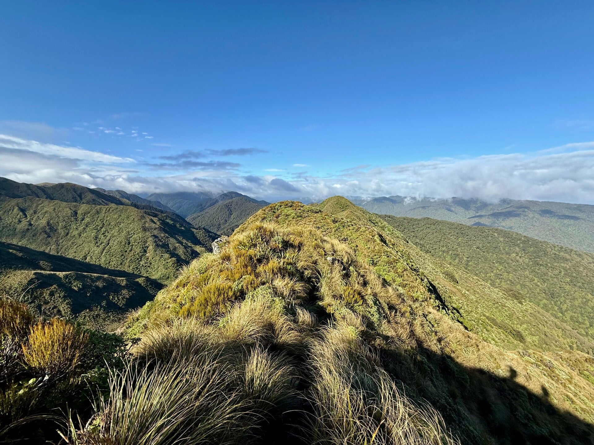
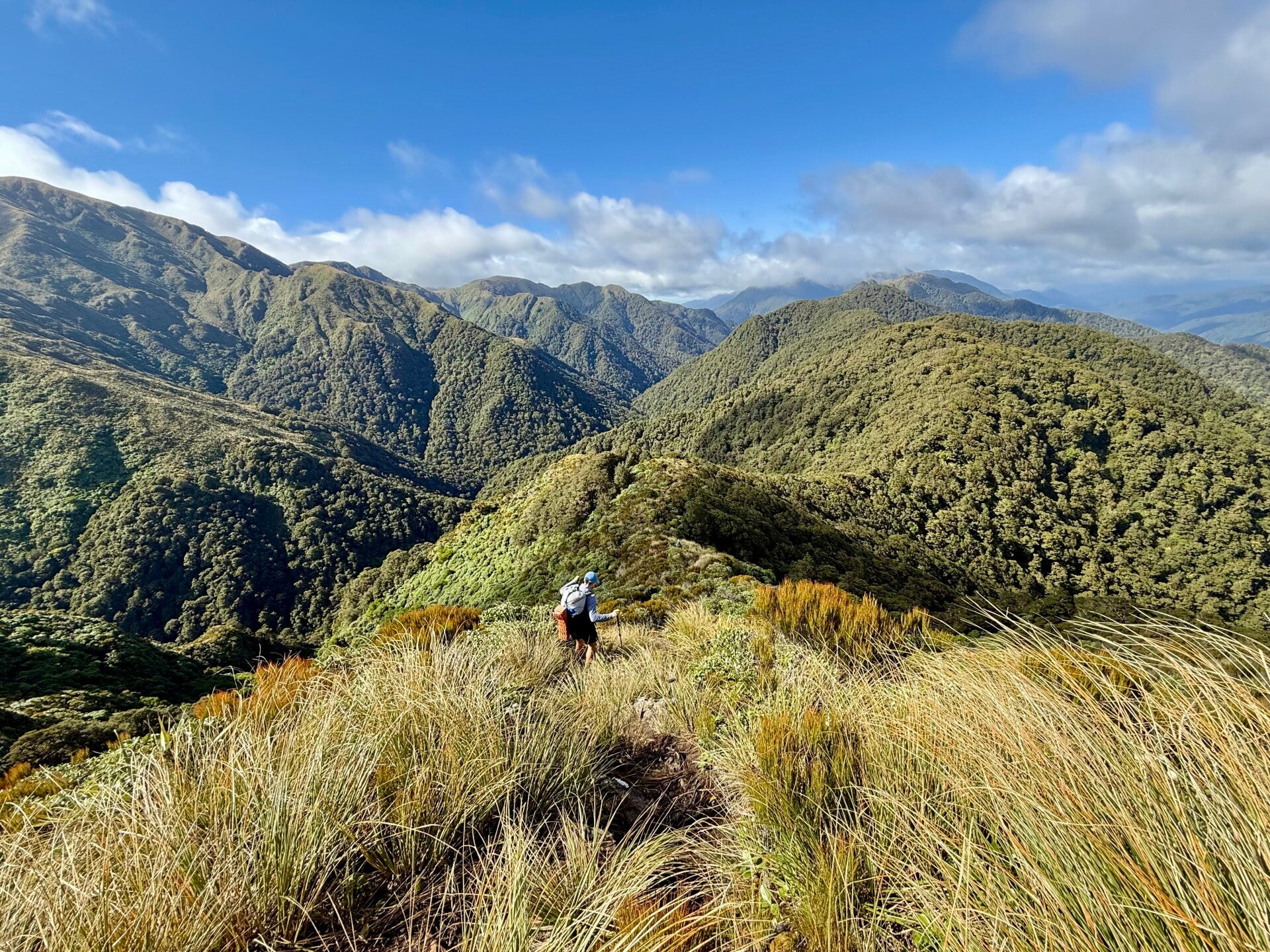
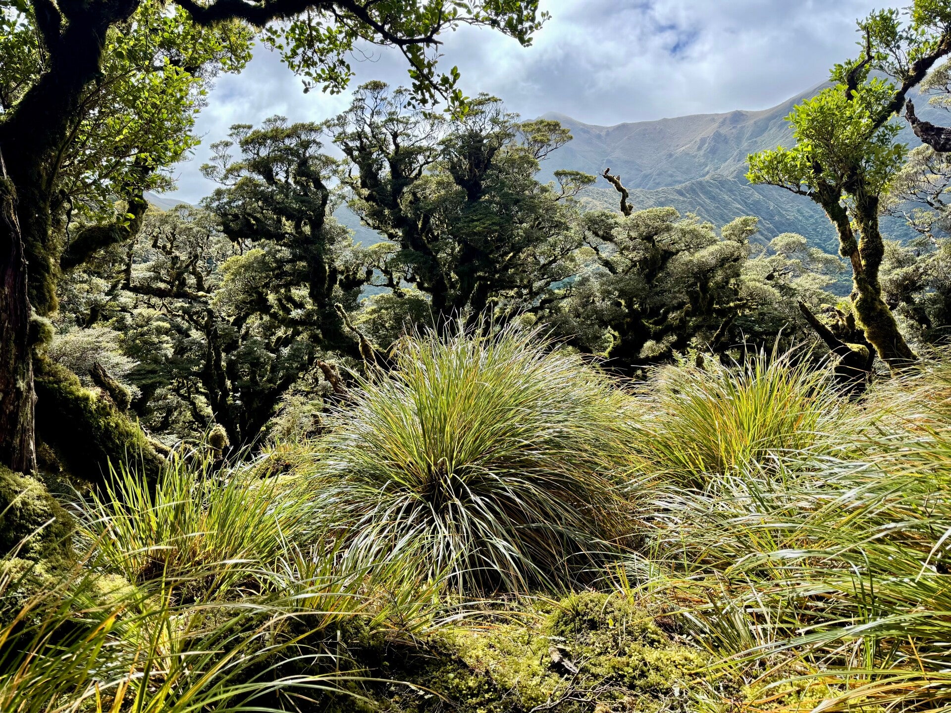
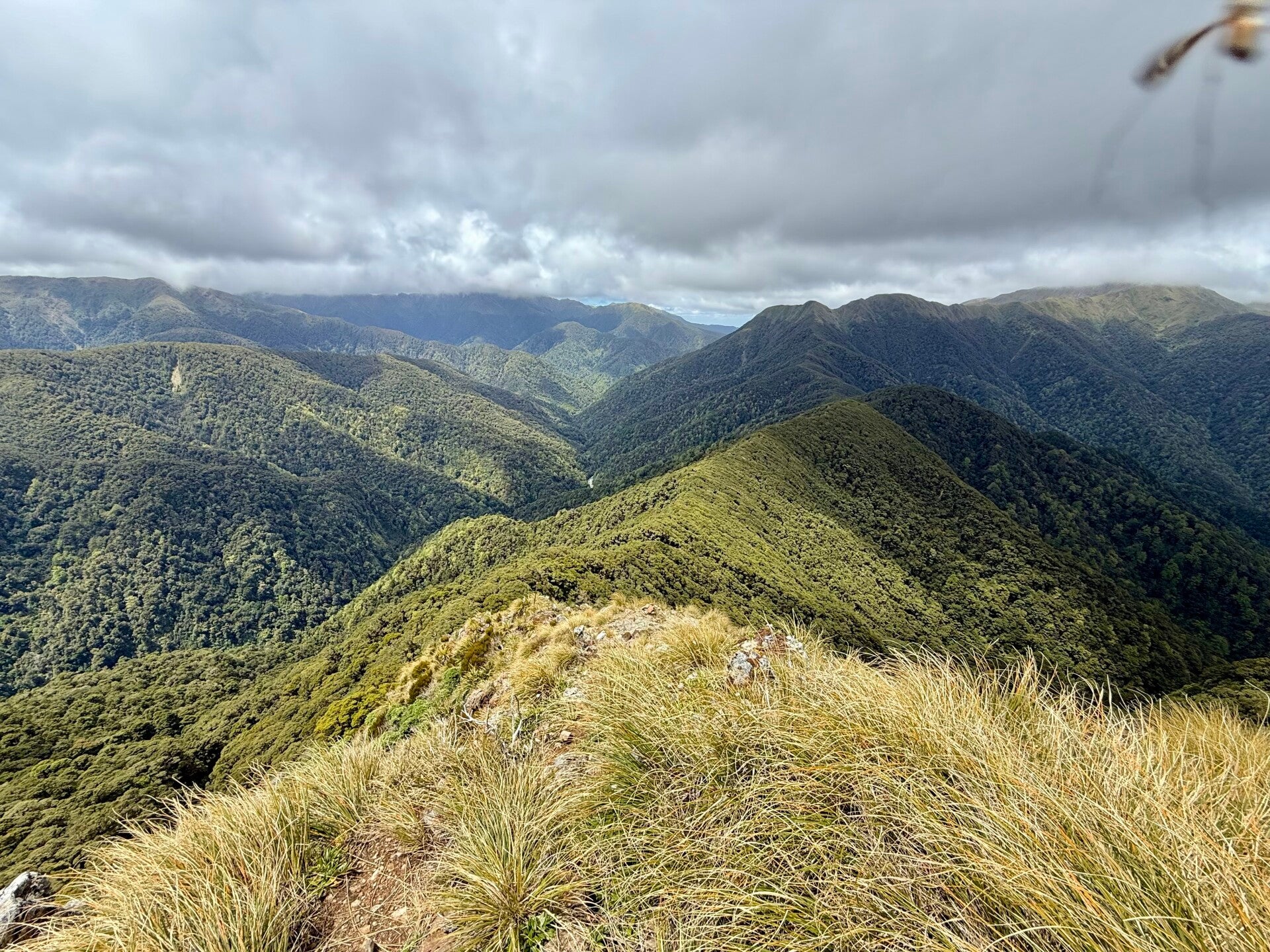
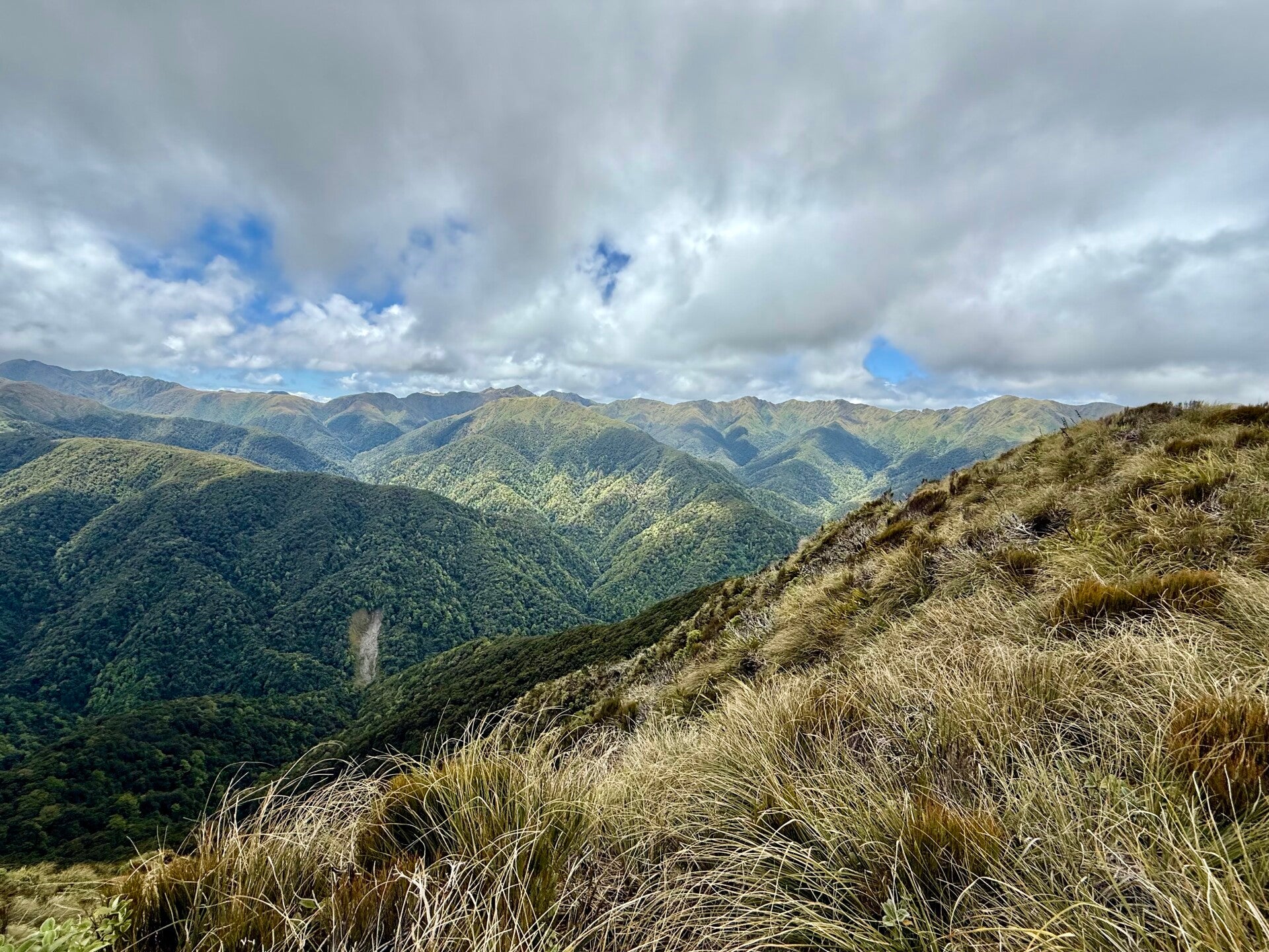
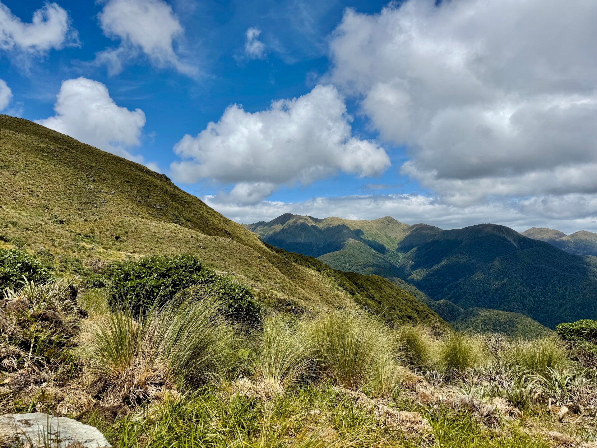
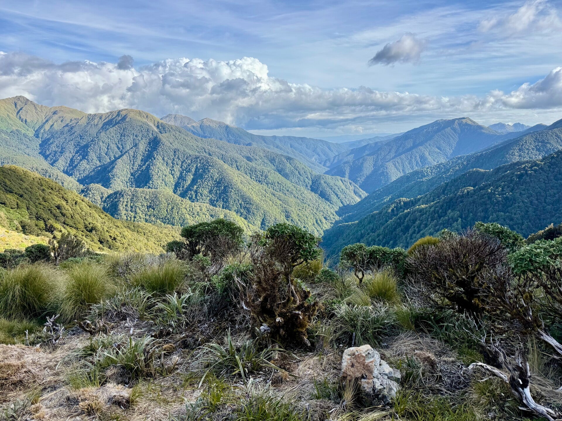
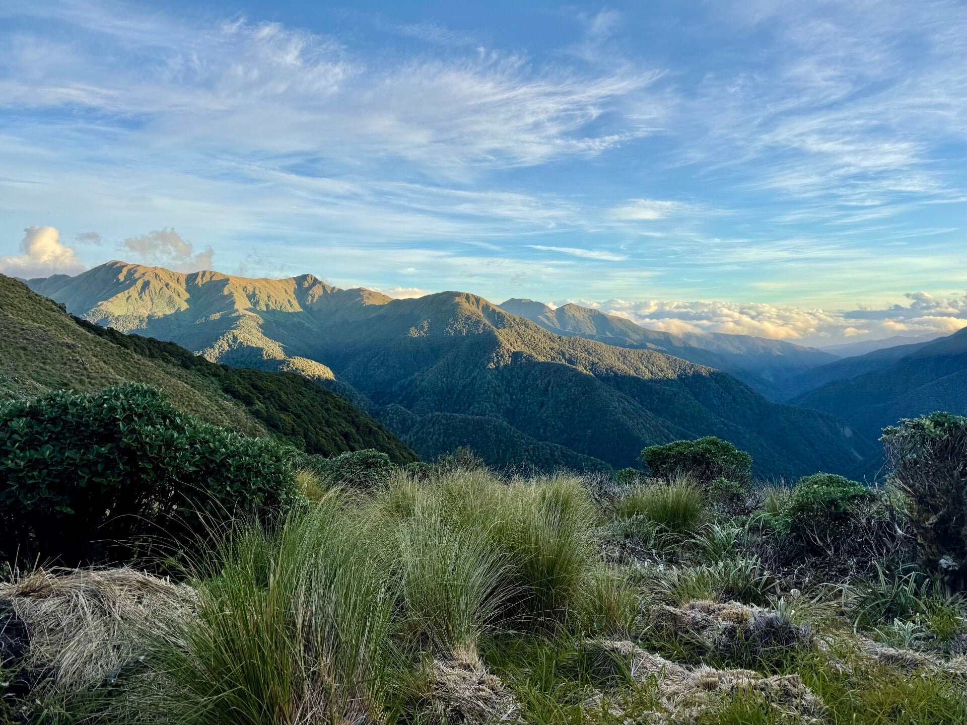
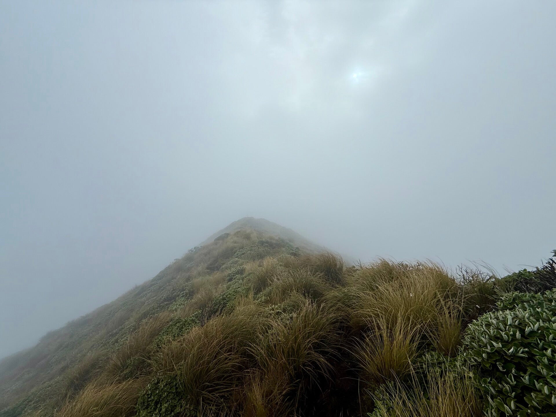
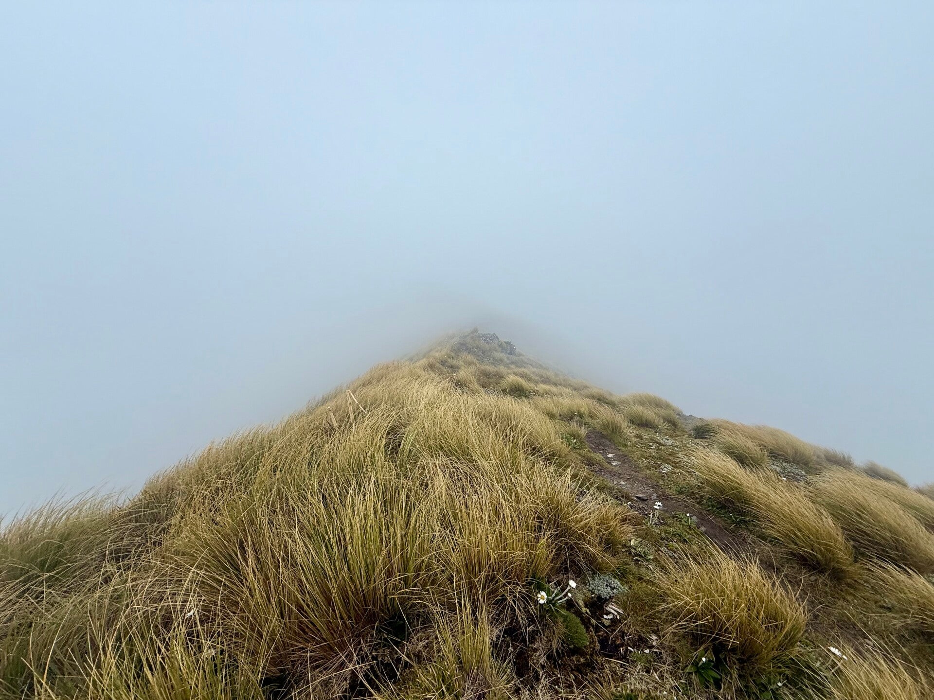
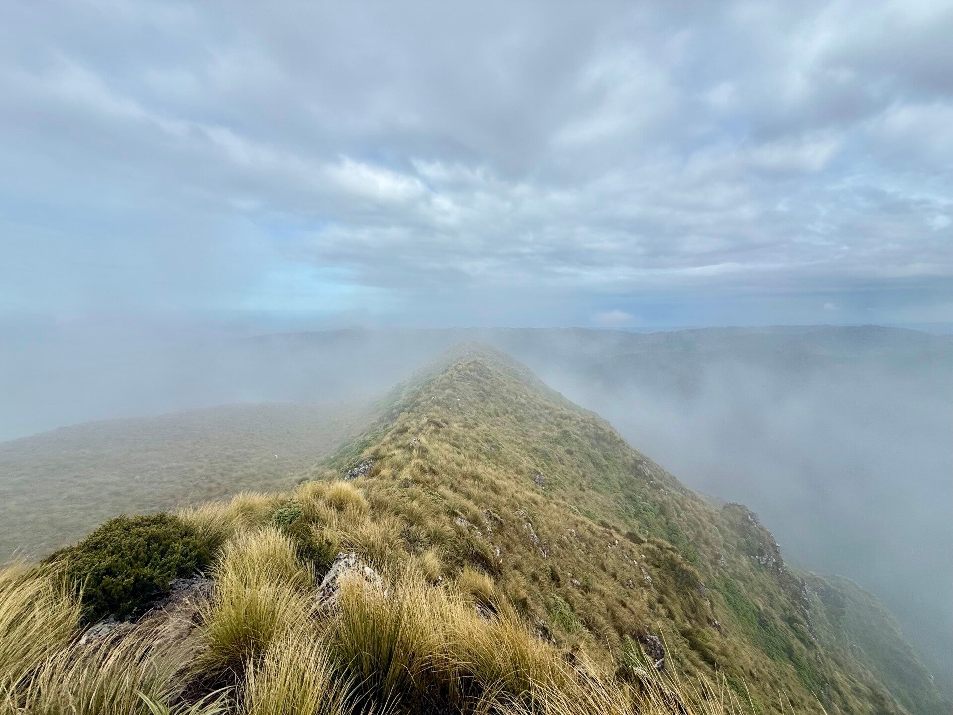
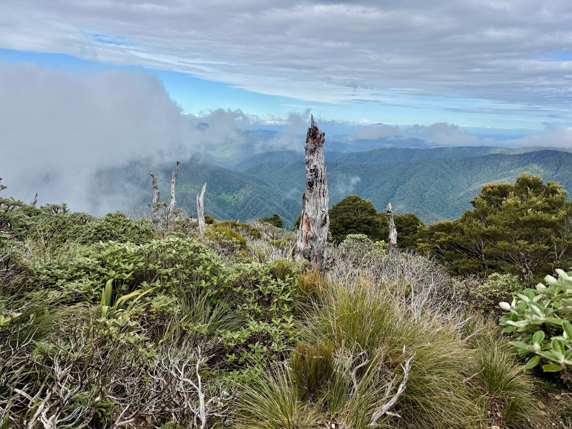
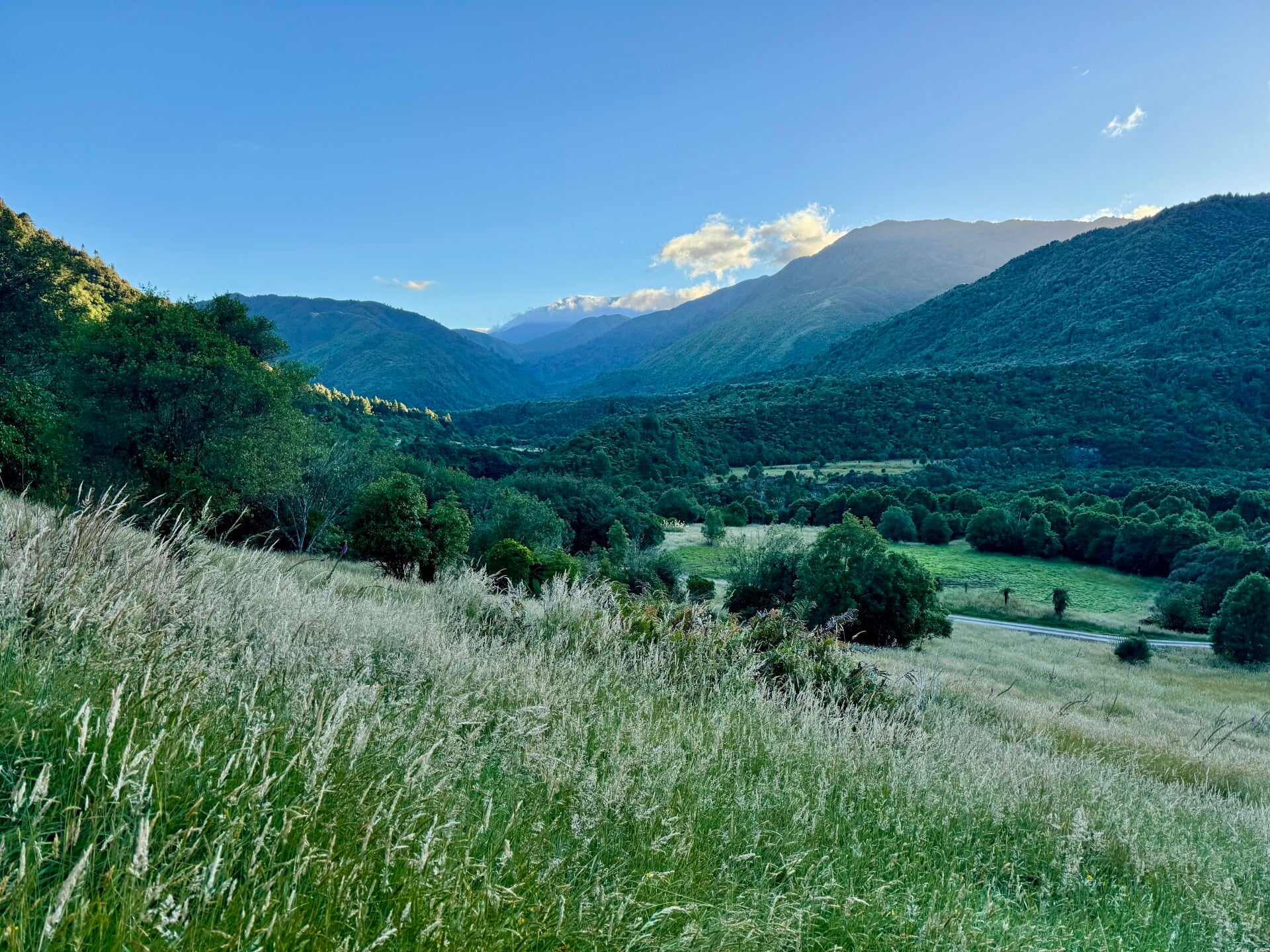
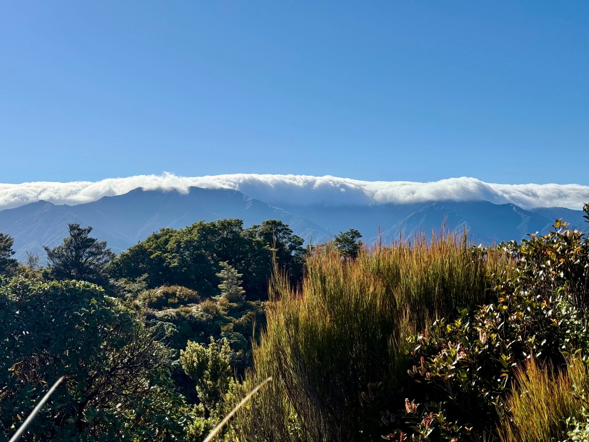
We climb in the fog for about an hour, but upon reaching the summit, we are fortunate enough to see the sky clear, like a curtain falling to reveal a stunning panorama. We have an almost 360-degree view of the entire mountain range. The natural wooded line between 1000 and 1200 meters in altitude is clearly visible, where no trees grow above this point. Yellowing grasses and a few bushes are the only plants able to withstand the strong winds at this altitude, adding splashes of color to the landscape. We follow the ridgeline constantly, sometimes encountering steep drops and, of course, the ever-present mud, which makes the task perilous.
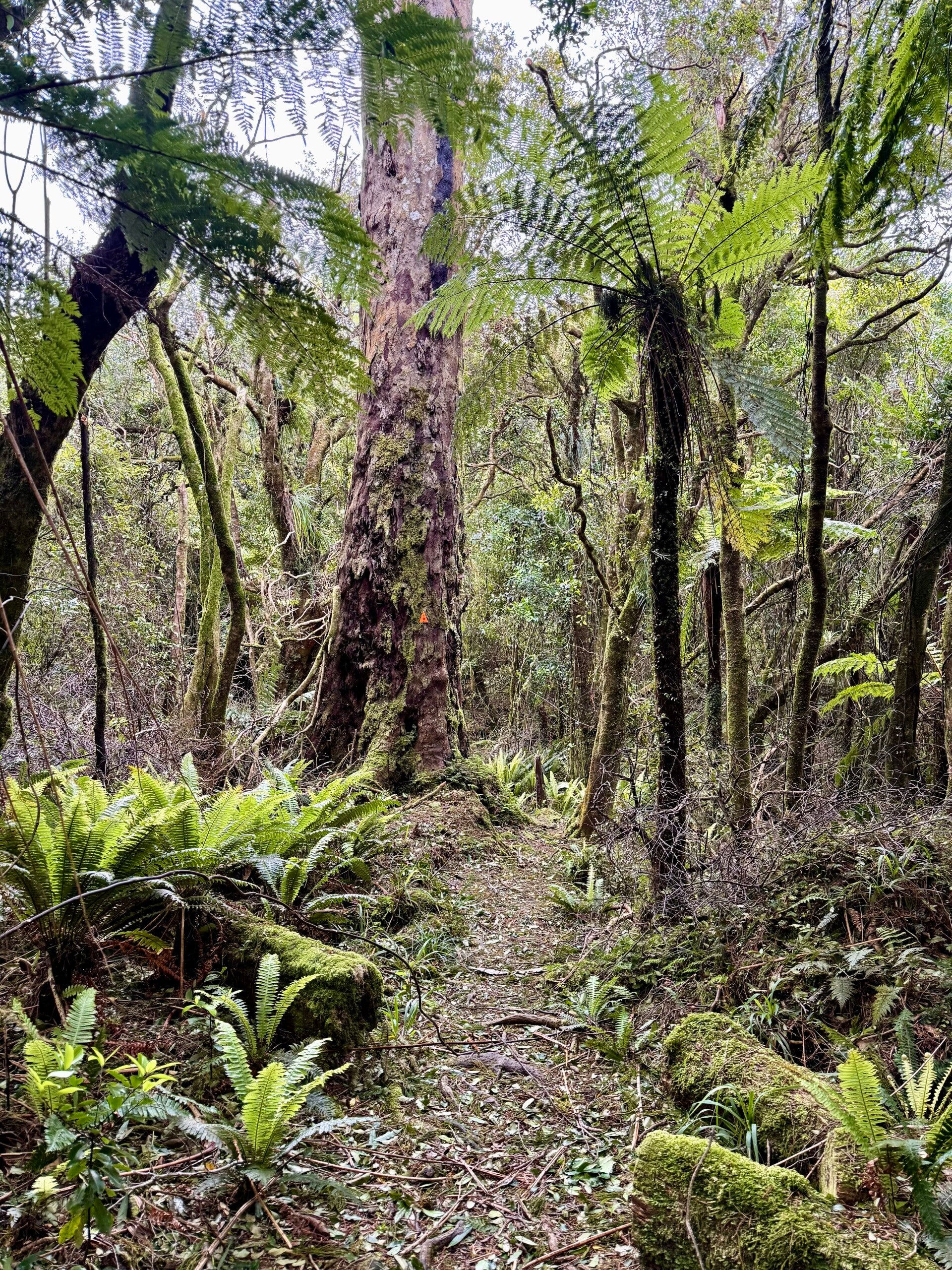
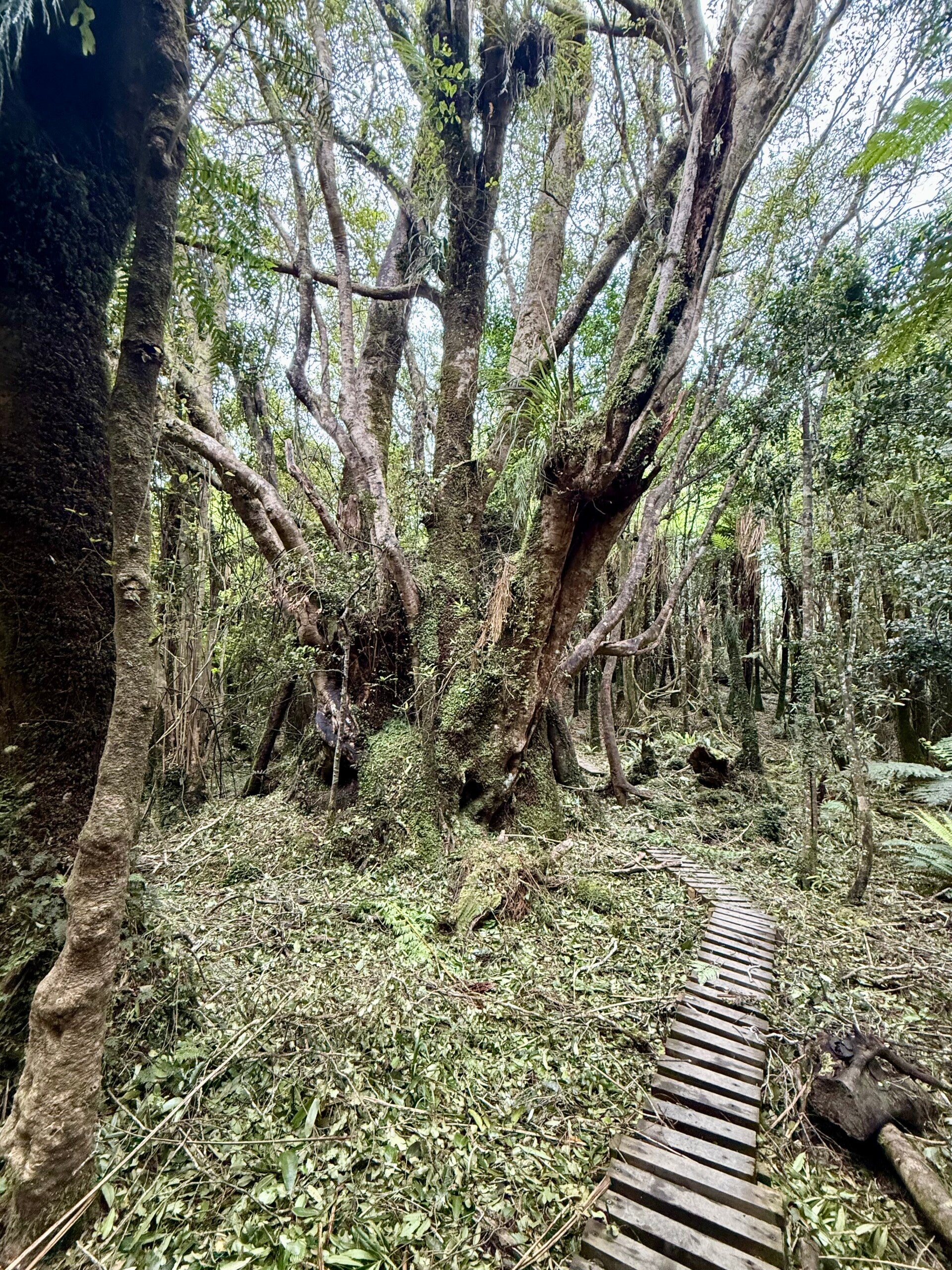
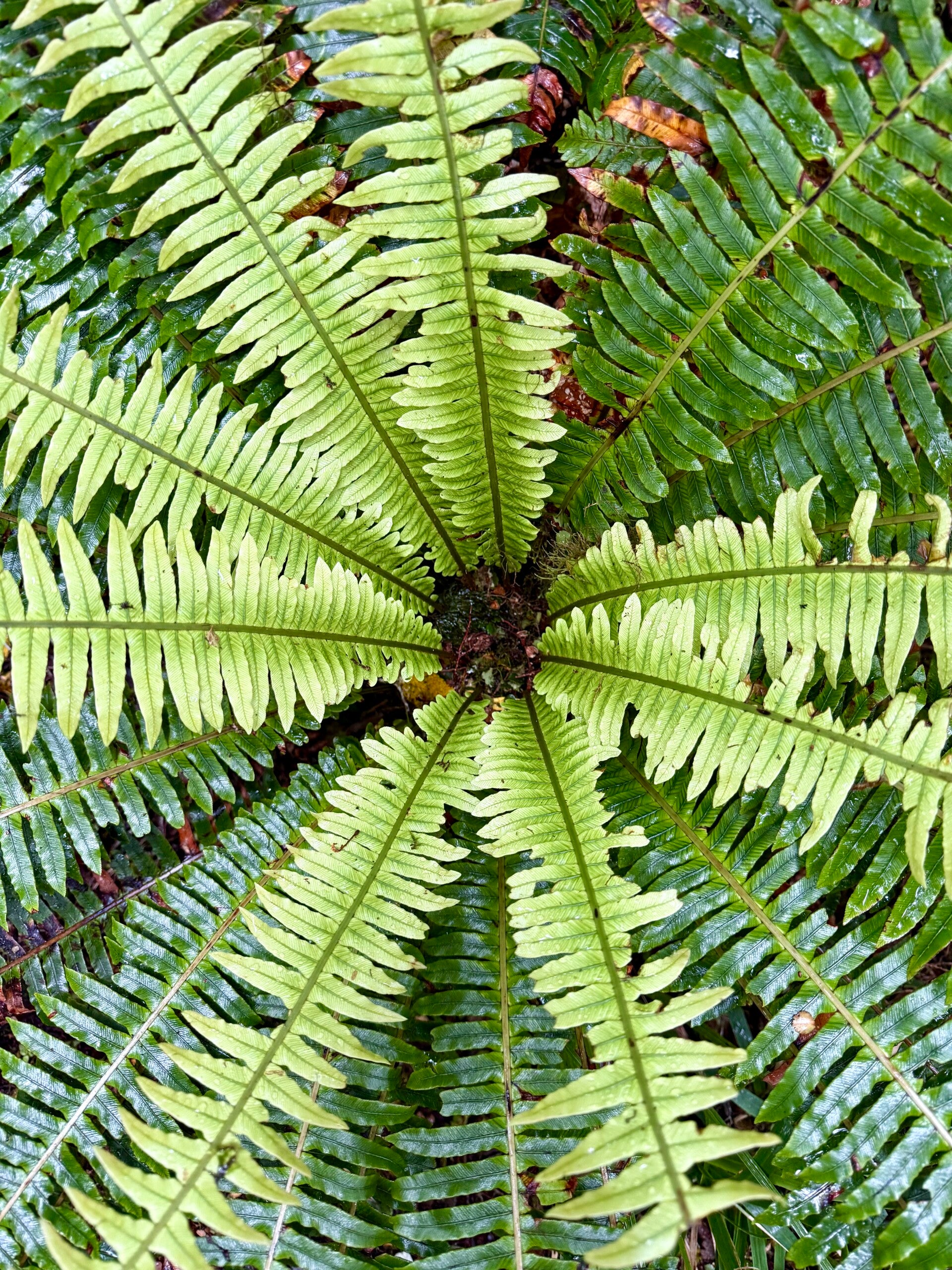
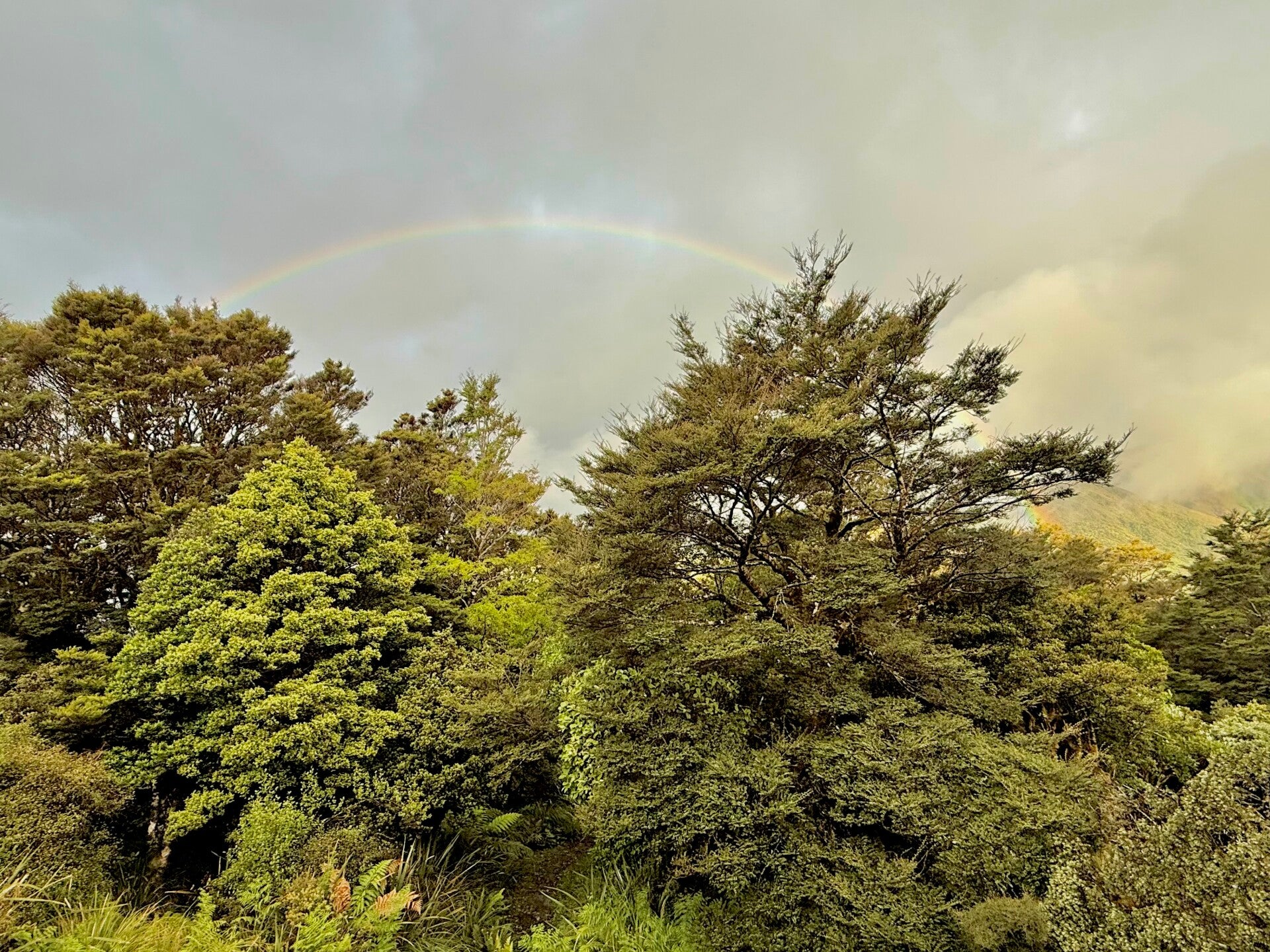
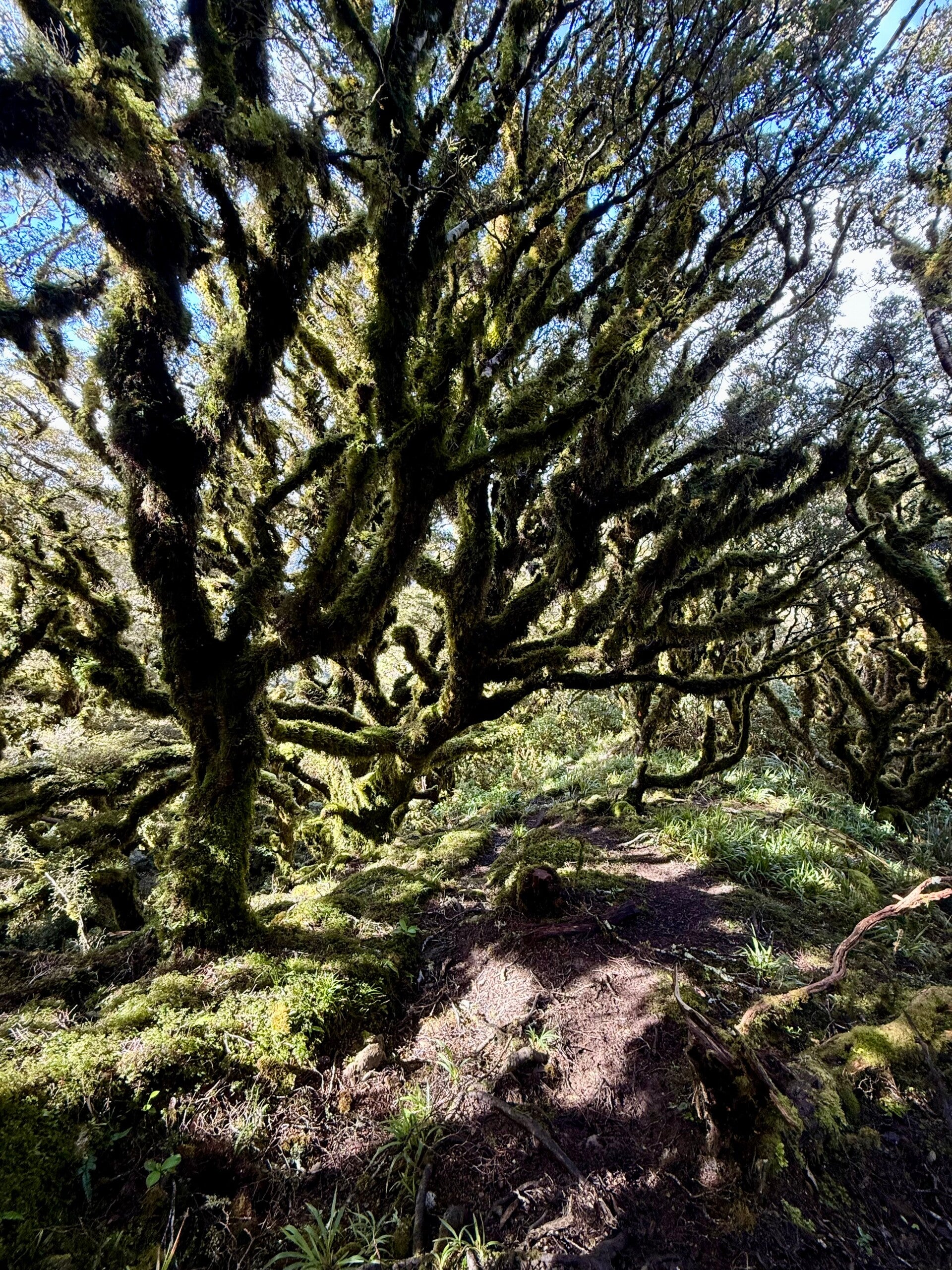
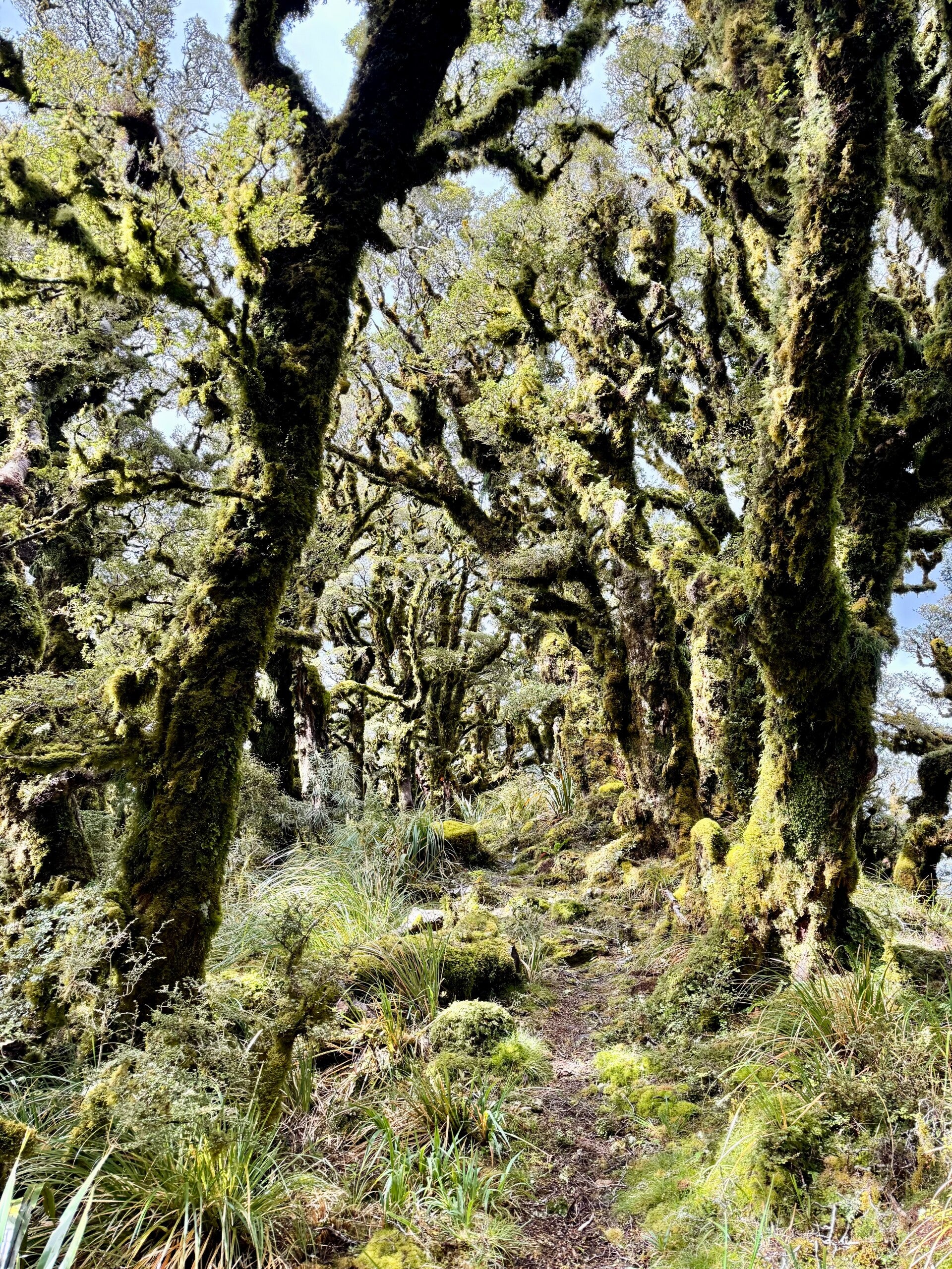
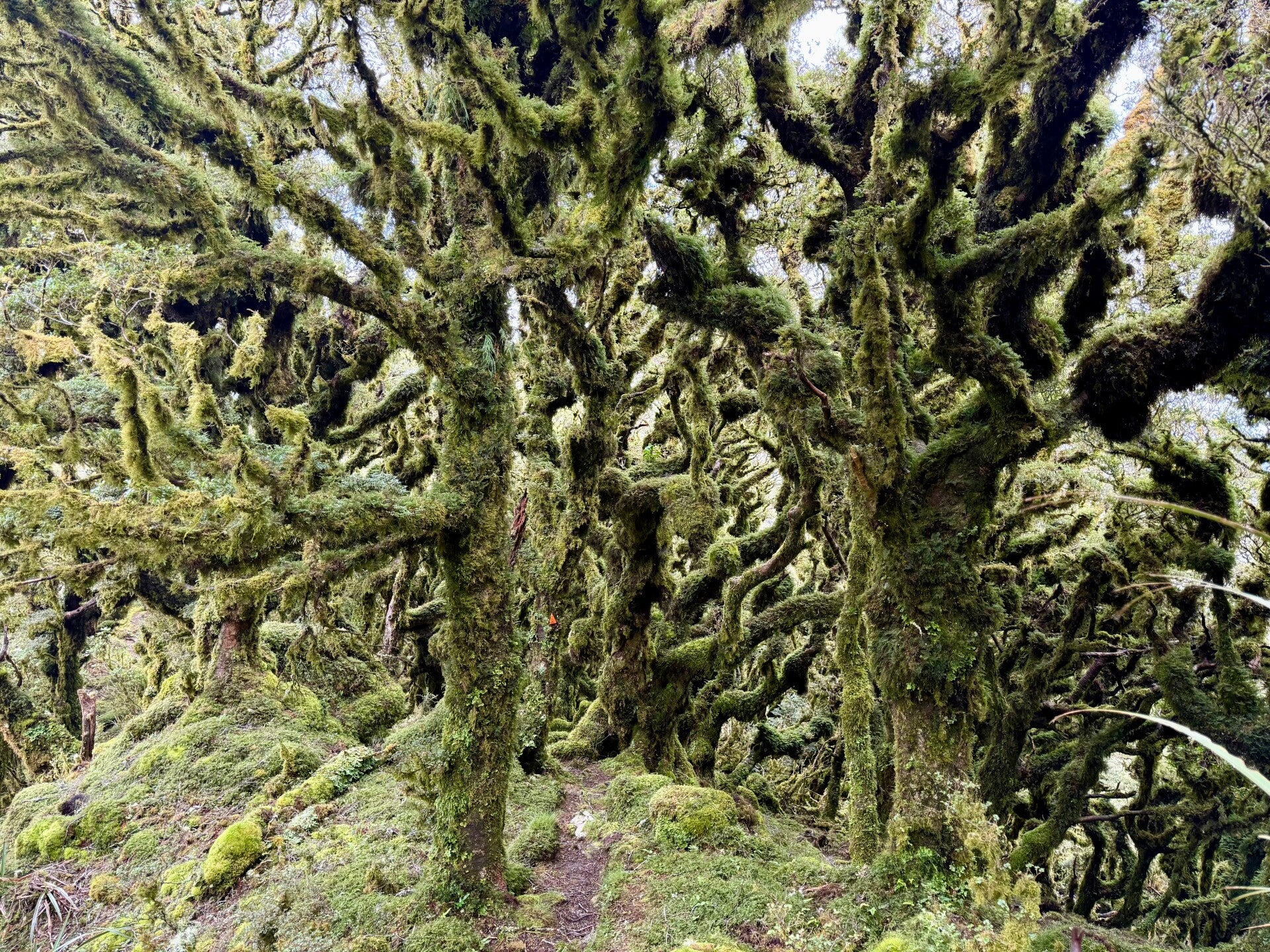
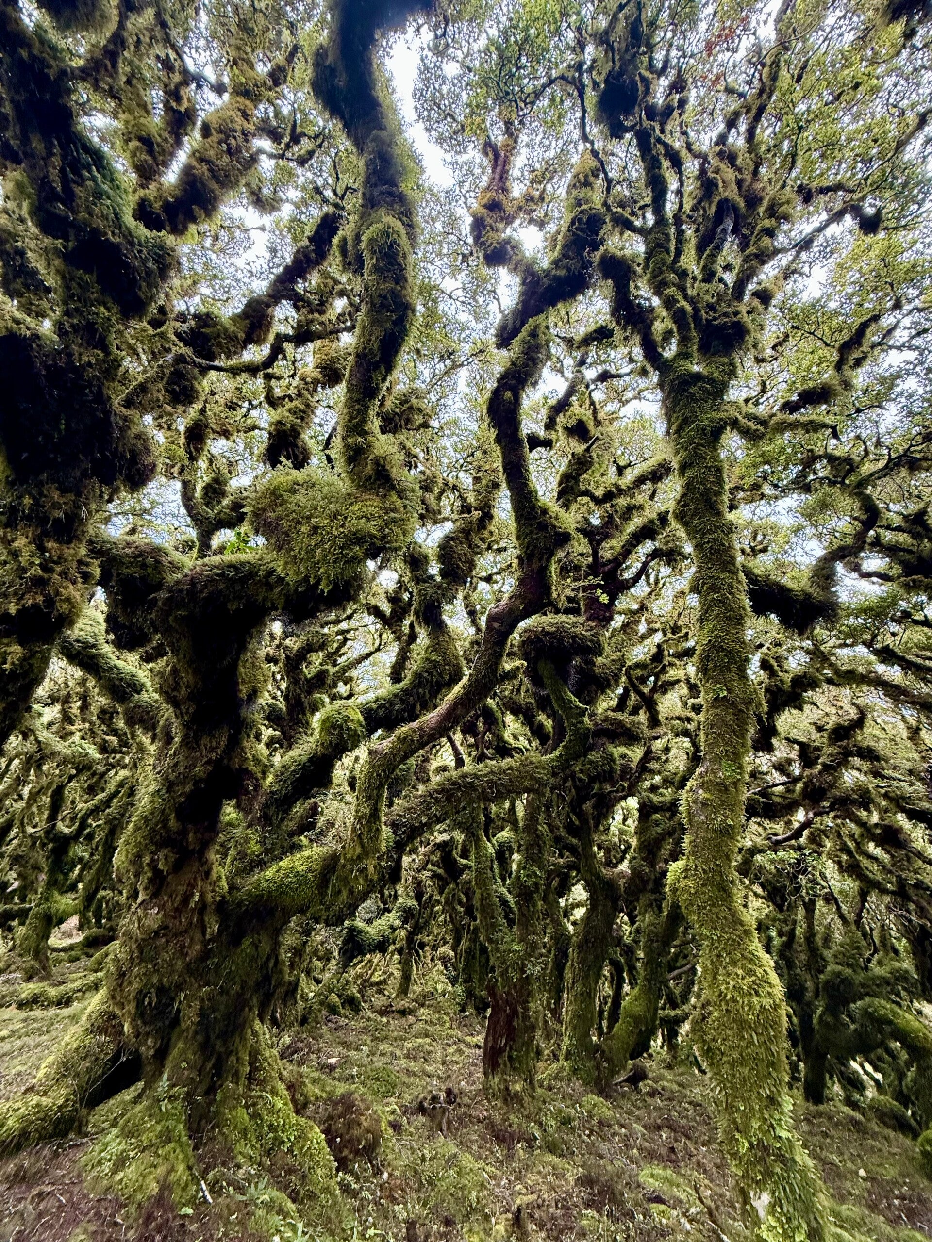
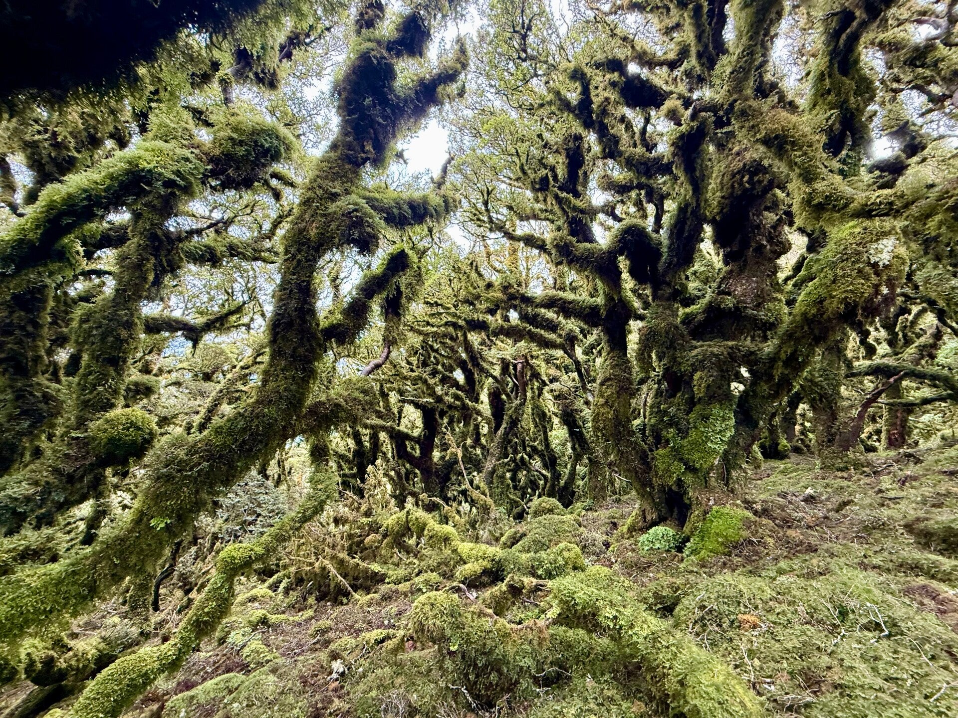
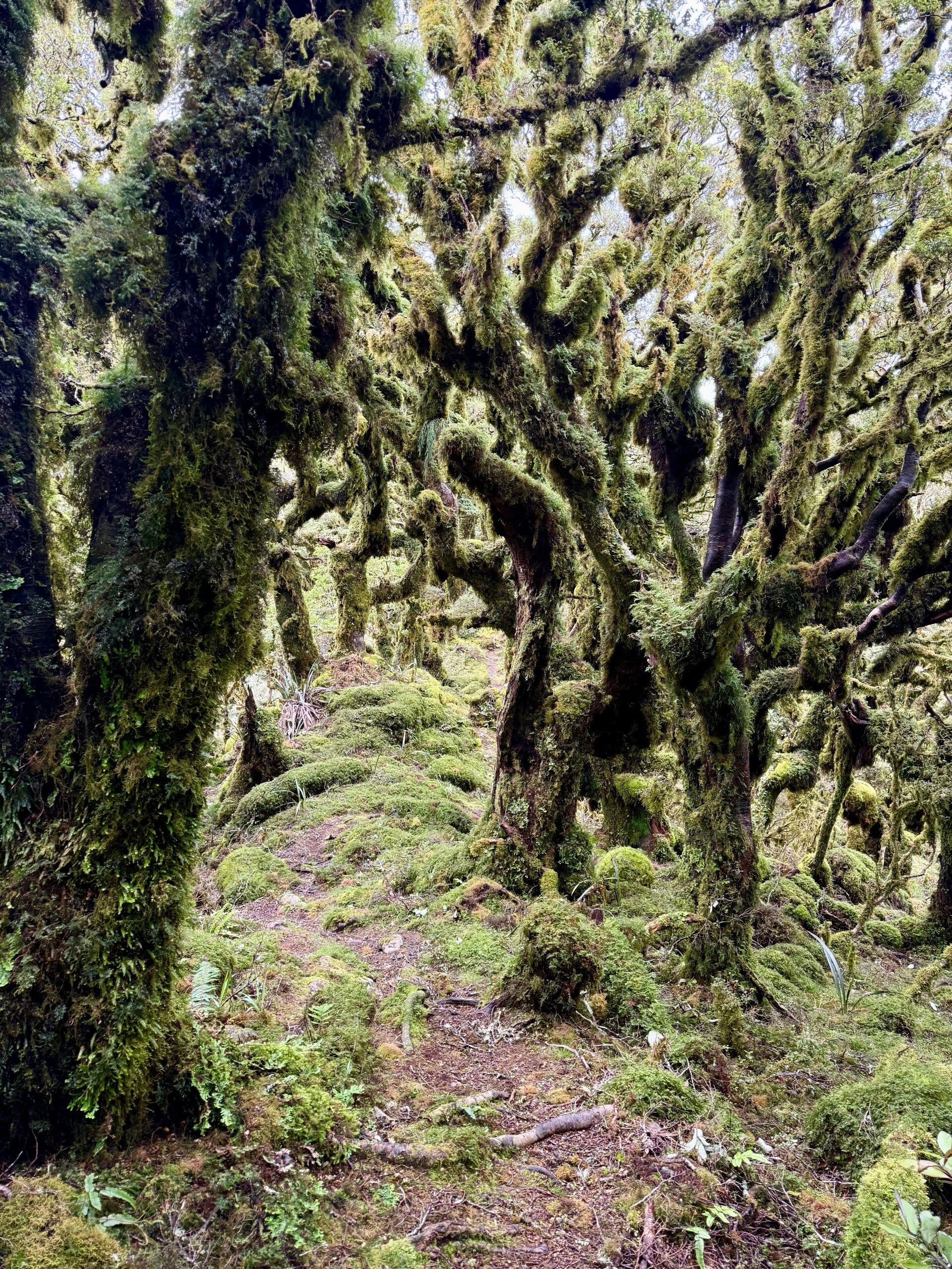
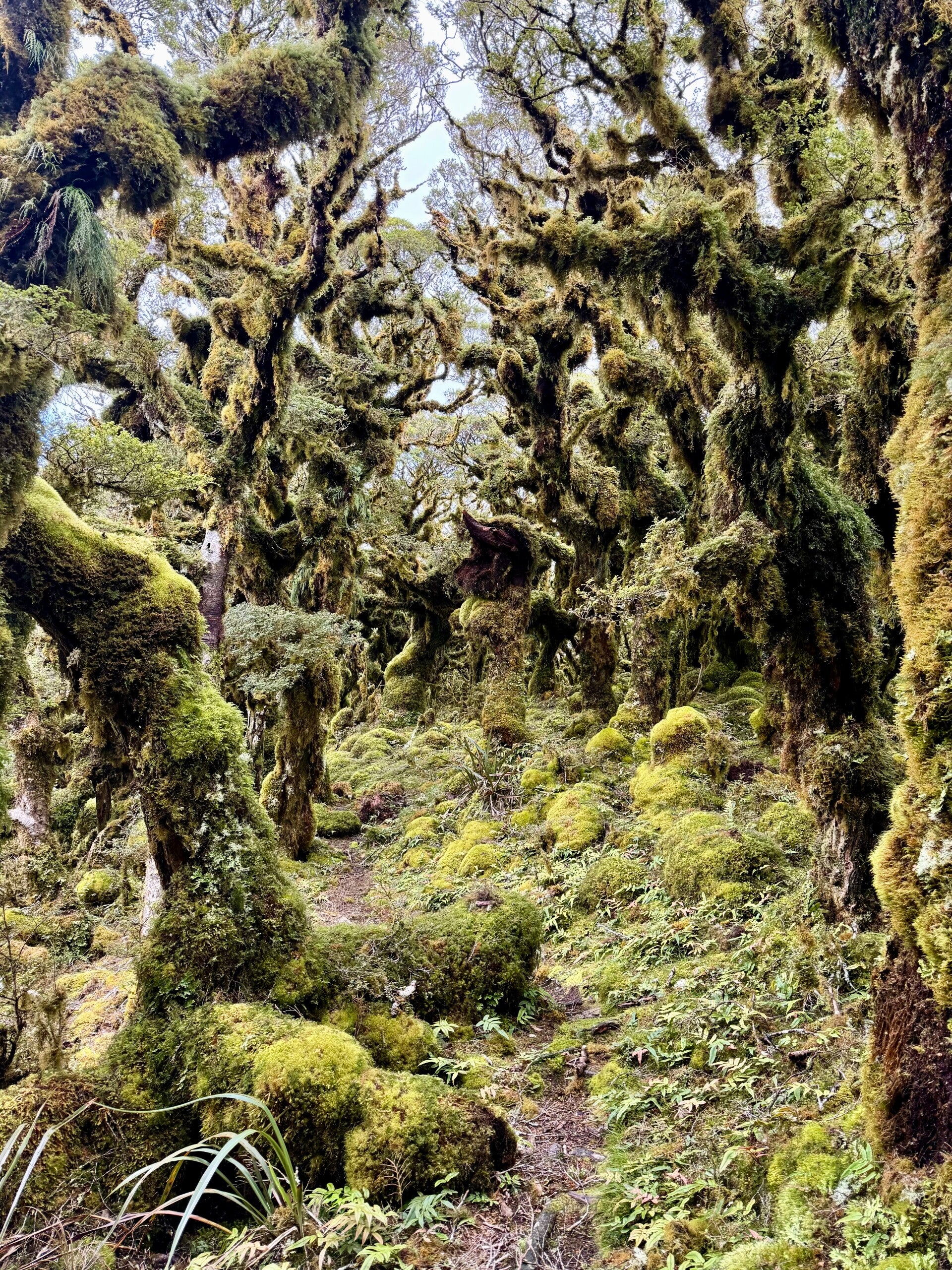
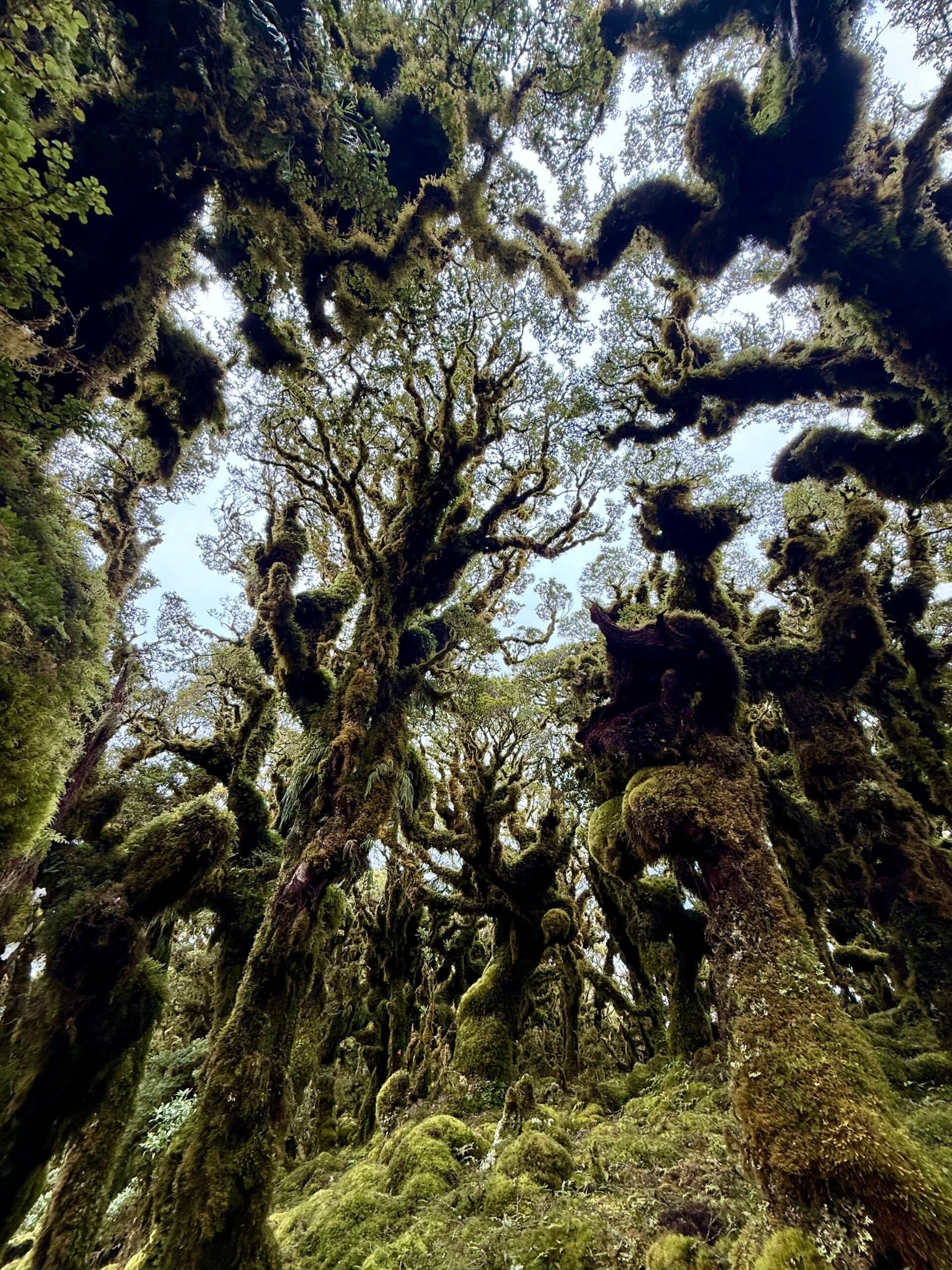
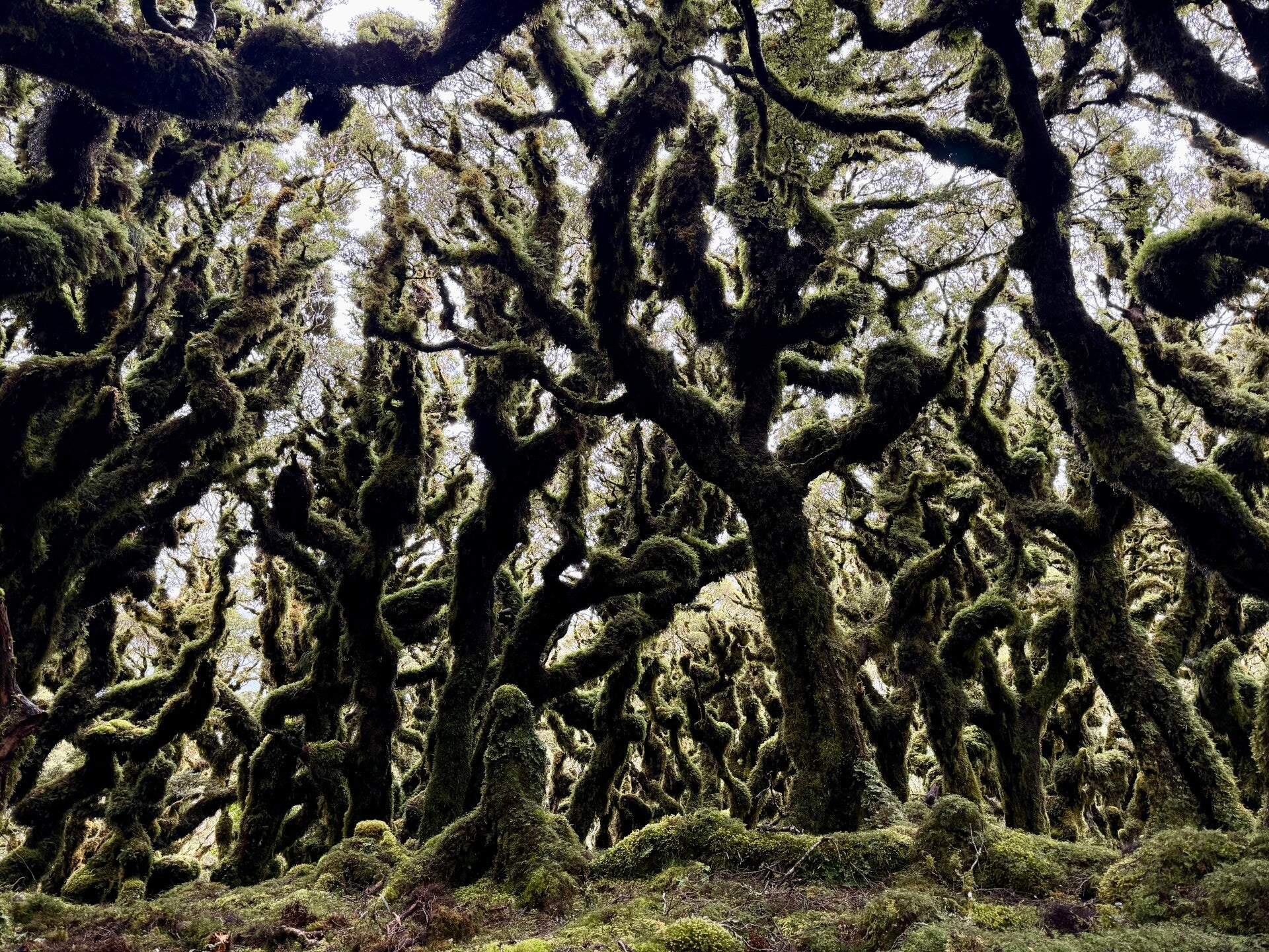
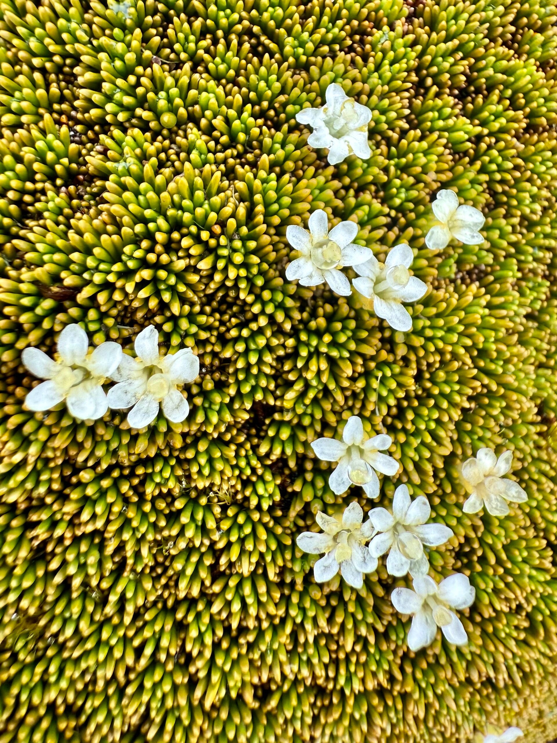
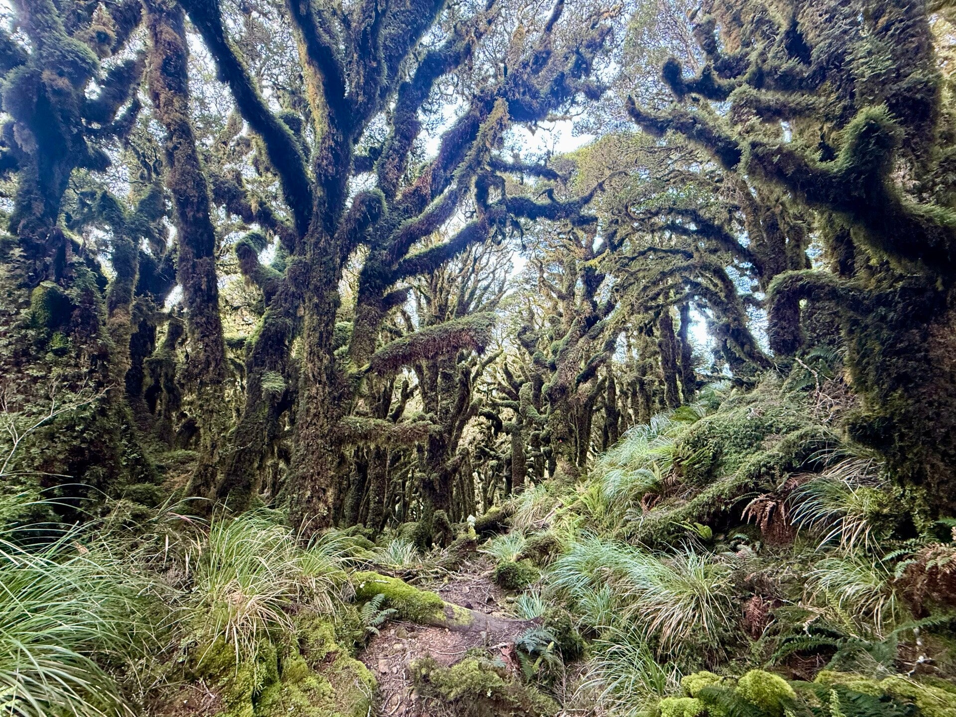
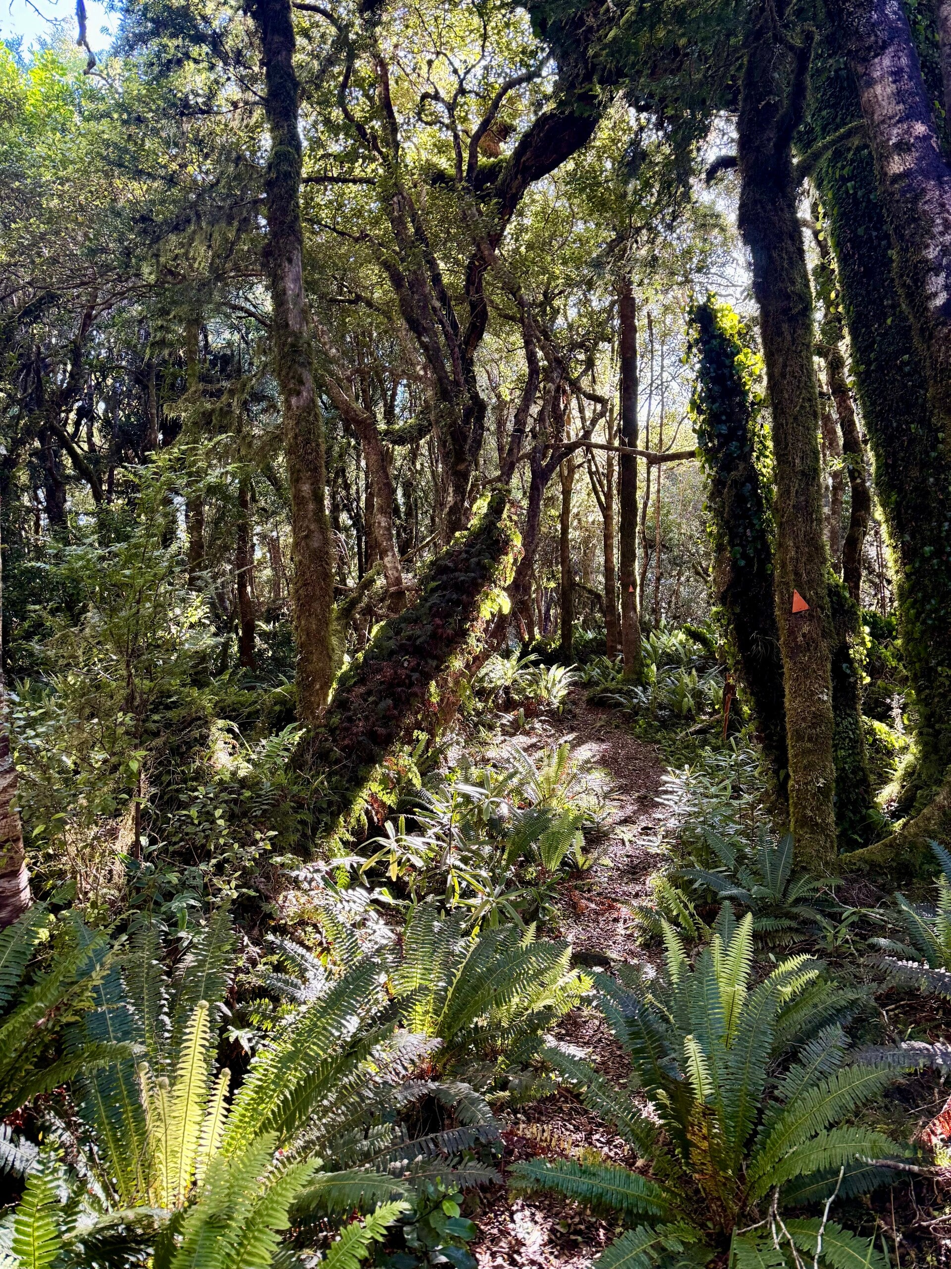
When we descend below the tree line, we discover a pristine forest, untouched by human activity, seemingly frozen in time. The morning fog has saturated the mosses that cover every square inch of the trees, which ooze with the first rays of sunlight. The trees vary in height; those directly on the ridge, exposed to the sometimes violent winds, barely reach three meters; the others measure approximately five to seven meters. All are bent and deformed, standing like ghostly statues made of bark and lichen, their undulating branches seeming to have been frozen in a ritual dance. I think it's the most beautiful forest I've ever seen.
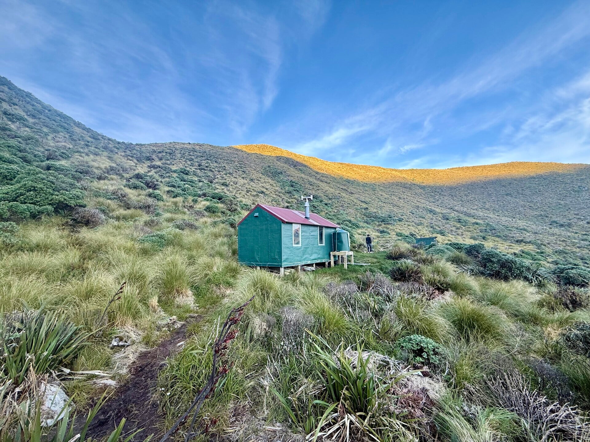
We pass several times between wooded areas and bare treetops, and after eight hours of walking, I reach the hut where we'll spend the night. Only six bunks are available, and since there are seven of us, we just have to squeeze in a bit.
We spend the late afternoon and evening playing cards, laughing uncontrollably!
🗓️ January 03, 2026
🏁 Kilometers : 1662
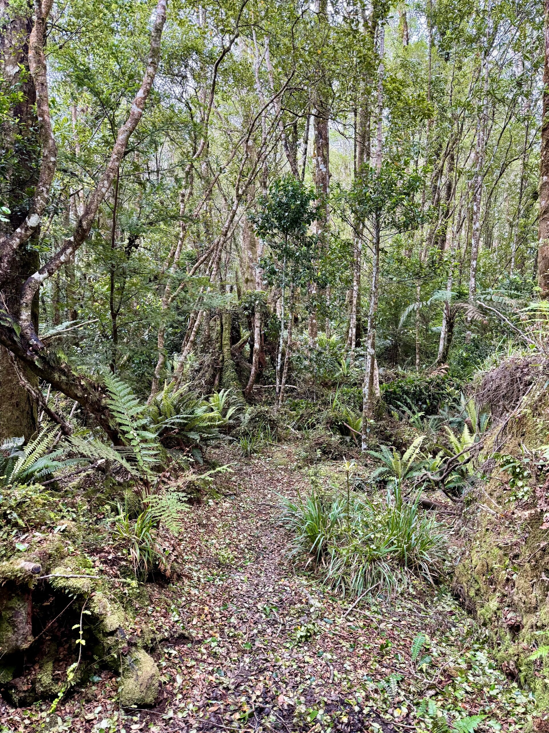
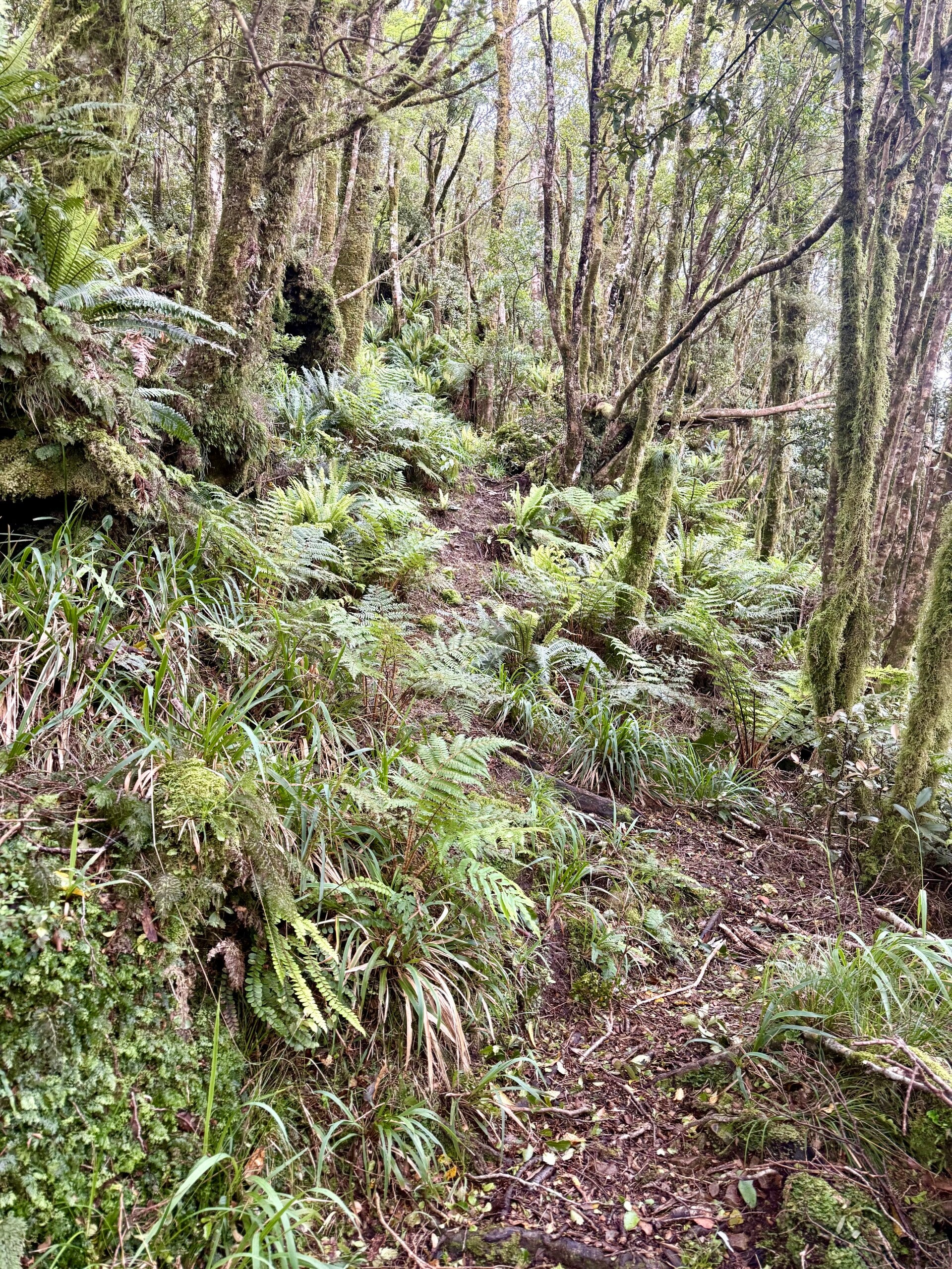
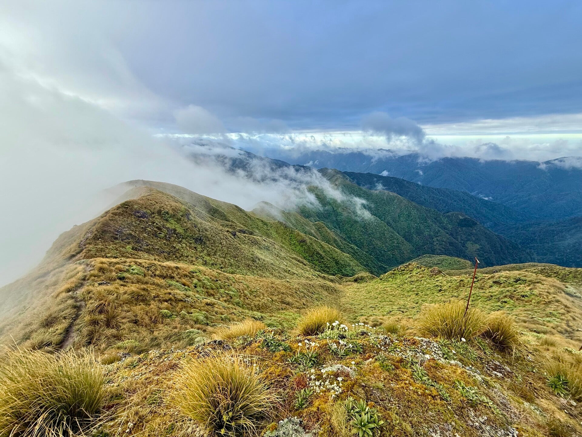
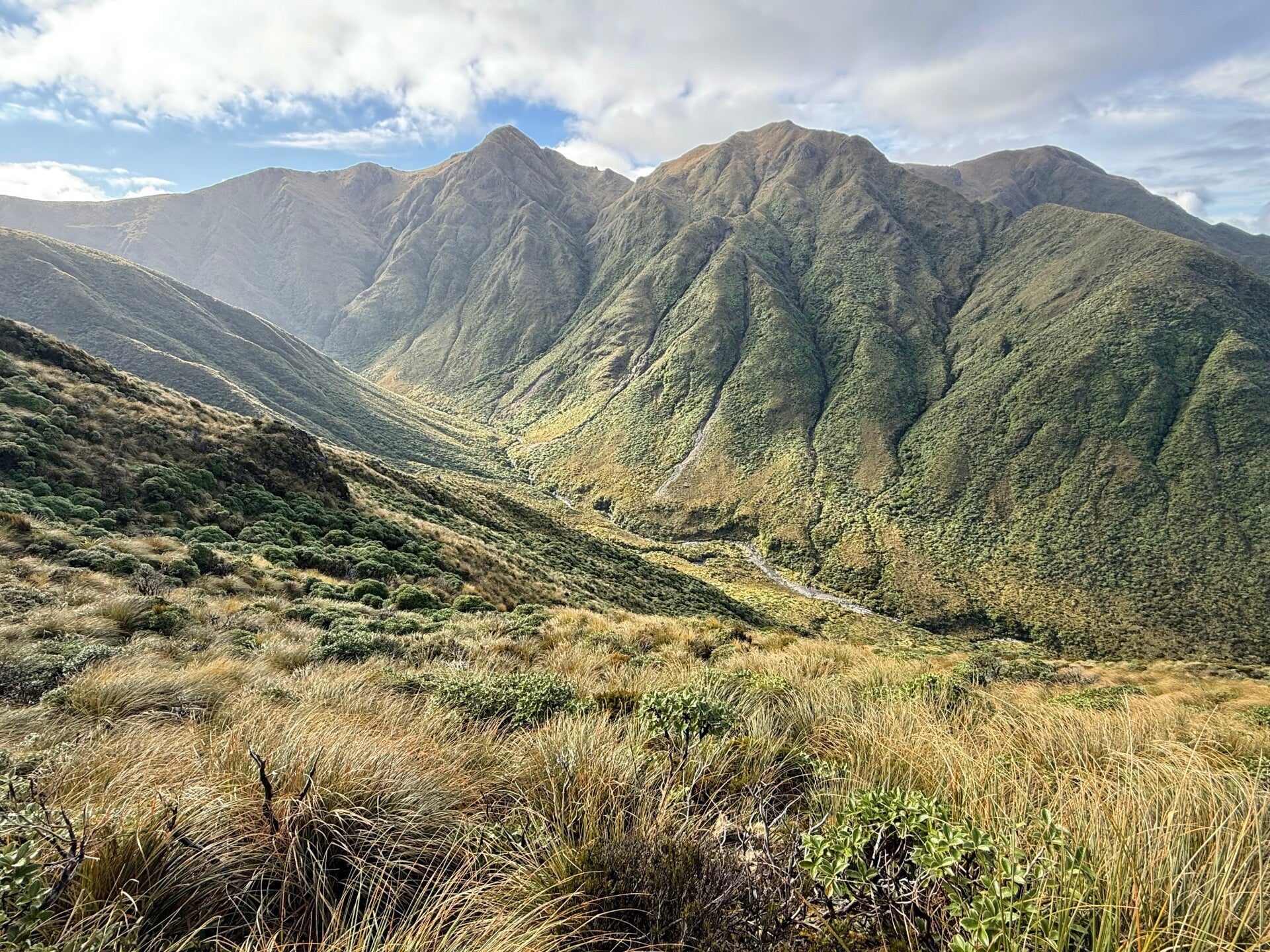
The day begins on the ridges in the fog and a strong wind. Yesterday's magnificent views are hidden from me today, which is a shame because this section is apparently very beautiful, with views all the way to the South Island. I trudge along, my feet sinking into the mud as usual, unsteady and chilled by the wind gusting across the ridges. I have 5 kilometers to hike along the summits in the cold, before descending 1100 meters, traversing a steep 3-kilometer trail under the canopy of a forest.
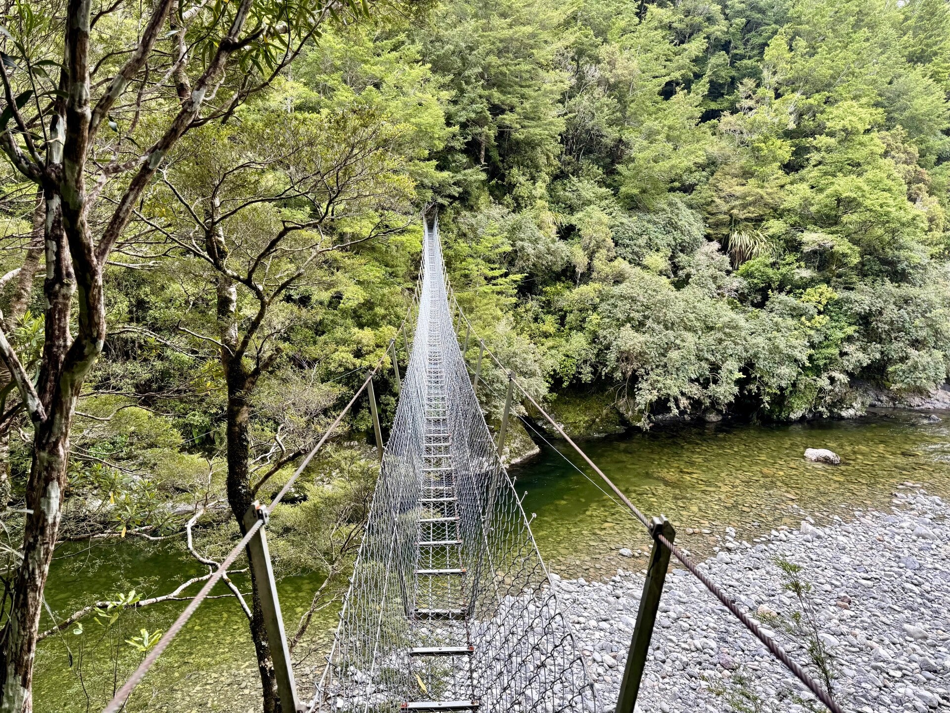
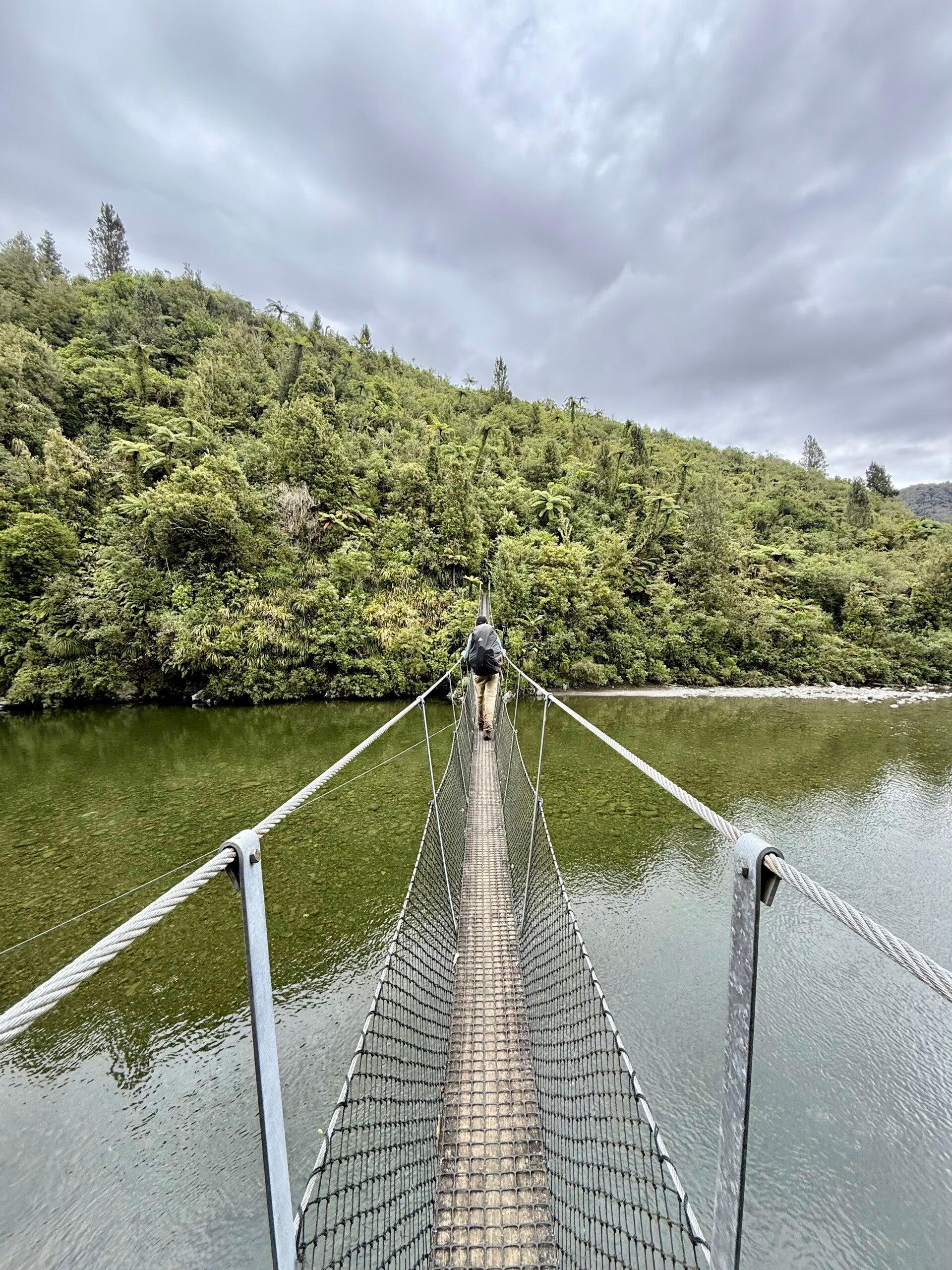
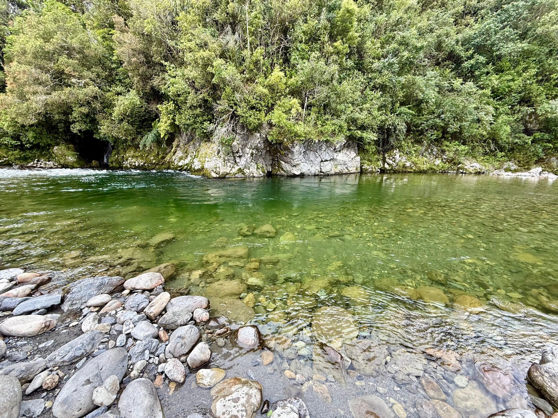
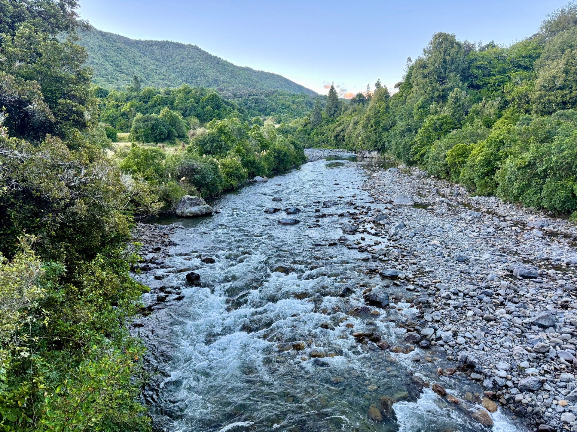
Reaching the bottom of the slope, I cross a river on a sort of rope bridge made of wire mesh, which is quite impressive to cross. I then arrive at a charming hut located beside a river where I have lunch. The last part of today's hike takes me through a forest where the badly rutted trail requires me to take numerous precautions, making progress arduous. It takes me almost 5 hours to cover barely 10 kilometers. I'm exhausted when I arrive at the hut for the night, but a quick dip in the cold waters of the nearby river revives me. One last leg tomorrow and I'll reach the town of Waikanae. I'm dreaming of a normal meal, a shower, and being able to do laundry!
After 7 days, my clothes are in an indescribable state!
🗓️ January 04, 2026
🏁 Kilometers : 1693
Last day in the Tararuas. The trail is fairly easy and the kilometers fly by. After 26 kilometers, we arrive in town and take the opportunity to eat a proper meal, do some laundry, and enjoy a pint to celebrate our week. We then have another five kilometers to reach our campsite for the night. A large family barbecue with 300 people is taking place around the pool, and, having plenty of leftovers, we are graciously invited to join in. We even get dessert! Natalie and Jolly devour it, despite having had a late lunch. We burst out laughing watching them move with difficulty after consuming so much food.
Two more days of hiking and we will reach the capital, Wellington, located at the very southern tip of the North Island. We're practically touching the South Island!
Photos from the 31st of December and 01st of January
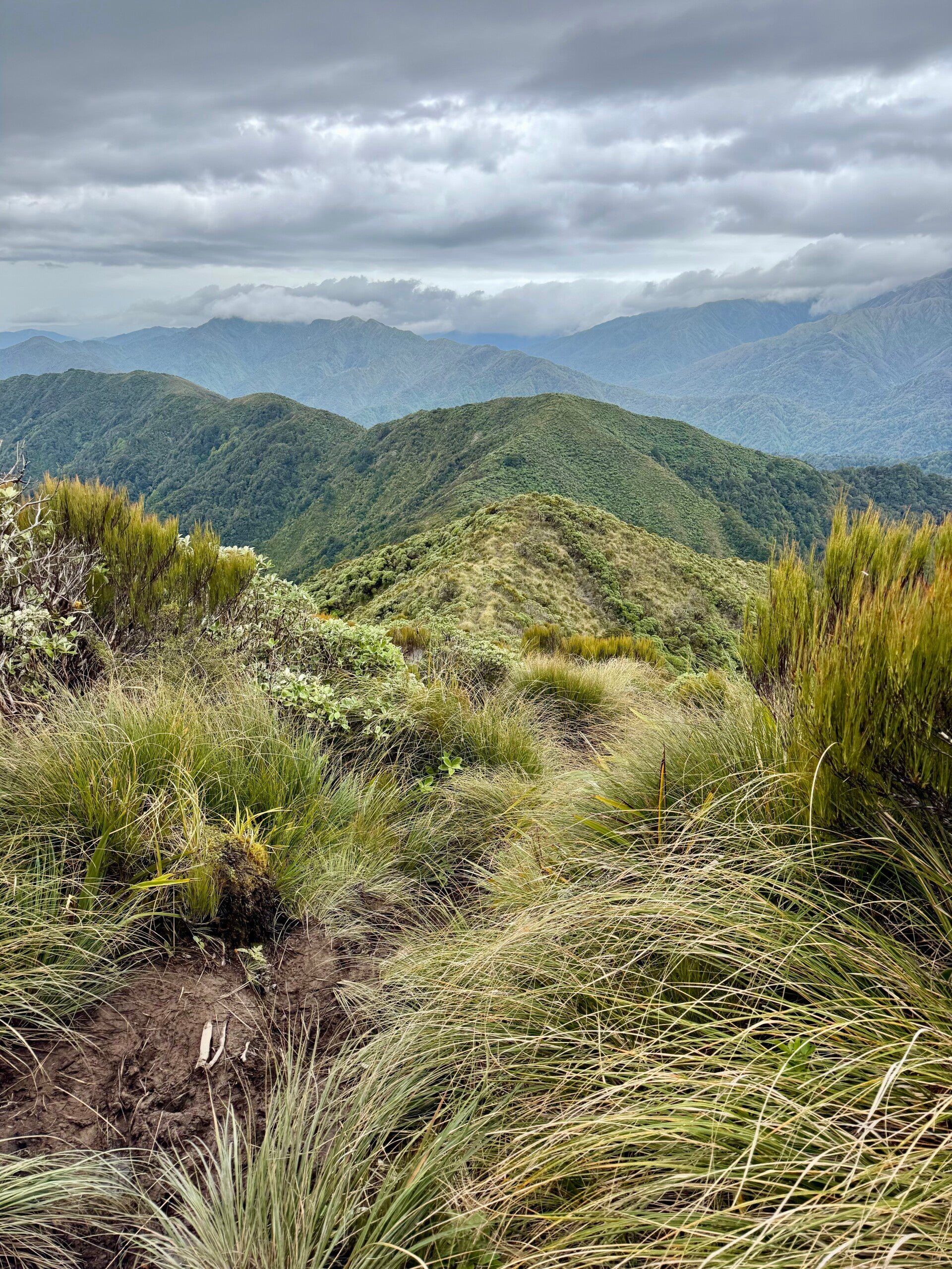
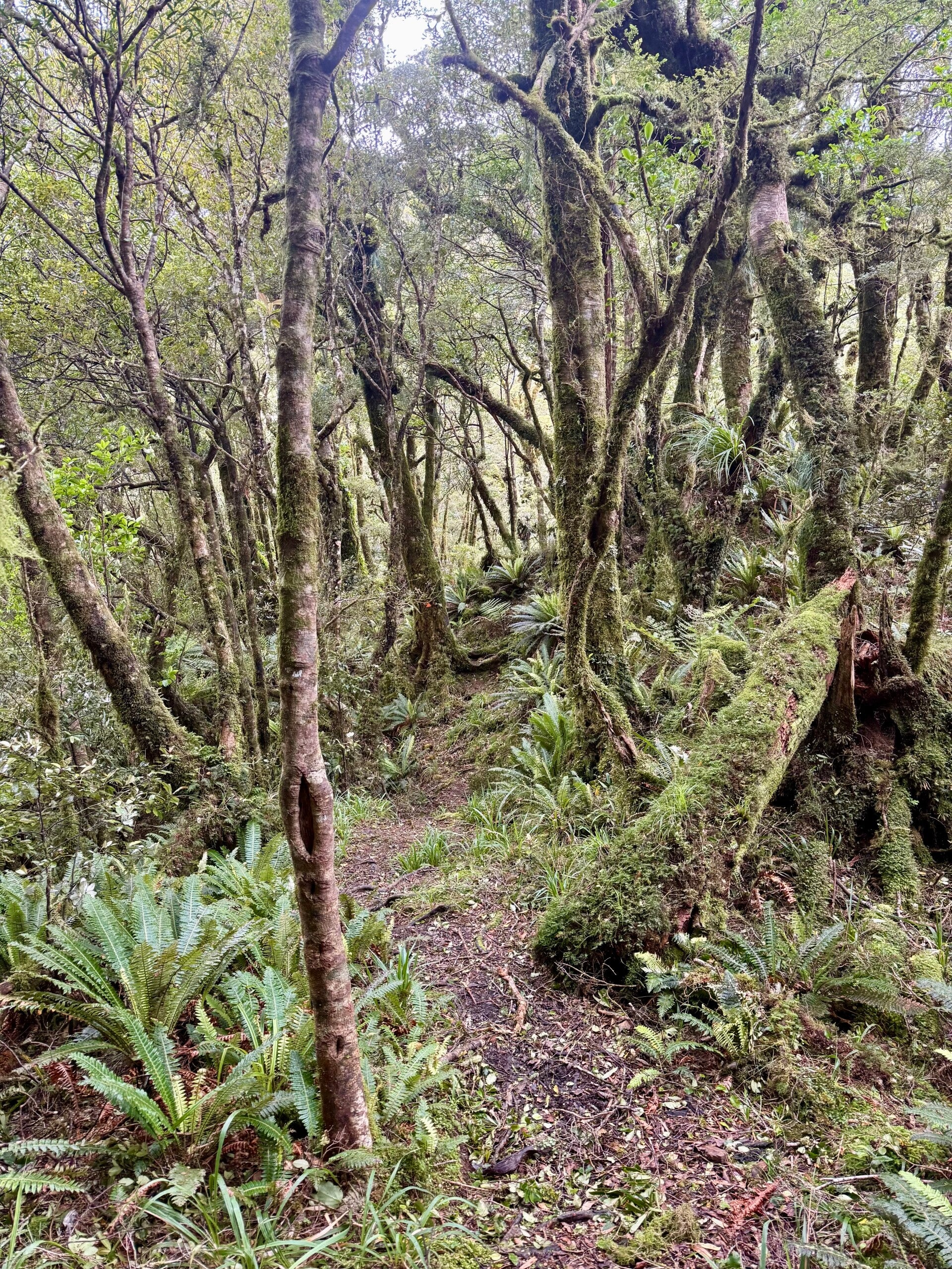
Photos from January 02, 2026


Photos from January 03 and 04, 2026

Add comment
Comments