🗓️ December 11, 2025
🏁 Kilometers : 1164
This morning I find myself on the northwest side of Tongariro National Park, a park comprised of several still-active volcanoes. A 7-kilometer walk along a road will take me back to the northern part of the park, the starting point for New Zealand's most famous hike: the Tongariro Crossing, an 18-kilometer trail that attracts 150,000 visitors each year. For our Te Araroa trail, we have several options: the short 18-kilometer route, two intermediate routes of 42 or 53 kilometers, or the long 79-kilometer route that circles the two volcanoes in a three-quarter loop, entering from the north and exiting from the west. I choose the longest version, knowing I have four days to complete it at a leisurely pace.
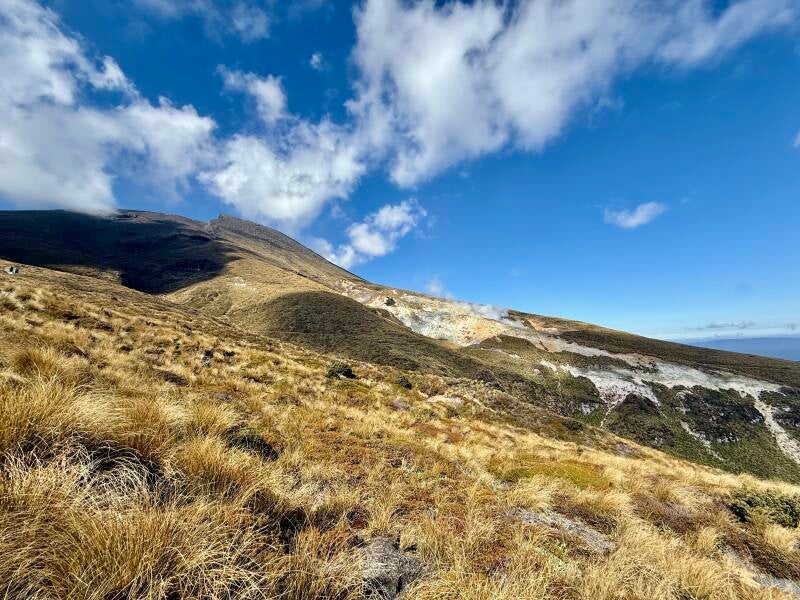
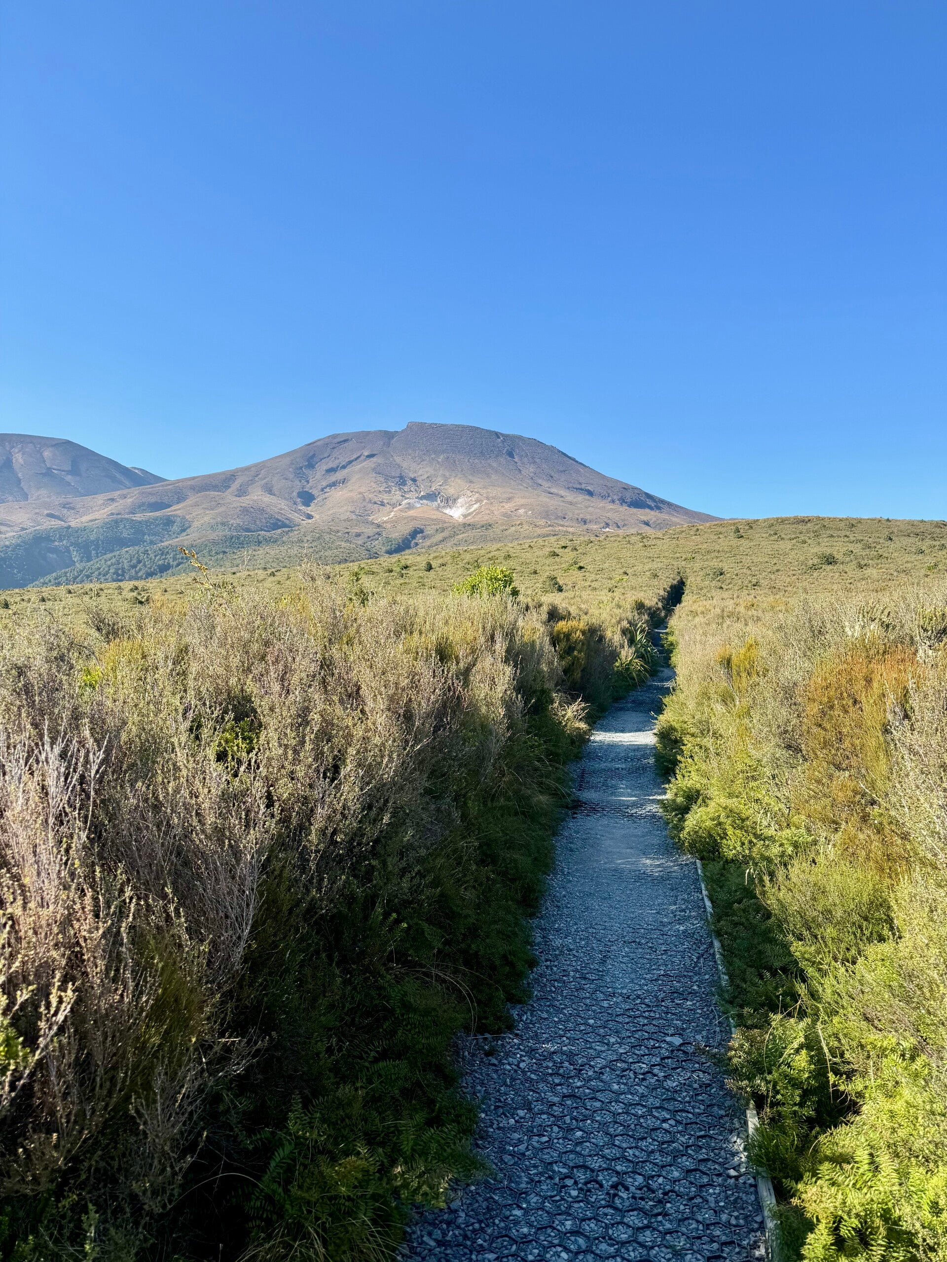
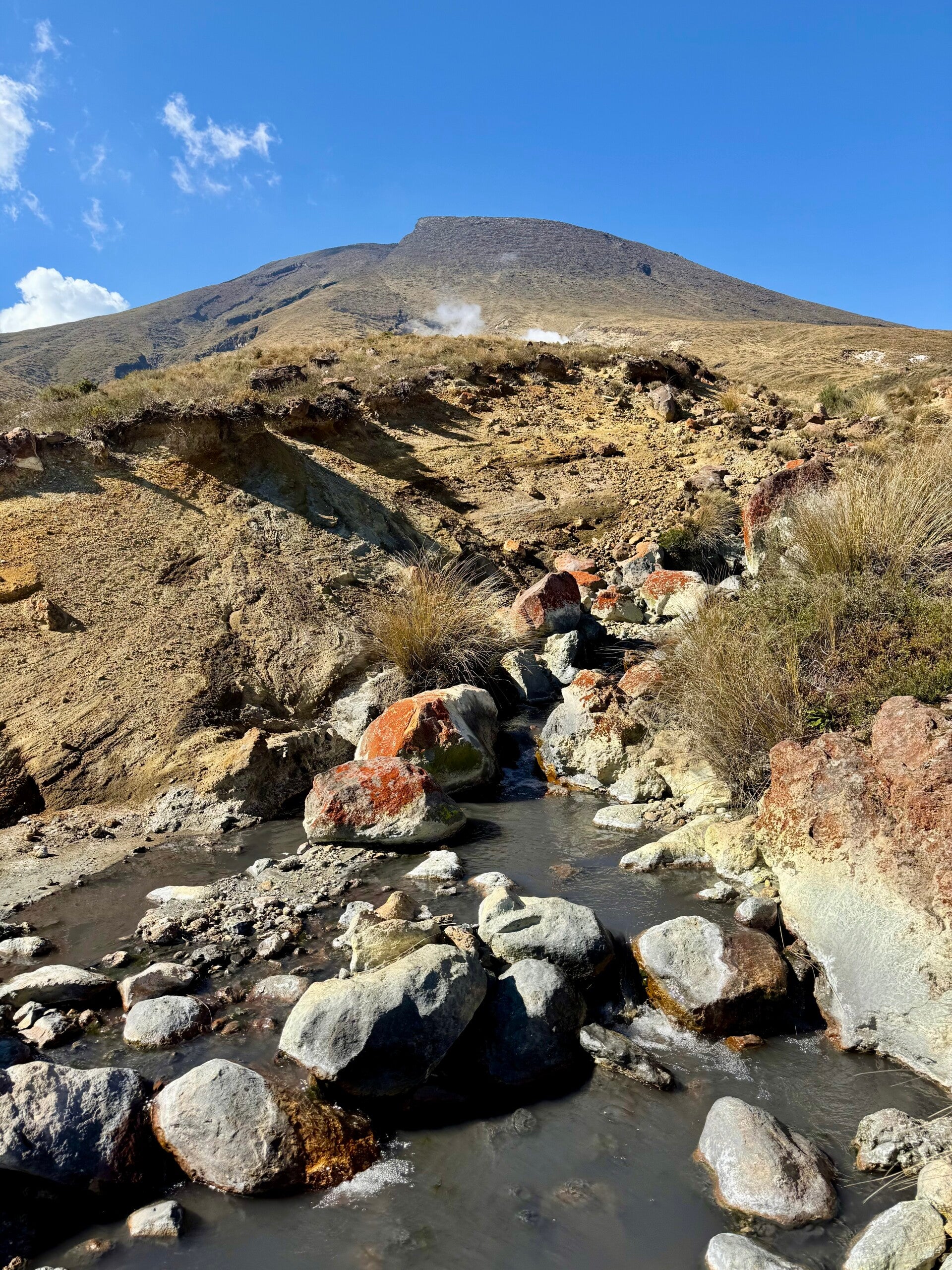
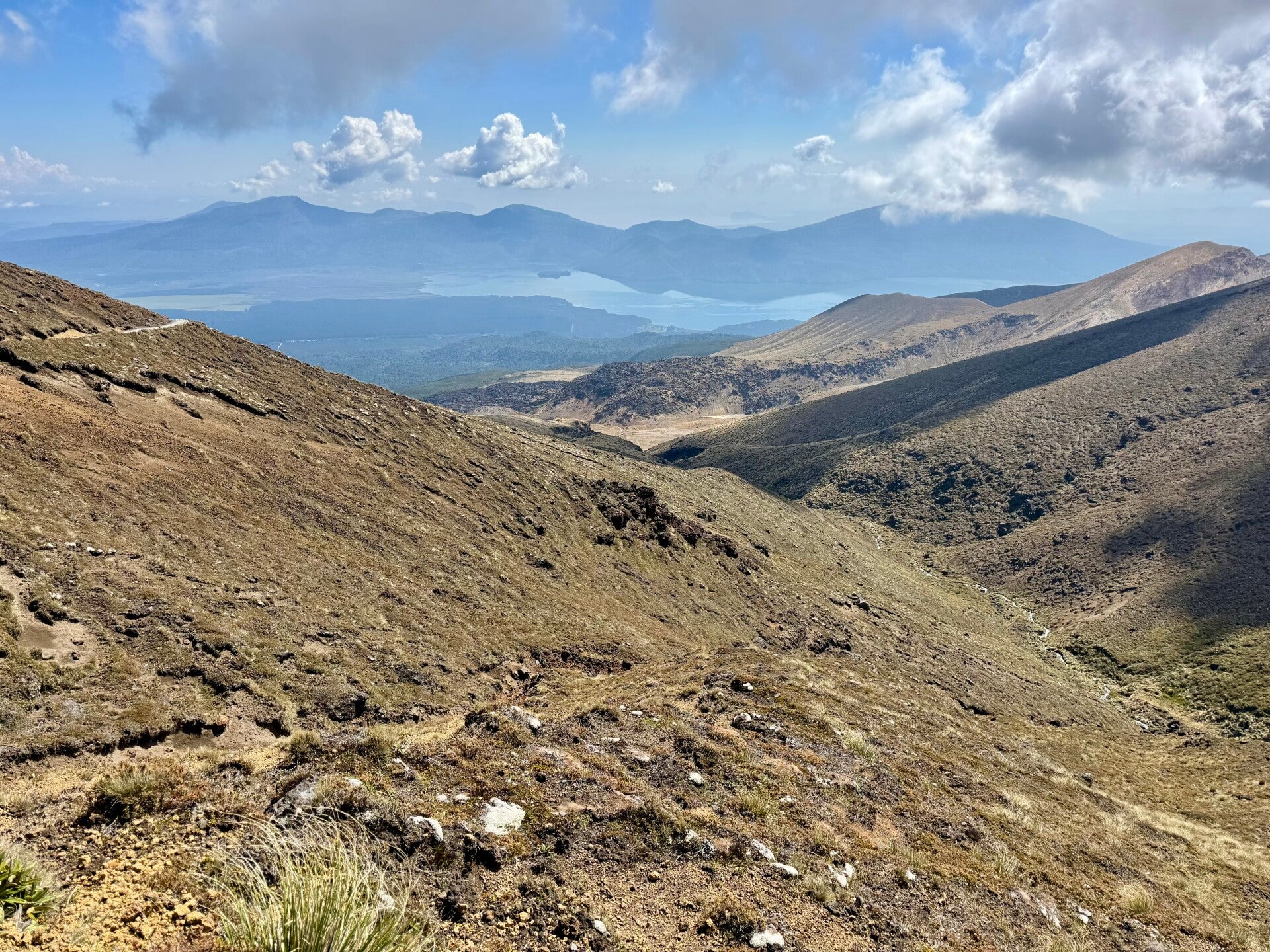
I set off at 5:45 a.m., quickly leaving the 7-kilometer road behind, and begin the trail that starts on the lower slopes of the park in a forest. The trail then emerges from the woods and winds its way up the northern face of the massif, passing between the Tongariro volcano on the right and Te Maari on the left, the latter having last erupted in 2012. I can see a crater about 5 meters wide, created by a rock ejected during the eruption at 700 km/h from a distance of about 2 km! This reminds me that the entire volcanic massif is still active and that other eruptions could occur at any moment. I can also see fumaroles on the flanks of the volcanoes, as well as the characteristic sulfurous smell of volcanic activity. As I climb, the view opens up to reveal the surrounding landscape, with its yellowing grass, blue sky, and white clouds. It's magnificent!
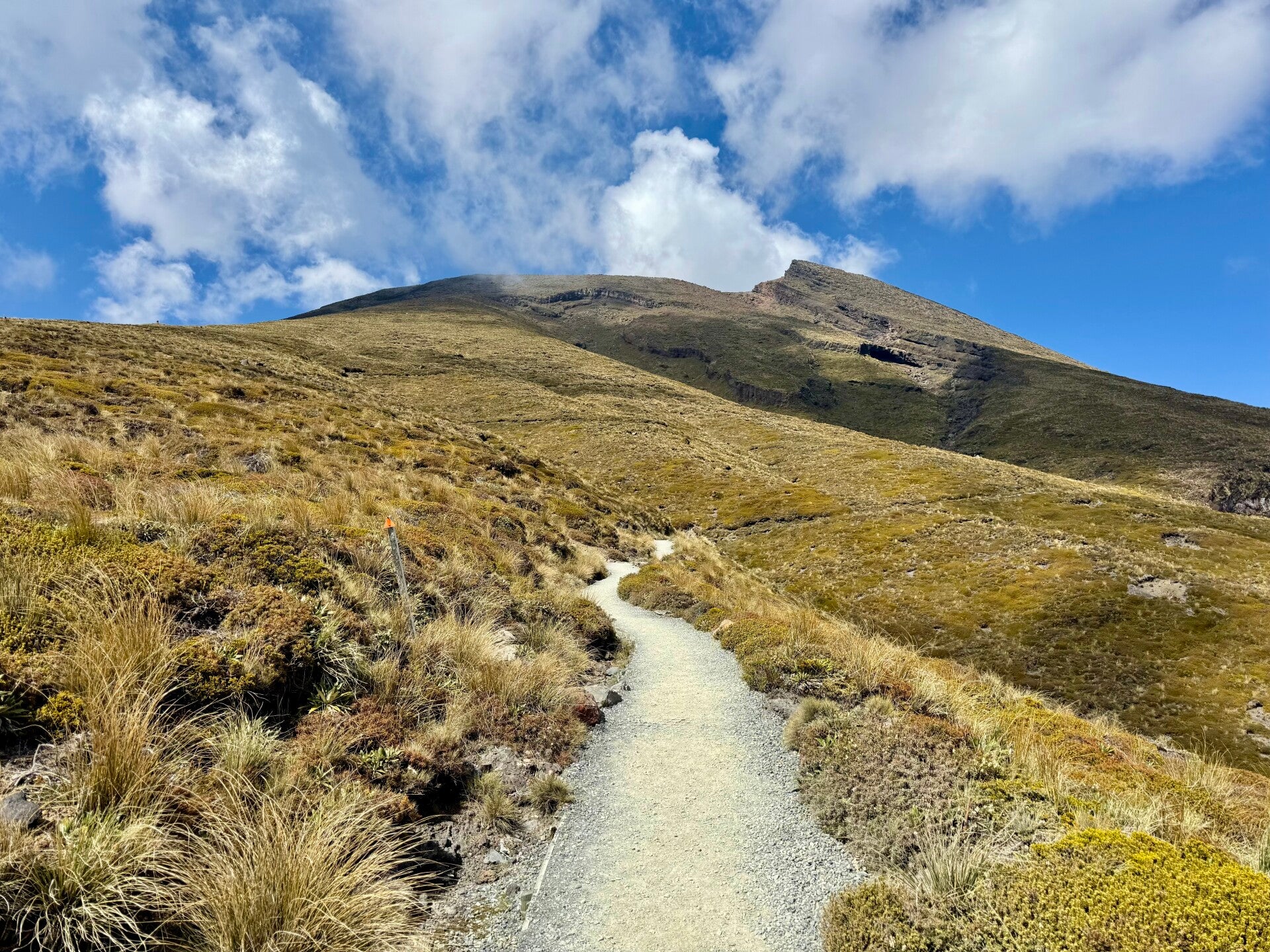
After a four-hour hike and a 1,000-meter elevation gain, I reach the 1,700-meter mark where the terrain flattens out on this plateau surrounded by a few volcanic cones. The landscape is arid and rugged, almost lunar, bare yet so beautiful! I start encountering many hikers doing the popular 18km trek in the opposite direction, from south to north. It seems most of them aren’t really used to hiking, and sometimes I feel like I am at a fashion show, given the extravagant outfits.
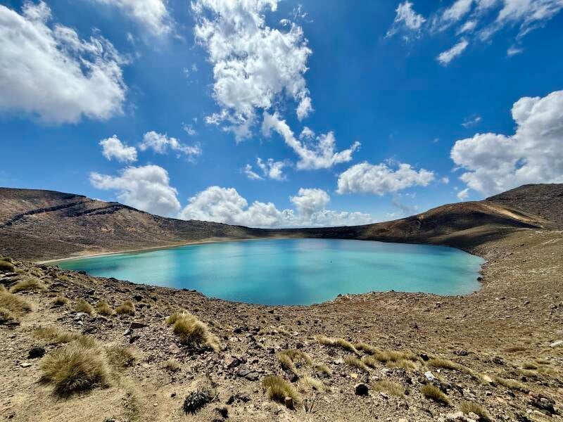
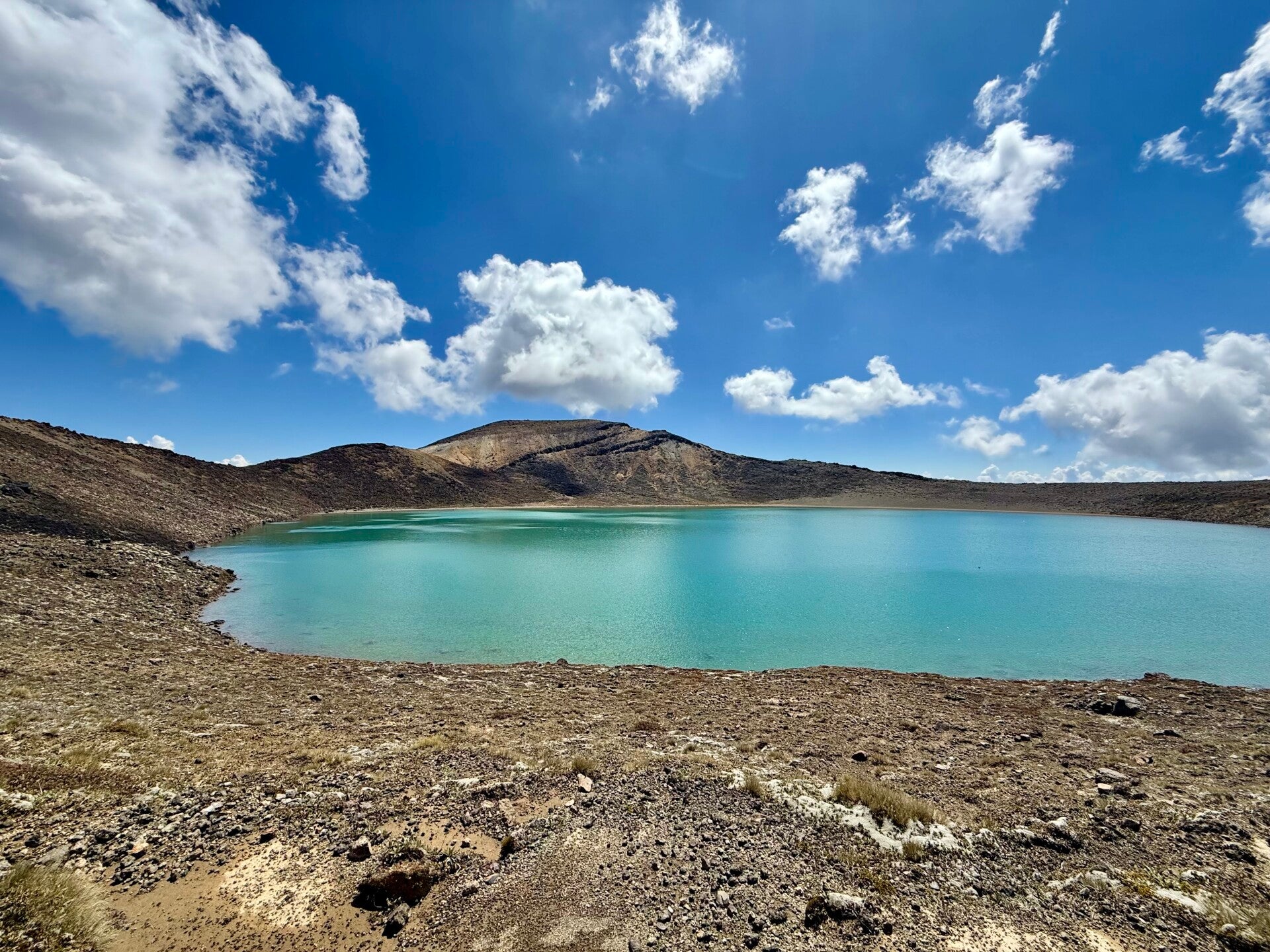
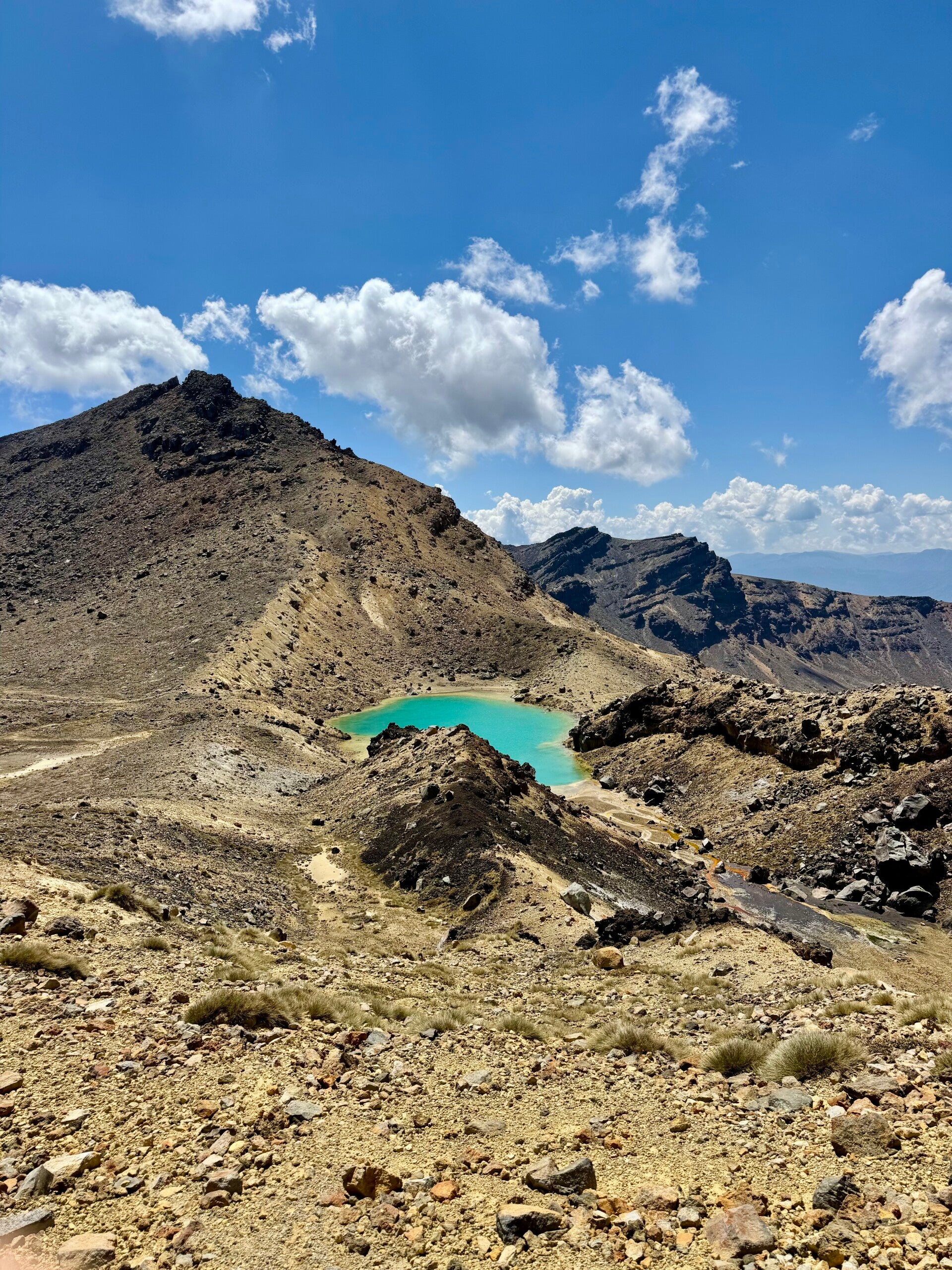
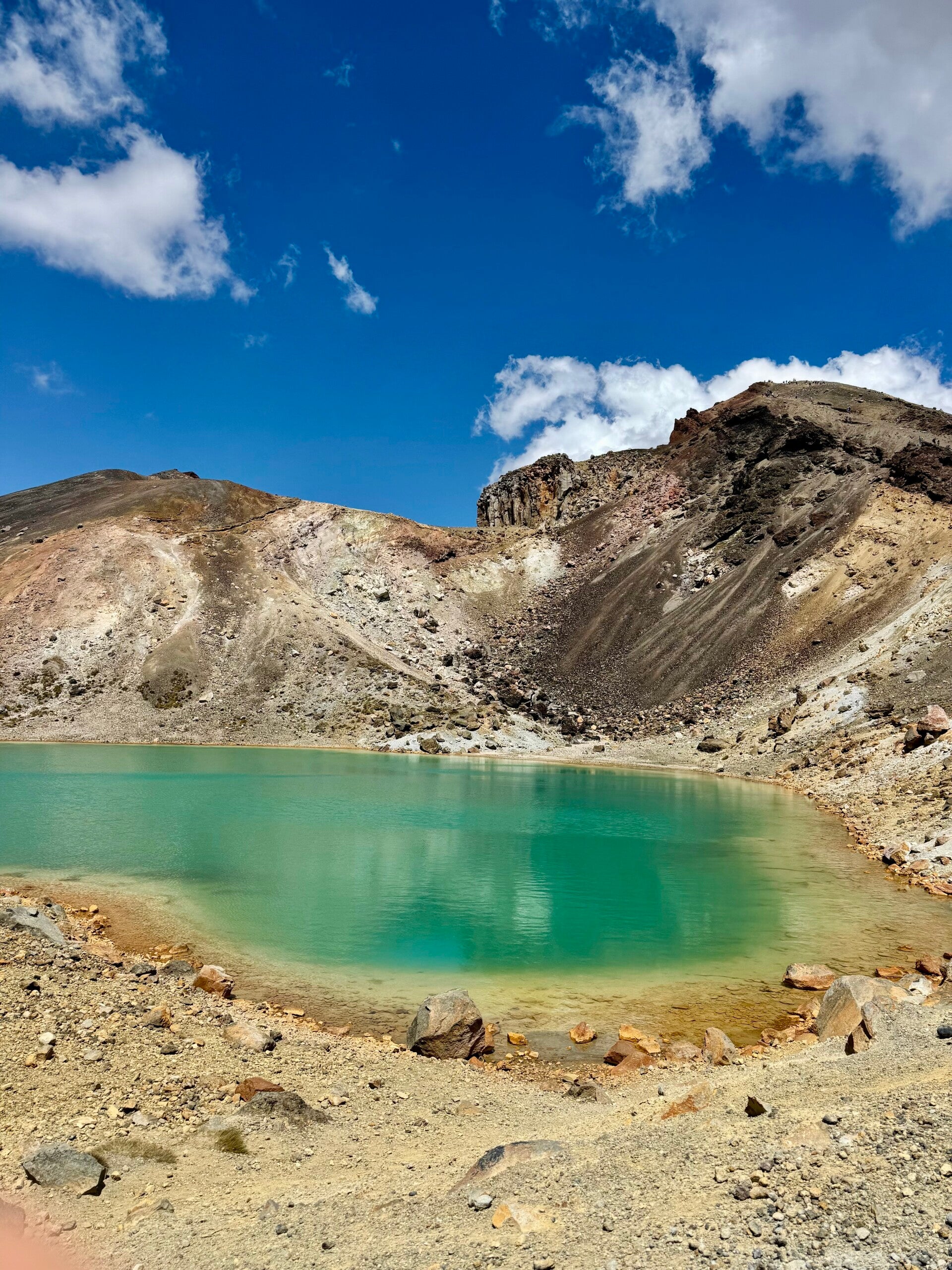
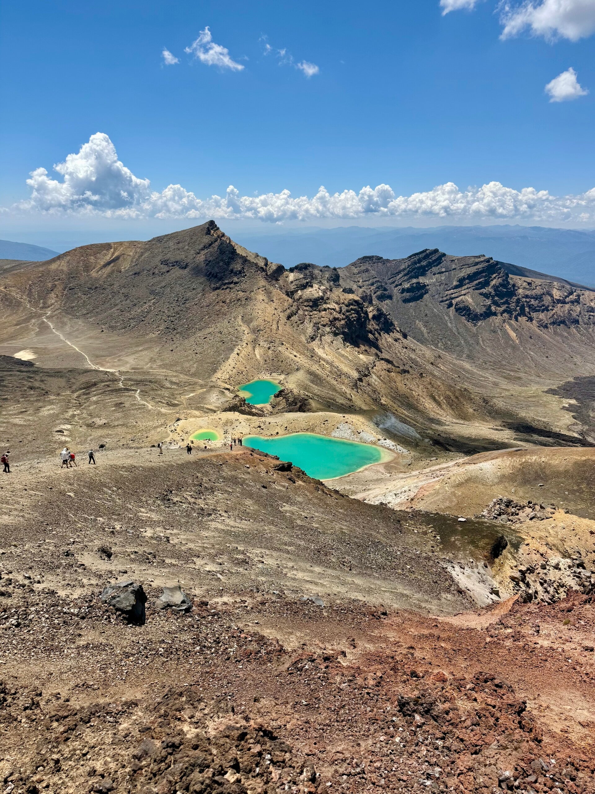
A little further on, I pass near the blue lake formed by an ancient crater.
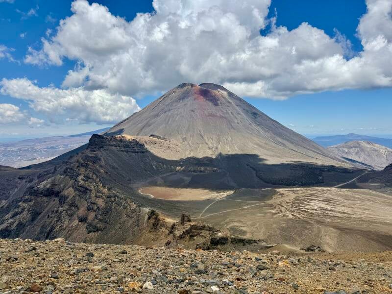
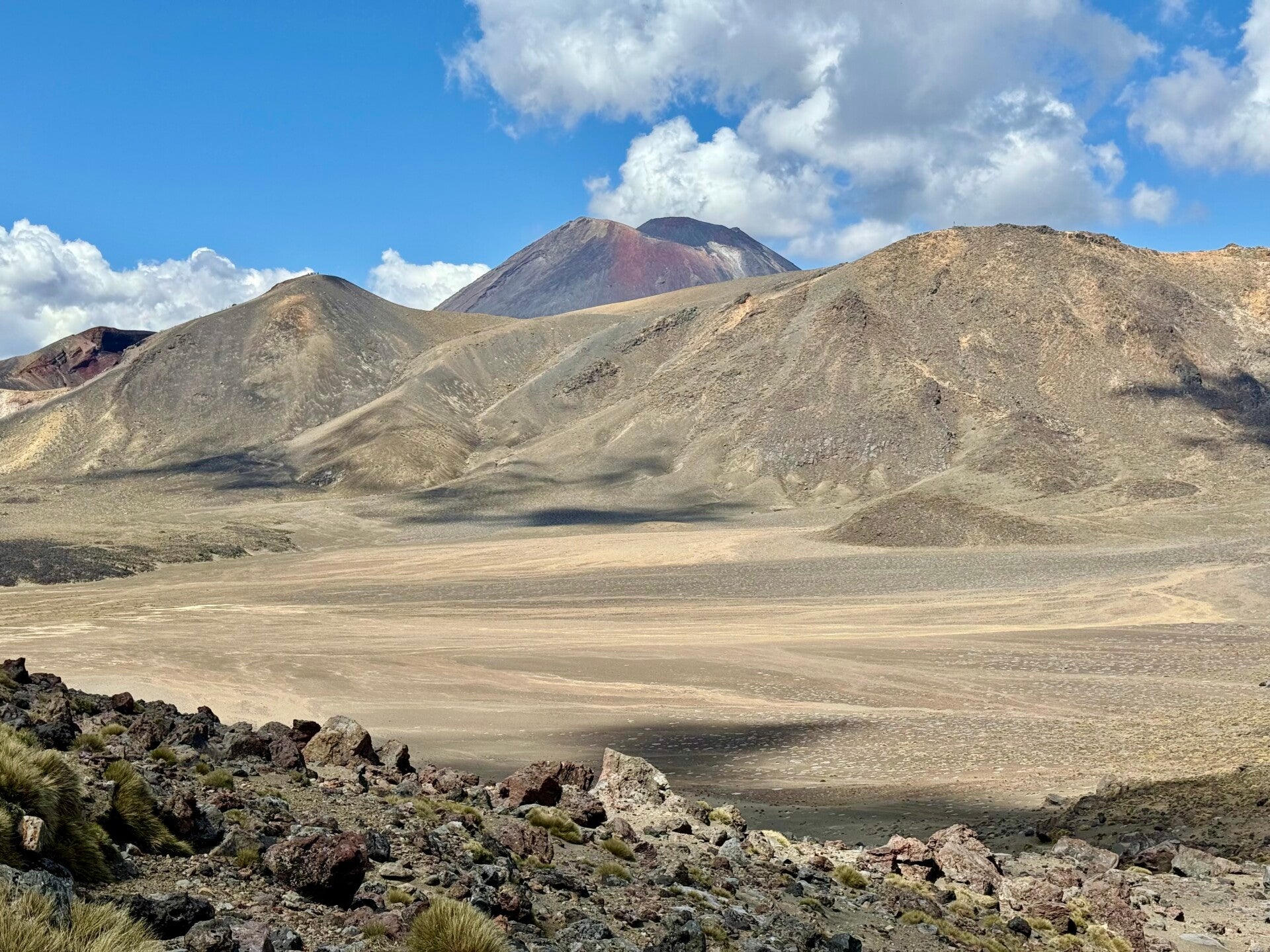
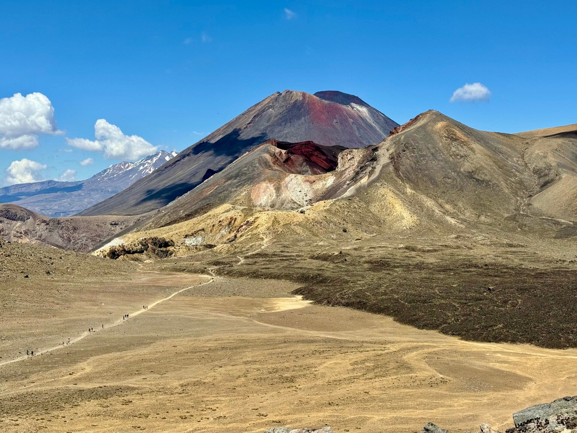
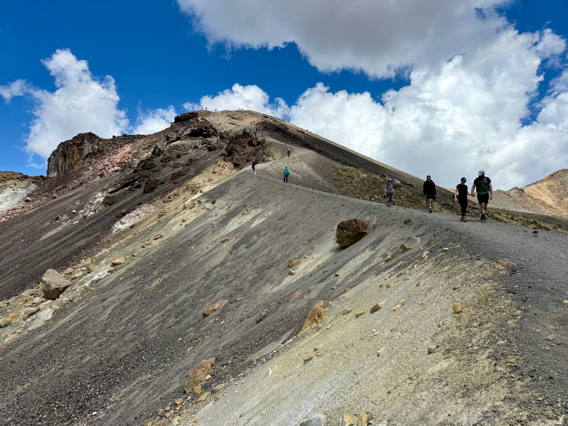
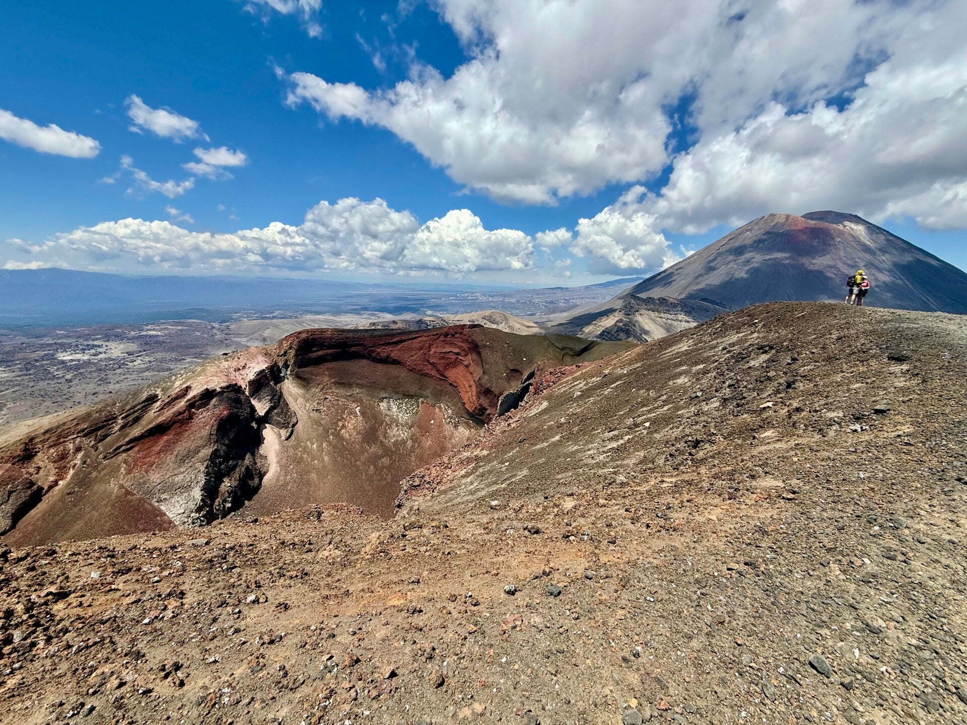
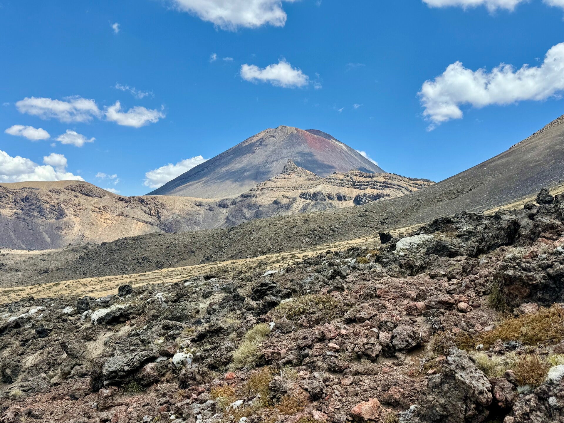
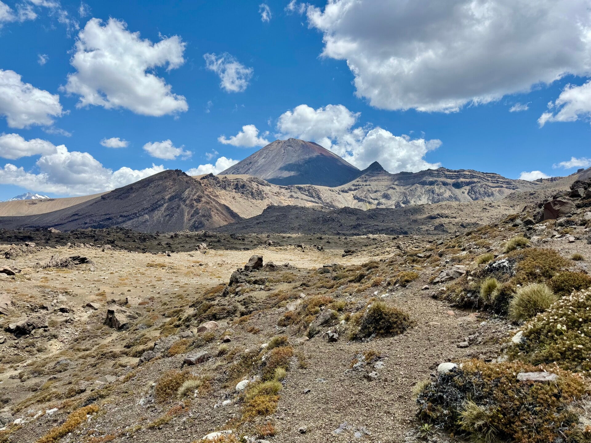
The terrain then slopes gently down to a junction: to the left, the detour to the two volcanoes, which I'll take, and to the right, the shorter route from which countless people are flocking. I drop my pack for a short out-and-back hike, heading against the flow of tourists to enjoy a beautiful viewpoint. The climb, although on a slope of small, loose pumice stones, seems easy once I'm rid of my heavy backpack. The 360-degree view from the summit of the red crater is magnificent, overlooking three small emerald lakes, a half-ruptured ochre-colored crater, and, most importantly, the famous Mount Ngauruhoe, which dominates the entire surrounding area and whose last eruption dates back to 1975. I sit down and contemplate this immense mass of lava rocks frozen into a perfect conical shape. For a Lord of the Rings fan like myself, the moment is magical; I imagine Frodo and Sam scaling its walls to throw the ring into the crater.
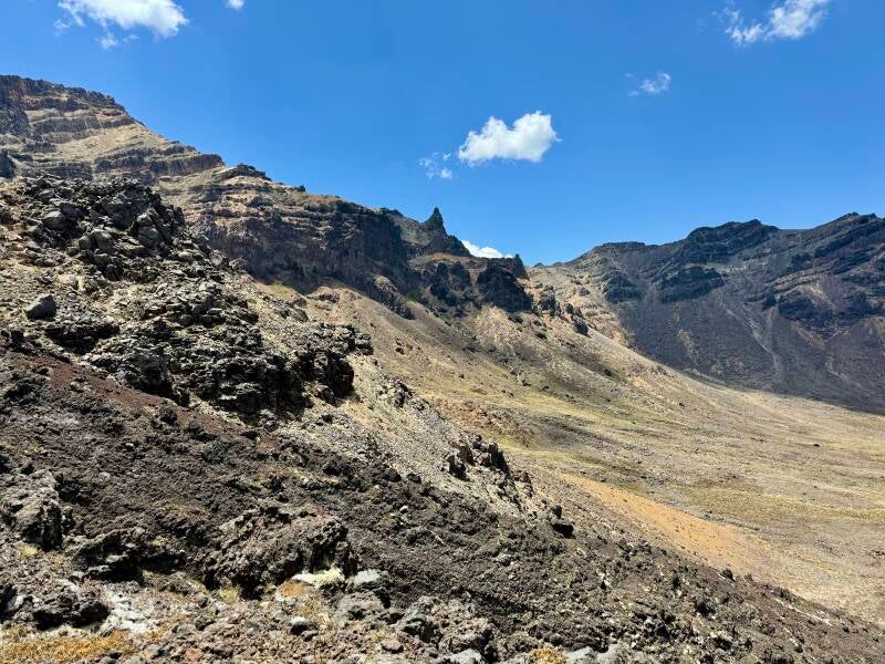
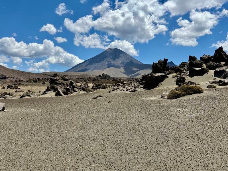
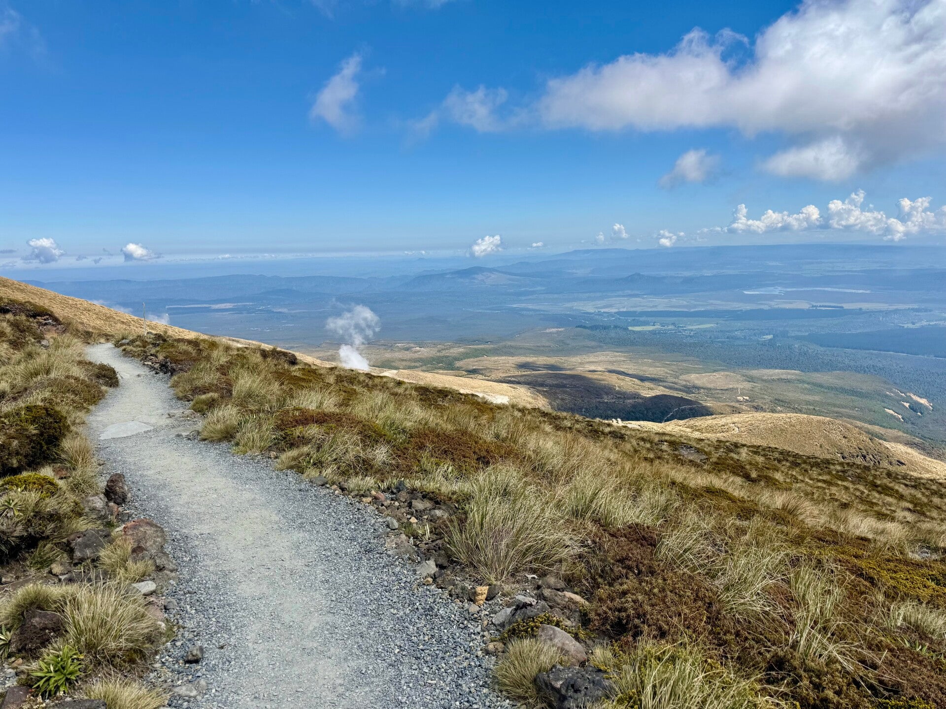
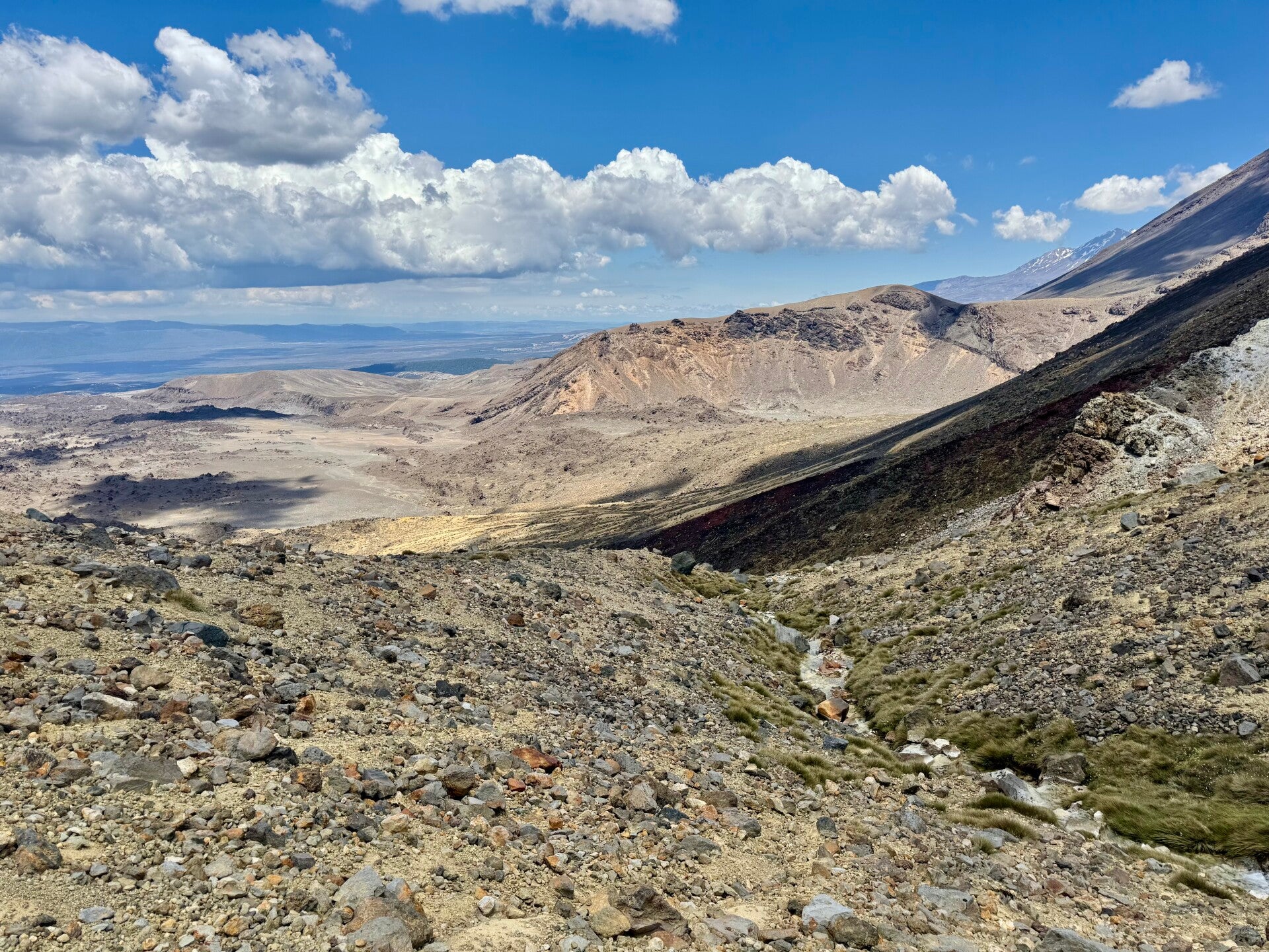
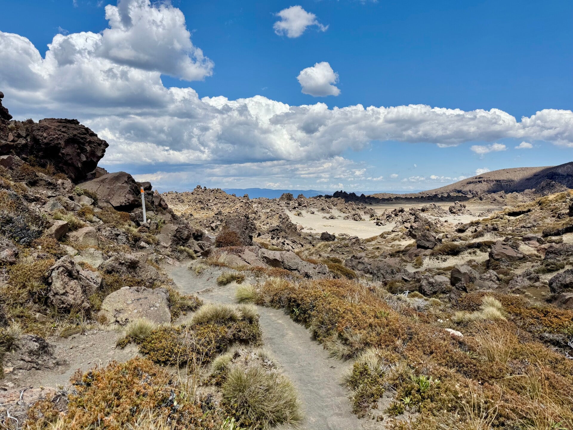
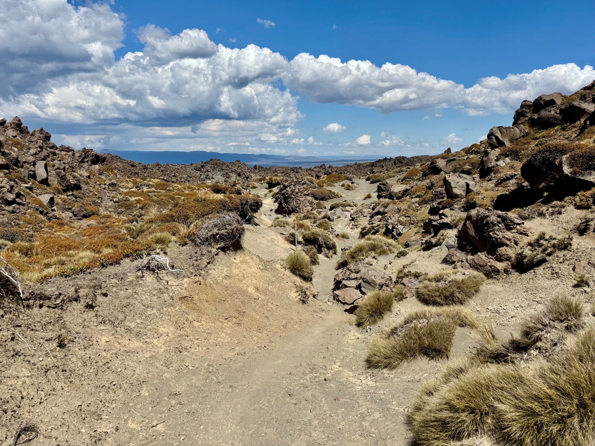
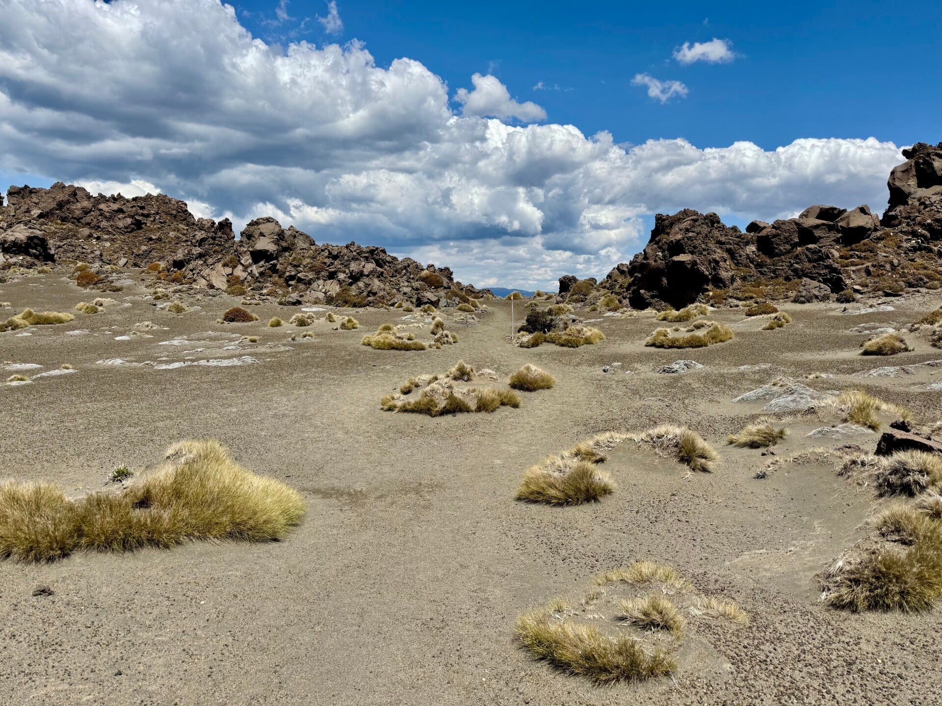
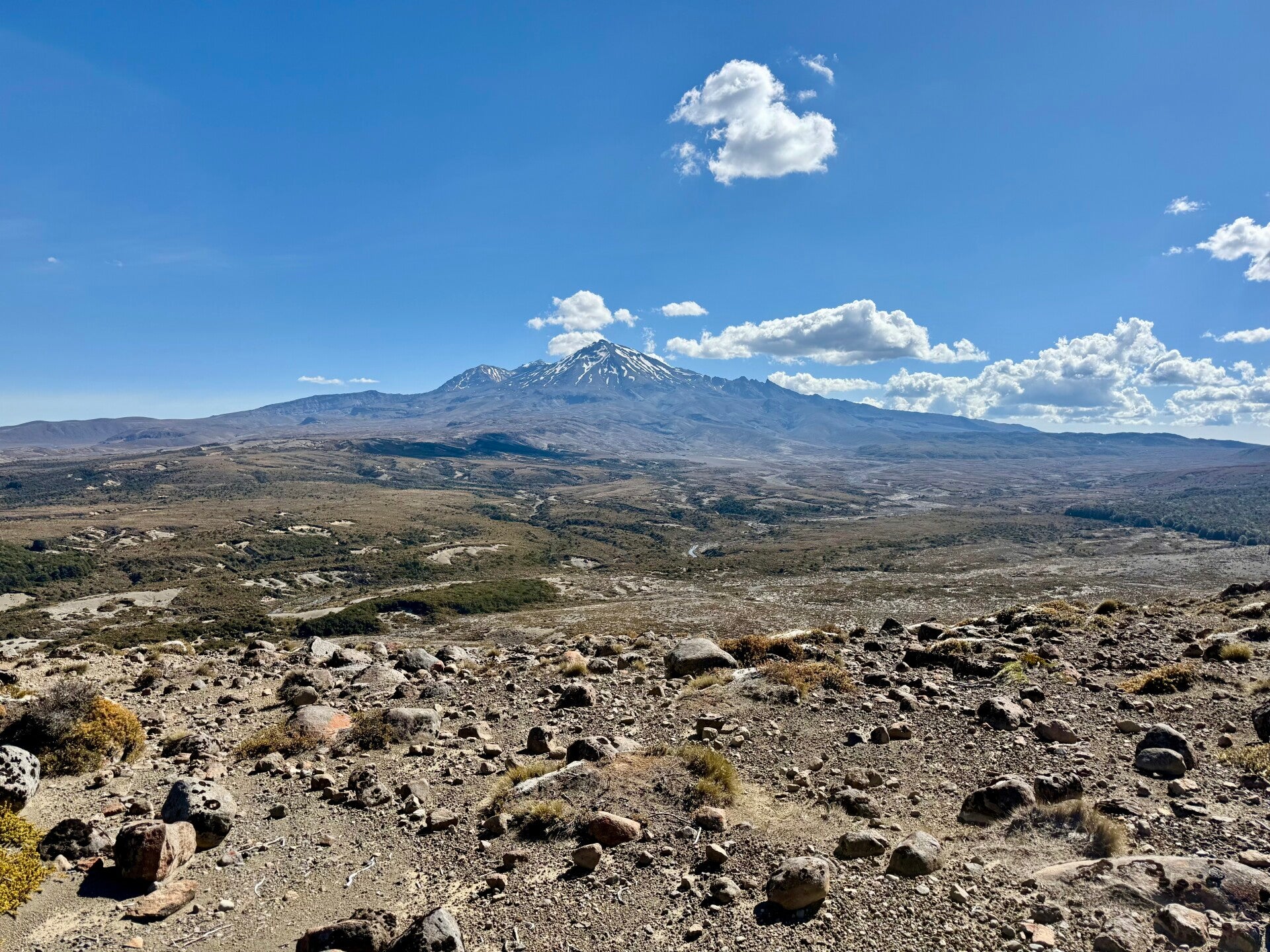
I return to where I left my backpack to eat my lunch and continue my trek, heading east at the junction. I begin a descent where the contrast is striking: I go from a multitude of hikers to a soulless landscape! The terrain is very slippery, so I take my time to avoid twisting an ankle; in fact, yesterday on this very section, a hiker I had met about ten days earlier suffered a double fracture and had to be airlifted to a hospital! This section is certainly tricky to navigate but is beautiful, made up of dramatic black lava flows and, beyond, a desolate jumble of rocks. I try to imagine the power of the eruptions that created these gigantic, scorched, shattered landscapes, giving an impression that is both majestic and apocalyptic.
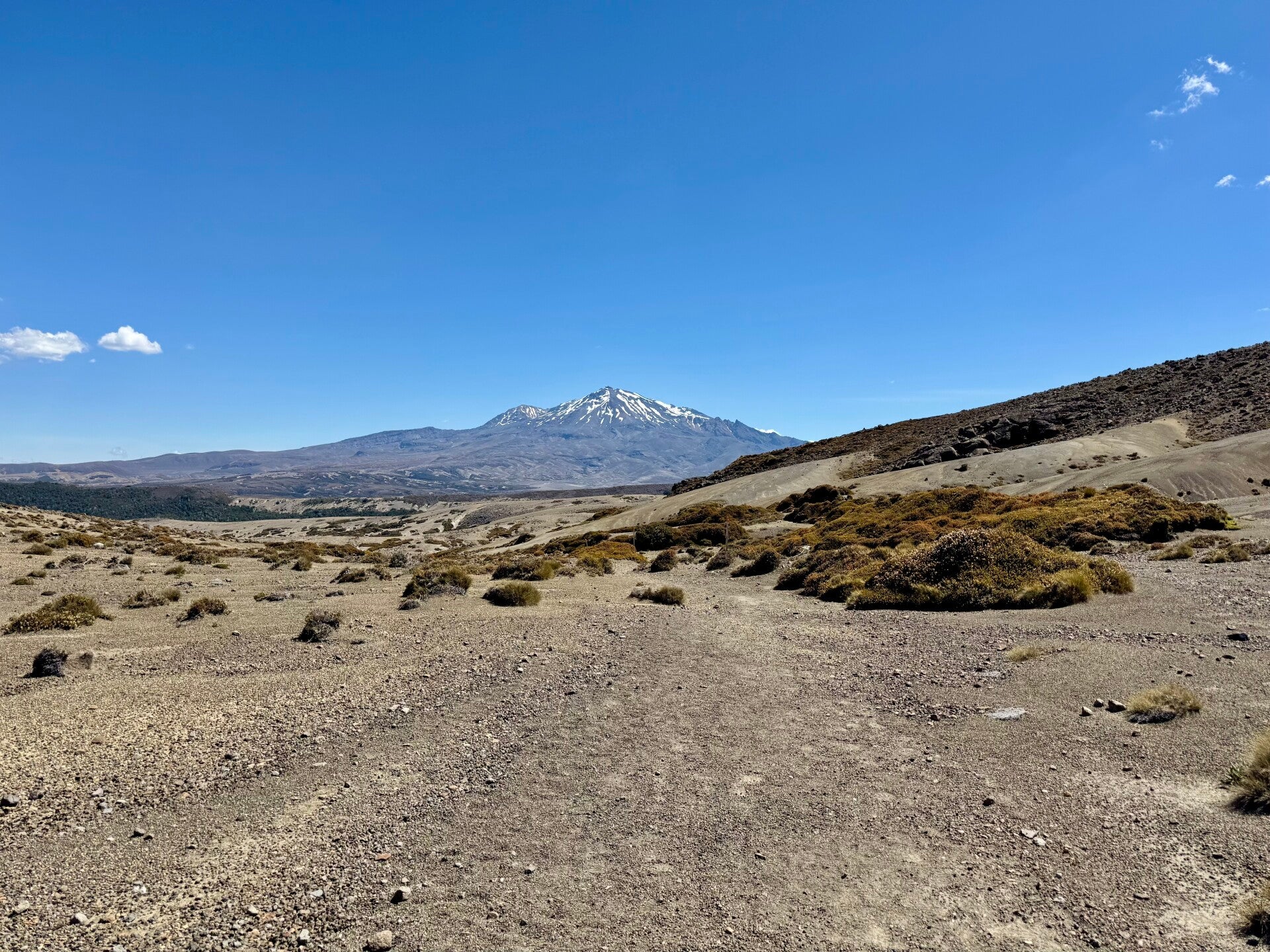
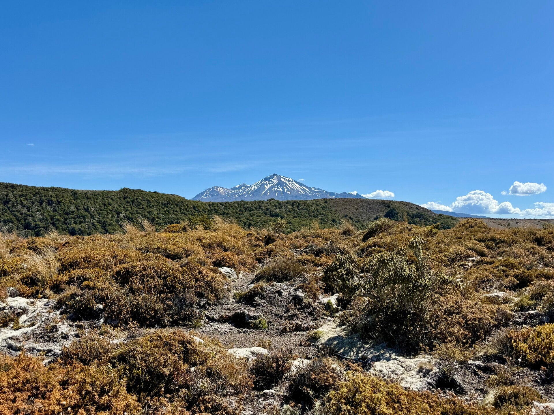
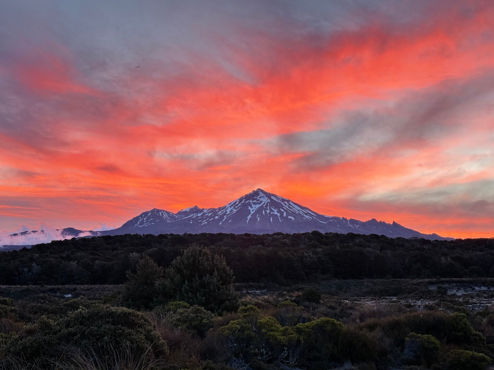
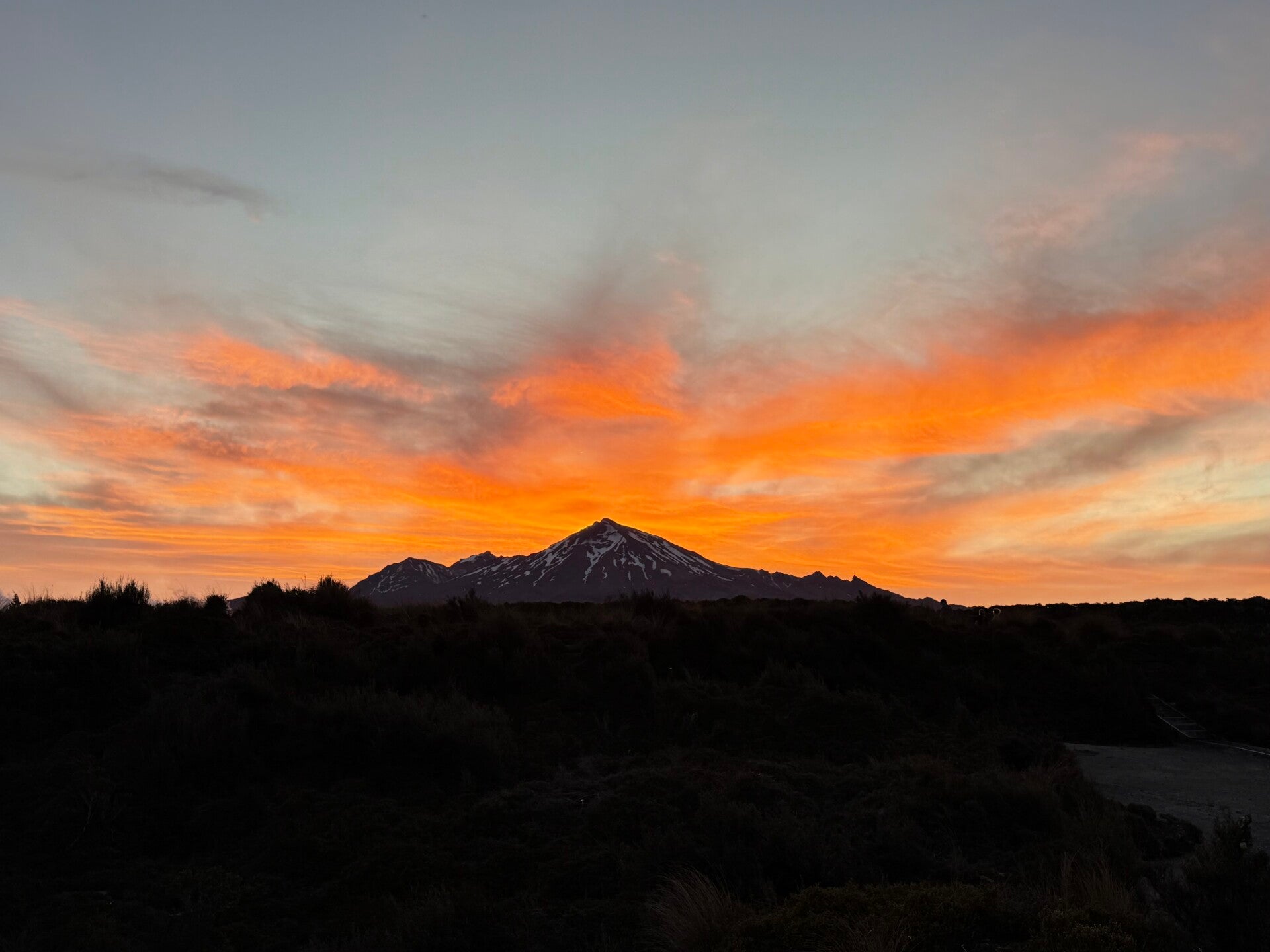
At the bottom of the slope, the path makes a right angle to the south. From here, vegetation consisting of yellowed grasses and a few low shrubs reappears in a kind of desert plain. To my right, I have Mount Ngauruhoe, and in my sights, the giant Reapehu, a 2,797-meter-high volcano whose peaks are still snow-capped. It's absolutely stunning! Since starting the trail some fifty days ago, this is the first time such a variety of spectacular landscapes have unfolded in a single day! I'm thrilled to know I have four days to explore it all and enjoy these wonders.
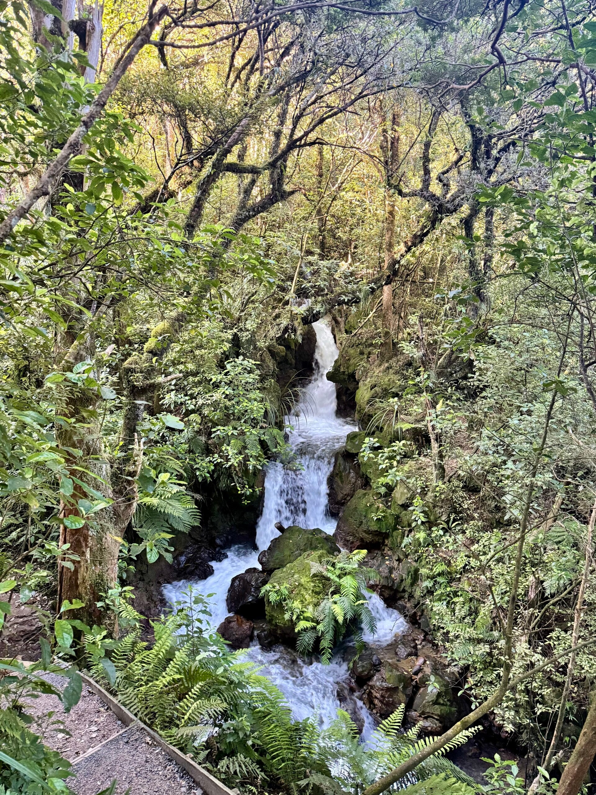
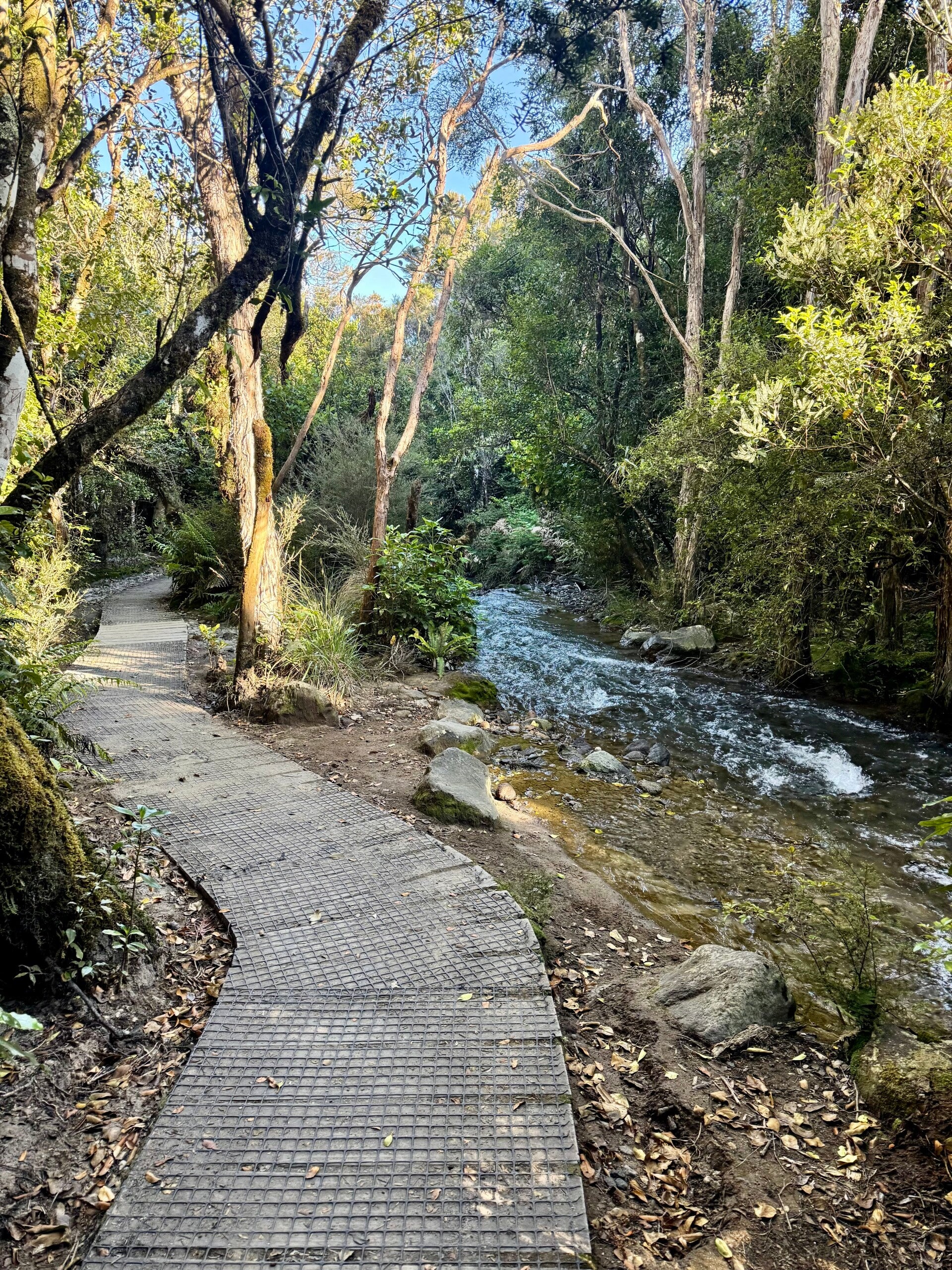
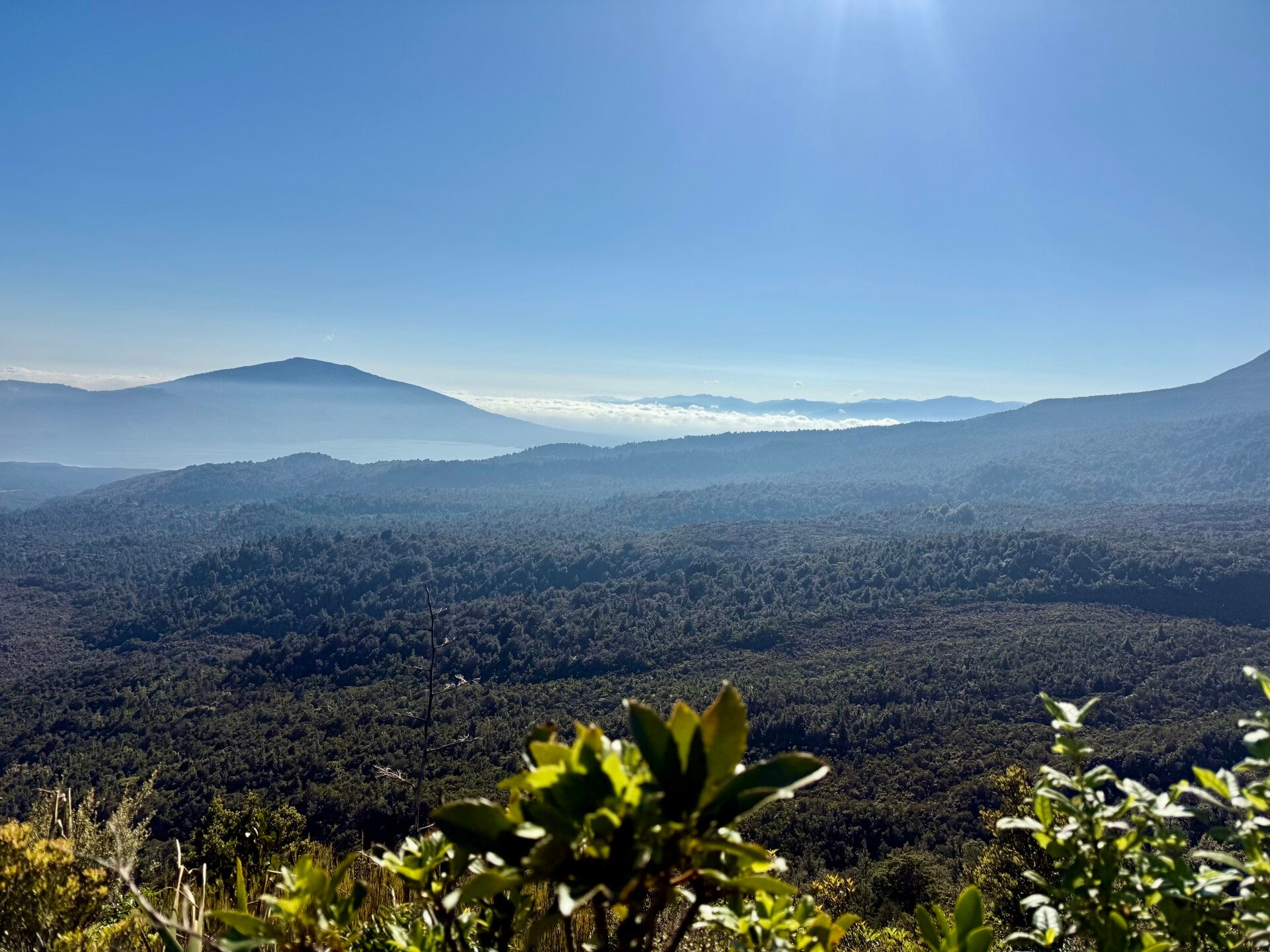
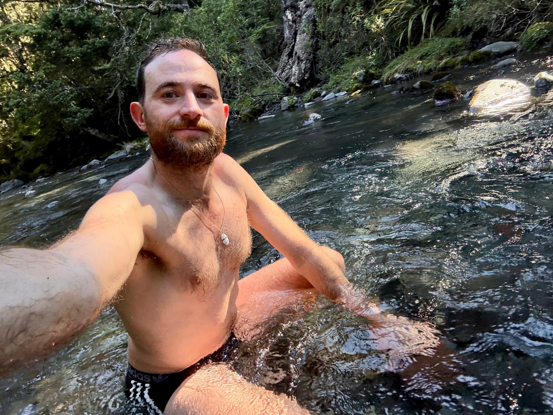
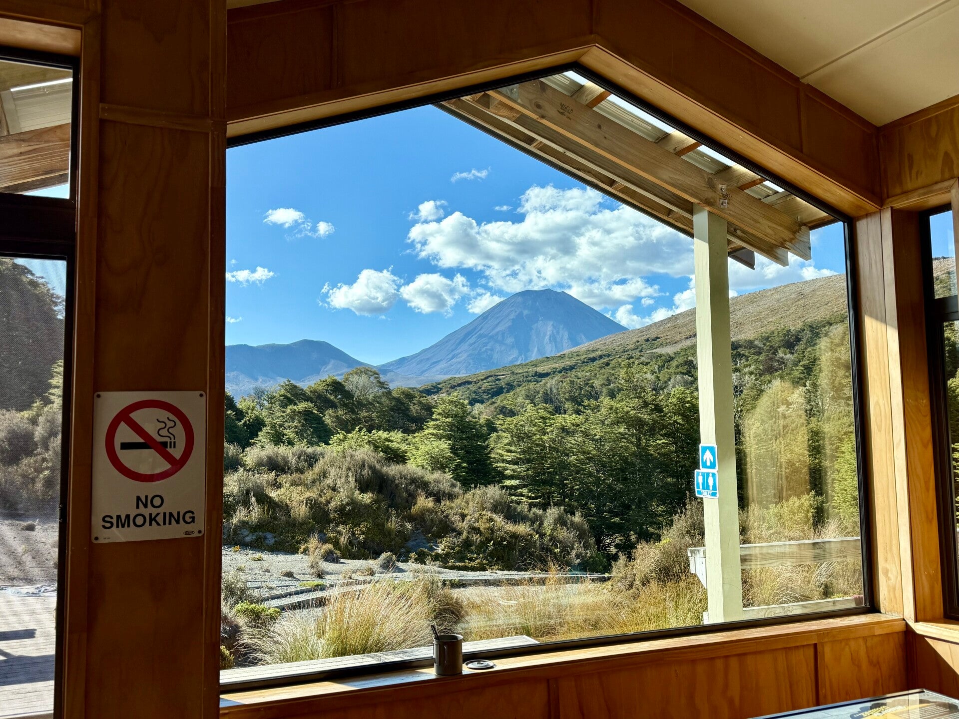
I end my day by crossing a forest and arrive at the evening hut, located at an altitude of 1100 meters. Like the previous one on Mount Pirongia some 300 km earlier, it's very large and luxury hut (for hikers!). A river flowing below the building allows me to take a bath in very cool water—what a delight after sweating so much and climbing 1500 meters in elevation during the day! The view from the common room overlooks the two volcanoes and invites relaxation: taking advantage of the opportunities presented to me, I decide that tomorrow will be a rest day right here to enjoy the surroundings!
A place like this doesn't come along every day!


Add comment
Comments