🗓️ January 17, 2026
🏁 Kilometers : 1919
We resume our hike this morning after two days of rest in Nelson. We need to hitchhike back to the Pelorus River bridge, where we'd left the trail three days earlier. We decide to have a two-person race, like something out of a reality TV show, with a pizza for the winners. I team up with Natalie, and Matteo and Jolly are our competitors. A race is a race, so we try to get ahead by positioning ourselves at the front of the road to catch the first vehicles. There aren’t many cars, and for good reason: it is Saturday morning and barely 7:00 AM. We wait for a good twenty minutes until a car stops, but the driver can only take us about ten kilometers. During the ride, we pass Matteo and Jolly, who are still waiting by the side of the road, and we take the lead!
After ten kilometers, our driver drops us off next to a small gas station, perfect for stopping. Natalie goes to order a coffee, while I remain on the lookout for cars to flag down, without much success. Matteo and Jolly take advantage of the situation to overtake us, not missing the opportunity to taunt us as they go. After 5-10 minutes, we get back in the car, but we can't catch up with them for the next 60 or so kilometers. When we reach the bridge, we can only acknowledge our defeat. I hope I can get my revenge next time!
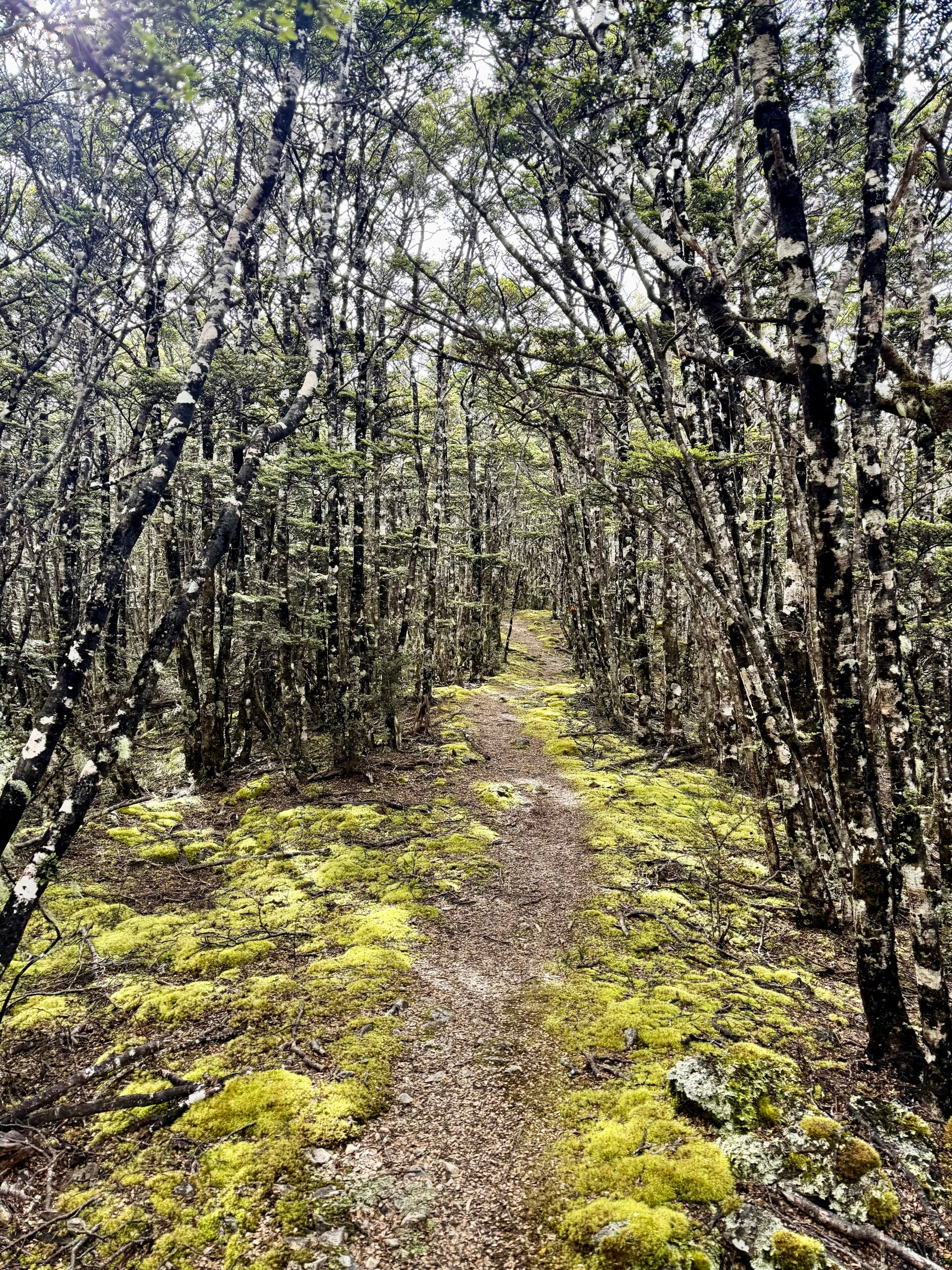
We have 27 kilometers to cover today to reach the Middy Creek hut, 14 of which are easy along a gravel road and 13 on a trail. The route follows the Pelorus River, which is a bit brownish and swollen from the rains of the previous two days.
I'm carrying about 20 kilos on my shoulders: basic equipment, provisions for 8-9 days, and water. I'm taking more precautions than usual, since the weight of the pack can sometimes be unnerving, and I desperately want to avoid twisting an ankle.
When I take a break halfway through at the Captains Creek hut, I get devoured by sandflies, a type of tiny midge that can bite you through your clothes. These little insects are known to be everywhere on the South Island, and I realize I'm not going to enjoy their company very much!
I finish the last five kilometers by continuing along the Pelorus River. Three times today, I've had to cross rope bridges made of wire mesh, which aren't very reassuring: they sway, they creak, and they don't look very sturdy… in fact, it's forbidden to have two people across at a time.
I arrive at the evening hut, which is very rustic, a bit dirty, and just as full of sandflies as the outside. So I prefer to pitch my tent on the grass nearby, with a view of the forest and the river—it's much more charming. I take a quick dip in the river; the water is very cold. My companions arrive at camp quite late; they had to help a hiker who broke his ankle. I was thinking I must have heard a helicopter this afternoon!
The evening ends with dinner, serving ourselves as dinner to the sandflies.
🗓️ January 18, 2026
🏁 Kilometers : 1938
Waking up early to a blue sky and crisp air is perfect for feeling extra motivated and lighthearted! Today's plan: a 19-kilometer hike through stunning forests. The trail climbs gradually 700 meters, sometimes following streams, and requires scrambling over numerous fallen trees and countless roots. My pack is heavy, but I feel great, buoyed by the beautiful weather and this almost untouched nature.
Each night we have the option of sleeping in a rustic hut or a tent. As long as the weather is good, I prefer to pitch my tent and enjoy the outdoors. The river just below me lulls me to sleep.
🗓️ January 19, 2026
🏁 Kilometers : 1944
We'll only cover a short distance today, but with a steep incline. Our group is splitting up: Natalie and Yvan want to move faster, Matteo wants to head back down to the nearest town for the day to repair his tent and backpack, which were riddled with holes by mice the night before, and Jolly wants to wait for him so he won't be left alone. Although I like everyone, I have to make a choice, and since Jolly's birthday is coming up soon, I decide to stay with him; I've brought enough food anyway.
For the first kilometer, we follow a river that leaps merrily over its rocky bed, the trail zigzagging between the right and left banks, requiring us to cross it many times. In one of the pools, we spot an eel about 60-70 centimeters long. Although it's still early and the water is freezing, we decide, somewhat as a dare, to jump in naked.
We continue our climb at a leisurely pace and arrive early at the Starveall hut, perched on a ridge just at the edge of the forest and very exposed to the wind. But lying down in the sun-drenched grass, we spend a pleasant afternoon.
Playing a few card games, of course!
🗓️ January 20, 2026
🏁 Kilometers : 1957
Today's plan is a 13-kilometer hike along the ridge. A strong wind blew all night, making the hut creak, and is expected to continue throughout the day. The sun is hidden behind very high-altitude clouds; we won't be warm, but at least we have views of the entire mountain range. Most of the time, we're above the natural tree line, surrounded by a landscape of rocky outcrops and lush grass. Despite the cloud cover and the very timid sun, the scenery is superb, and the gusting wind is invigorating. I sometimes struggle to walk in a straight line because the gusts make me sway, but since the ridgeline is slightly rounded, there's no danger of being blown off the trail.
I feel full of energy today, and doubt is creeping in: should I stay with Matteo and Jolly, who only plan to do 13 kilometers today, or continue on to the higher peaks of the Richmond Range and cover another five kilometers? I feel a kind of internal conflict and frustration at stopping early when I still have plenty of energy left, but at the same time, I promised Jolly I'd stay with her until her birthday three days later. I also have to admit it's partly my fault because I relied on the group and didn't take the time to study the maps and notes and decide what would be best for me.
So, I decide to stay with Jolly and Matteo for this section, and for the next mountain range next week, to make the decisions according to my own conscience… if it fits with the group, all the better. But at least I'll be following my own desires.
🗓️ January 21, 2026
🏁 Kilometers : 1970
We wake up to rain this morning. The section of the hike I hadn't done the day before is one of the most beautiful on the route, and also one of the highest. It leaves a slightly bitter taste knowing I could have done it yesterday in good weather. Matteo decides to stay at the hut and not attempt the climb. Jolly hesitates and wants to stay with him, but personally, I feel confident. After a moment of hesitation, Jolly reluctantly decides to come with me but still tried to convince me to stay so as not to scatter the group. In my heart, I know the group might come to an end, and I don’t want to wait any longer for the others. I feel it is time to unleash the horse within me, the one that is just itching to gallop!
The hut is located at an altitude of 1100 meters. We begin the ascent of the two peaks of this section: Little Rintoul, which rises to 1643 meters, followed by Mont Rintoul at 1731 meters, descending approximately 400 meters between the two. Progress is slow, the trail climbing long scree slopes with unstable rocks, then following the windswept ridges. Several times we have to use our hands and feet, but overall I am thoroughly enjoying being out here in this vibrant natural setting. The rain is only a light drizzle, and the wind, although cold, doesn't destabilize us on the steepest sections.
After four hours of covering only five kilometers, we reach the halfway hut where we take the opportunity to warm up a bit before continuing on another eight-kilometer section that climbs for the third time, exceeding 1,500 meters in altitude. The rest of the trail is under the forest canopy along the ridges.
The hut for the night is located next to a small, idyllic lake where it would have been lovely to swim if only the sun would deign to show its face. But today it preferred to play hide-and-seek behind the clouds.
🗓️ January 22, 2026
🏁 Kilometers : 1984
It rained heavily all evening and night, and we have to wait until around 9 or 10 a.m. for the rain clouds to finally disperse and give way to a timid sun. As we take our first steps into the forest, we realize it is overflowing with water, and numerous small streams have formed haphazardly, creating little waterfalls that cascades across the trail. The problem is that today we have two sections to cross: the first descending to the valley floor, and the second following the main river, which we assume is swollen with rainwater.
And indeed, upon reaching the river and crossing the rope bridge that leads to the hut halfway along the trail, we find the river level higher than usual, but still lower than we had feared.
Four women hikers who had spent the night in this hut are patiently waiting for the river level to recede. They explain that when they woke up, the water level was higher and brown. By midday, it was clear again, though slightly brownish. Since the depth seems reasonable, we decide to tackle this section after having lunch.
We quickly catch up with the group of four hikers who had set off before us. They seem a little nervous about the prospect of their first river crossing. Jolly and I had both taken the "Safe River Crossing" course in Auckland before starting the trail in mid-October. So we are both confident and give them a quick lesson. Two techniques can be used: alone, facing the river and using hiking poles for support, or in a group, moving forward in a straight line, close together, a bit like cancan dancers. We choose the second method; in a group, everyone will feel more confident. I position myself at the beginning of the line, acting as a sort of pillar, the current pressing against my leg. If one of us falters, the others are there to help stabilize them. The technique works, and although the water is above our hips in the current, we successfully cross the river.
The trail continues through the forest, following the stream along the steep slopes. Several times we have a sheer drop beside us and must be careful not to stumble; we would fall several meters if we landed in the river. Seven times we cross the stream, each of us gaining confidence with each crossing. The joy of overcoming each new challenge puts a smile on everyone's face, and by the time we reach the end of the trail at the evening's hut, we all feel like we've had one of our best days.
There are nine of us sleeping in the hut, which only has six beds, but by playing Tetris, we find a way to make it all work.
Two more days of hiking and we'll be done with the Richmond Range.
🗓️ January 23, 2026
🏁 Kilometers : 2012
We decide to get up early today because we want to do a long day of hiking for Jolly's birthday. The weather is cloudy, but the sun occasionally peeks through. I set off a little before Jolly and plan to wait for her at one of the huts along the trail. Right away, I tackled a 1,000-meter climb in the first 3 kilometers. My legs feel like lead, and I am panting like a bull.
Once I reach the top of the pass, the trail follows the ridges, sometimes offering beautiful views, sometimes shrouded in the mist of clouds clinging to the peaks. I can see the next hut six kilometers before reaching it, as it is located at the bottom of the valley opening up before me. I receive a message from Jolly telling me to push on and that she would join me later if she makes it.
After taking my lunch break at the hut, I continue along a section that alternates between rocky slopes and low shrubs. I reach the second hut, marking my 2000th kilometer since the start at Cape Reinga on October 21st. It is still early afternoon, so I decide to push on. The elevation changes become significant again, and numerous showers accompany me throughout the afternoon. I have to cross several rivers during the day; my shoes are soaked from the previous day and therefore can’t dry. The views are magnificent; the Richmond Range truly spoils us with its beauty and diversity.
The last kilometer is through a rather marshy peat bog, a mixture of water and mud, before having to take off my shoes. There are only four of us in the hut that night, so I got a bed!
I covered 28 kilometers today and climbed over 2000 meters of elevation gain! A good day!
🗓️ January 24, 2026
🏁 Kilometers : 2032
Before starting the story of this last section, I'd like to wish my big sister a very happy 40th birthday! The number 40 doesn't suit her; for me, she stopped at 20 years old 20 years ago!
We leave the hut around 7:30 a.m. so we can arrive as early as possible in the small village of Saint Arnaud. We have 12 kilometers to cover on the last stretches of the Richmond Range, through forests and along ridges. It is rather cold this morning; we can see that the clouds had dusted the peaks over 1500 meters with snow overnight.
We are eager to reach the village. Our clothes smell awful, and we haven’t showered in over a week (I bathed in rivers every evening to maintain personal hygiene, but not all my companions like to take a dip in cold river waters !)
And most importantly, we can go to a restaurant and properly celebrate Jolly's 35th birthday (it was the day before). Cheers!
Photos from January 17 and 18, 2026


Photos from January 21 and 22, 2026


Photos from January 23 and 24, 2026


Add comment
Comments