🗓️ March 07, 2026
🏁 Kilometers : 2893
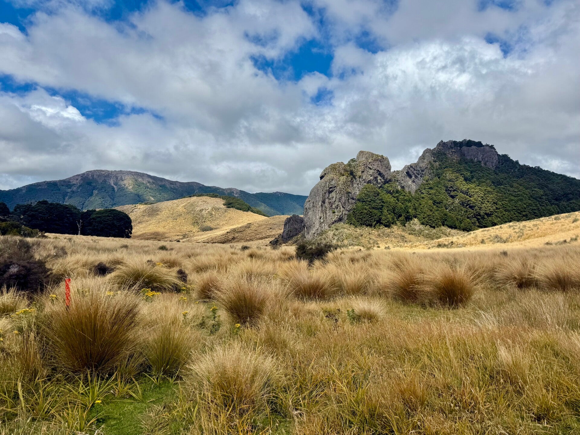
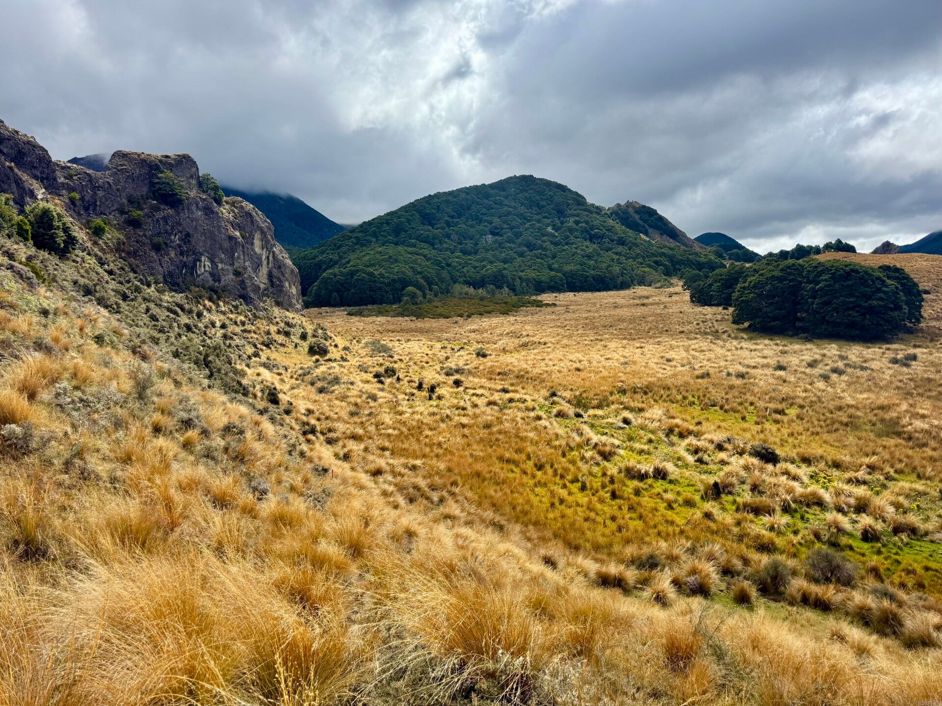
We're setting off on our last major leg, six days of hiking, with a rest day planned for tomorrow, March 8th, which is forecast to be very rainy. Today we have 23 kilometers to cover, including 6 on a gravel road before entering the Takitimu forest massif.
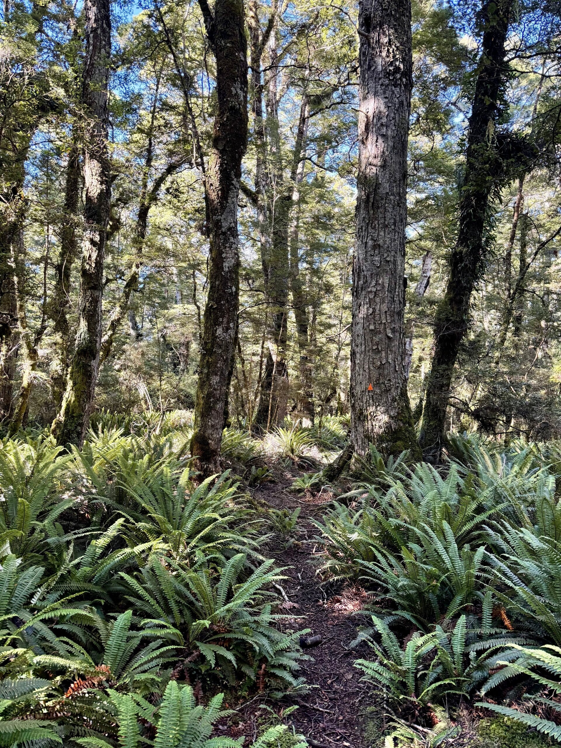
As soon as we enter the woods, we realize the next 17 kilometers will be tough! We climb a slope where the rather rutted trail winds its way with difficulty between trees, roots, mud, and patches of ferns. The rain starts to fall, as if to add another layer of difficulty, though it doesn't last long.
Once we reach the summit of the pass, we descend the opposite slope, which is also incredibly muddy! I miraculously manage not to slip and return to flatter terrain.
The rest of the route is the most challenging, alternating several times between marshland and forest. Every time we cross the marshes (which are actually long stretches of tall grass with very damp ground), we have to guess which way to go. Only a few widely spaced markers are scattered about (most often hidden by tall clumps of grass), leaving us to be the heroes of our own disastrous adventures! How comical it would be for you to watch us cursing through the tall grass that reaches our faces, trying to find a path riddled with traps, mud-filled holes, or stagnant water into which our legs sink up to our knees. The task is arduous, but I must admit that the Indiana Jones aspect gives me quite a bit of pleasure, even if I'm panting like a bull from the exertion and let out a few exclamations of surprise when my shoe fills with foul-smelling liquid.
We had underestimated this day's hike, and it is late when we arrive at the evening's hut, which supposedly has 12 beds… or so the official website says. In reality, there are two huts: a new one, with eight beds, which is already full, and a dilapidated old one, smelling of damp soot, perfect for a few Jeffrey Dahmer or Jack the Ripper types looking for peace and quiet deep in the forest… Faced with this very tempting choice, I prefer to pitch my tent, even though rain is forecast for the following day.
Don't call me Nicolas R-hut-man anymore!
🗓️ March 08, 2026 (day off trail)
It rains all day, the river next to the hut swelled and doubled in size. We spend most of our time playing cards.
🗓️ March 09, 2026
🏁 Kilometers : 2915
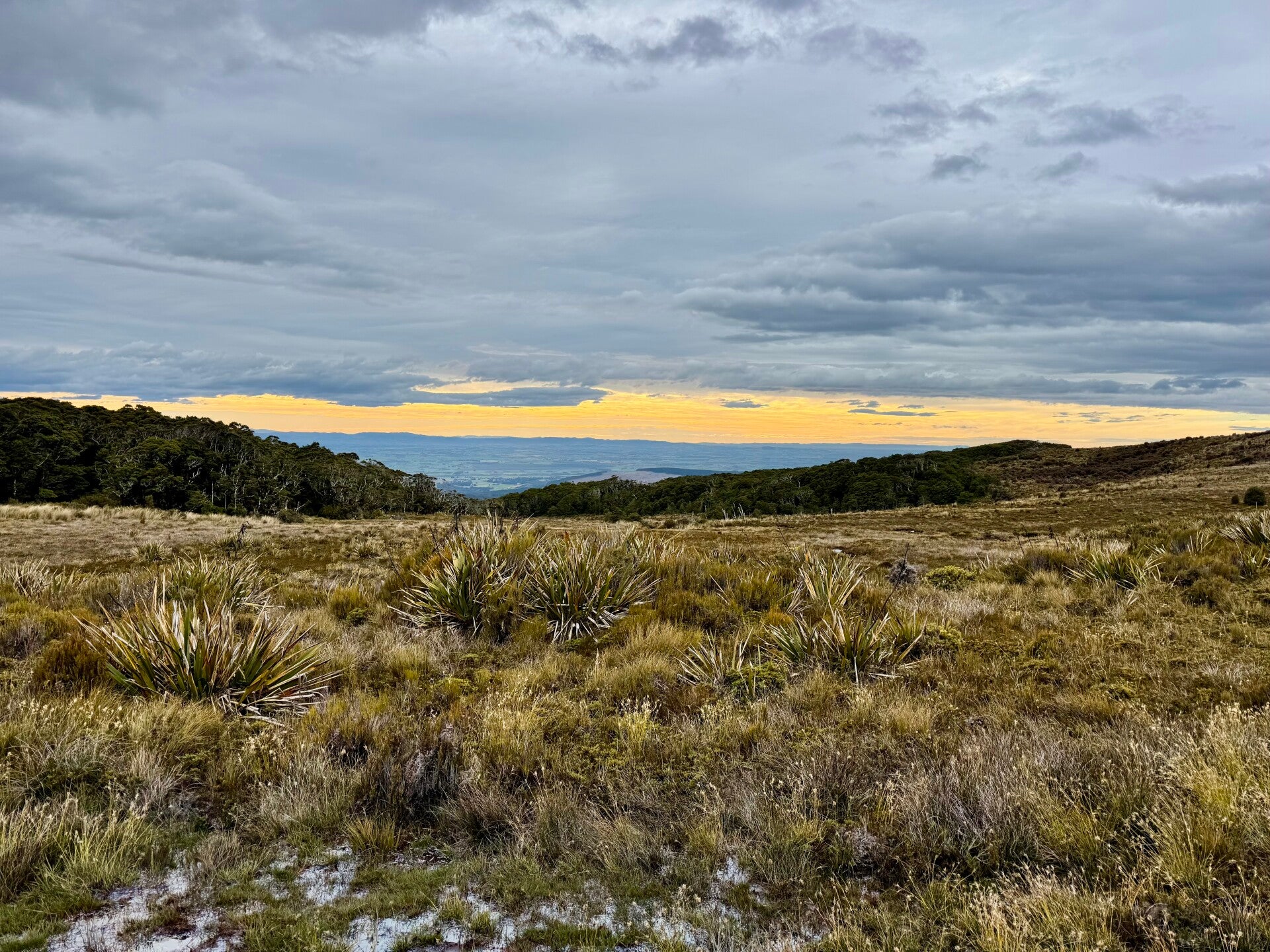
The ground is so saturated this morning after yesterday's rain that our shoes instantly become sponges. Temperatures plummeted overnight, and it's a cold morning. The trail leads through a small marshy area before entering the forest for the rest of the day. I stand here, my hands cold, my feet numb, the sun timidly refusing to peek through the clouds, and the morning wisps of mist. I pause for a moment to fully appreciate where I am: almost at the very tip of New Zealand, surrounded by beautiful yet rugged nature, on one of the southernmost landmasses on Earth. Part of me is hungry to explore new places again and again, while the other part is happy to be finishing this adventure that began almost five months ago and longs for some comfort and rest.
After a four-hour hike, we reach the hut where we have lunch, then walk for another three hours to the evening hut, rustic but once the fire in the stove is lit, it reveals a certain charm. I realize that the adventure will be over in about a week and that I will miss my companions Natalie and Yvan very much.
🗓️ March 10, 2026
🏁 Kilometers : 2948
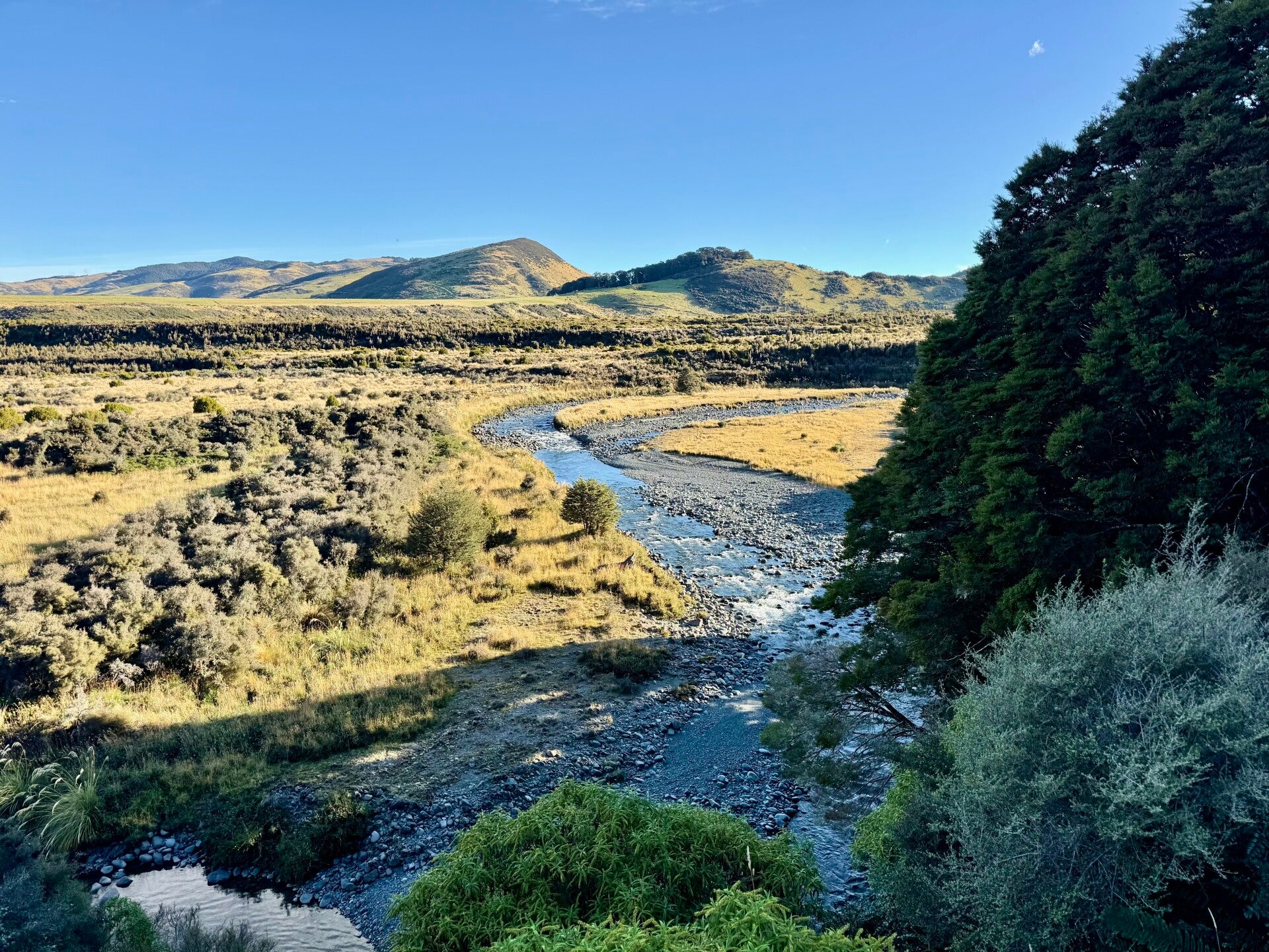
A day spend walking through sheep and cattle paddocks, passing by Birchwood Station (in New Zealand, "station" is the name given to large sheep and cattle farms).
It's very cold when we set off; the ground is frozen, and we have to ford several rivers and streams. Fortunately, the sun quickly comes out to warm us up. Over 32 kilometers, we walk from one paddock to another, initially walking together and then splitting up after lunch. Natalie, a real live wire, asks us often absurd questions throughout the morning to liven up our conversations, questions like, "If you had the choice, would you rather have feet instead of hands or hands instead of feet?" to which I reply, "If you had the choice, would you rather have a mouth instead of an asshole or an asshole instead of a mouth?" No comment…
The afternoon passes in the company of cows and sheep (Natalie took a nasty fall in some animal droppings – check out the photo, it's quite something!), and we spend the evening in a sort of simple farmhouse cabin, made available by a trail angel for a small fee, complete with a bed and a hot shower!
🗓️ March 11, 2026
🏁 Kilometers : 2983
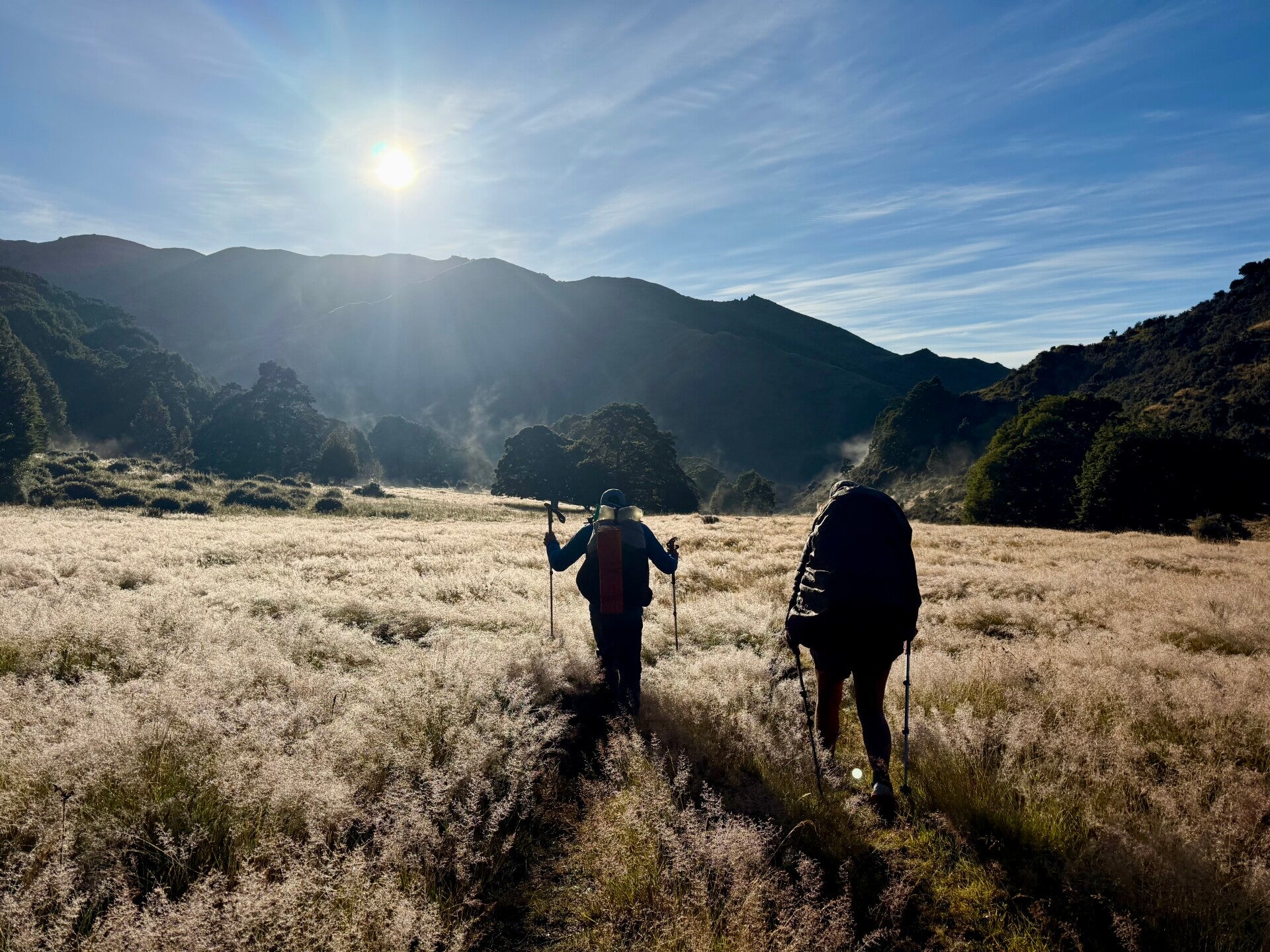
Today's hike begins on a path alongside some sheep enclosures. I see Natalie walking in my direction, even though she had set off five minutes before me. Behind her, a large cloud of dust gathers, which turns out to be a flock of sheep chasing her, forcing her to turn back—the scene is comical! We find a place to step aside and let the sheep pass.
We have a steep slope to climb. Whoever designed the trail didn't bother to make switchbacks, or even a proper path at all, and we climb directly up the grass, which is very steep. At the top, the view of the surrounding area is superb. This sunny morning, without a single breath of wind and with just a few lingering patches of mist on the horizon, seems frozen in time.
For the rest of the day, we wander between fragrant eucalyptus forests and less subtly scented cow and sheep enclosures…
In the late afternoon, we enter Longwood Forest, and finding no place to camp, we decide to eat our dinner and continue on, hoping to find a spot before nightfall. Luckily, around 8 p.m., we stumble upon a small clearing that will do just fine.
Tomorrow, we'll begin crossing Longwood Forest. I've often mentioned the muddy sections we've had to deal with since the start of the trip, but this forest apparently breaks all records. Like a final obstacle, it stands between us and the ocean, which we should reach the day after tomorrow.
We know we're going to be wading through mud! Exciting!
🗓️ March 12, 2026
🏁 Kilometers : 3006
The predicted muddy day lived up to its promise!
We wake up early, knowing we have a long hike ahead. From the very first steps, we are trudging through mud, though it never rose above our ankles. For a few hours, we scramble under the cover of the woods or through marshes; progress is arduous because the mud is everywhere. The forest is beautiful; the gnarled trees, draped in moss and lichen, seem mysterious and magical. Indeed, the name "Longwood" sounds like it comes straight out of a fairy tale or a Disney film.
We are then treated to a 4-kilometer respite on a very decent path that descends to an old gold quarry where Chinese miners had tried to strike it rich at the beginning of the century. A stream allows us to refill our water bottles, and then we set off again for what is predicted to be the worst section.
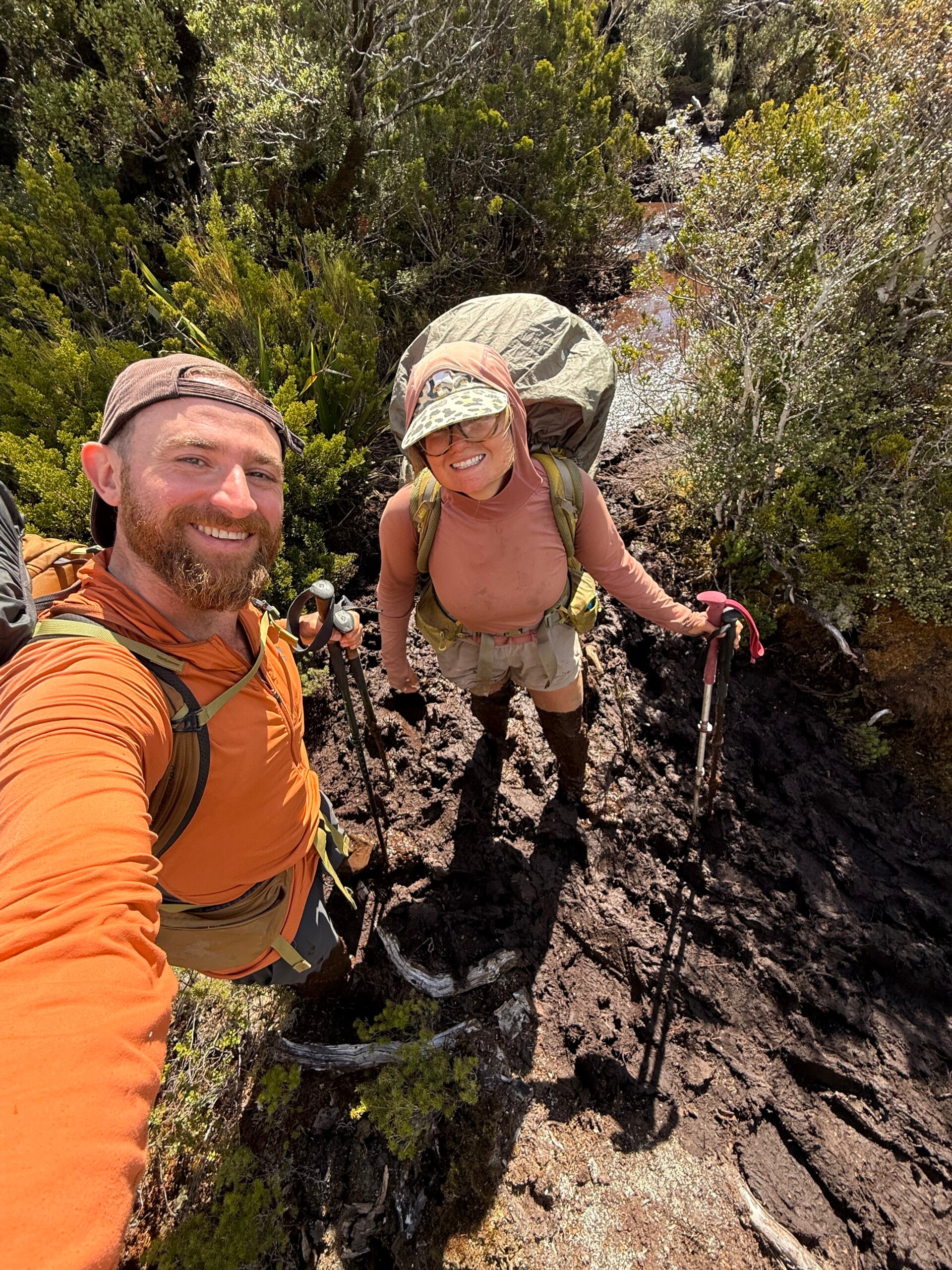
And indeed, veritable pools of mud await us. Sometimes it's possible to get around them by cutting through the bushes, but when there are no alternatives, we plunge our legs in and get a nauseating muck up to our thighs.
We initially have different techniques: Yvan tries to hop gracefully around to avoid the worst spots, I try to skirt the deeper areas but know I'll get dirty anyway, and Natalie goes straight through without a second thought—we even give her the nickname "Panzer."
Of course, as the difficulty increases, we all end up covered in mud, but Natalie definitely holds the record. She even has to retrieve her shoe with her hands from the bottom of a muddy puddle and ends up with brown stains all the way up to her chest… much to our amusement! We've rarely laughed so much!
As the afternoon wears on, we are becoming quite exhausted, but there is no way we can camp; we have to keep going. Around 6:30 p.m., we finally find a small spot in the forest where we have to pack the tents tightly to make them all fit. We had hoped to reach the ocean some twelve kilometers further down, but we have to face the facts: the Longwood forest had won out!
🗓️ March 13, 2026
🏁 Kilometers : 3030
It is a beautiful morning when I wake up, but it had rained overnight, which doesn’t help the already extremely muddy state of the trail. I decide to proceed "Natalie Panzer" style, meaning I go straight through the middle to avoid wasting time going around the mud pits. And there are mud pits absolutely everywhere; there isn’t a single meter of trail spared. It almost seems ridiculous, it is so surreal! Numerous tree trunks litter the ground, forcing us to make detours or climb over stumps. We have to anticipate slips and sometimes even grab onto branches to avoid falling.
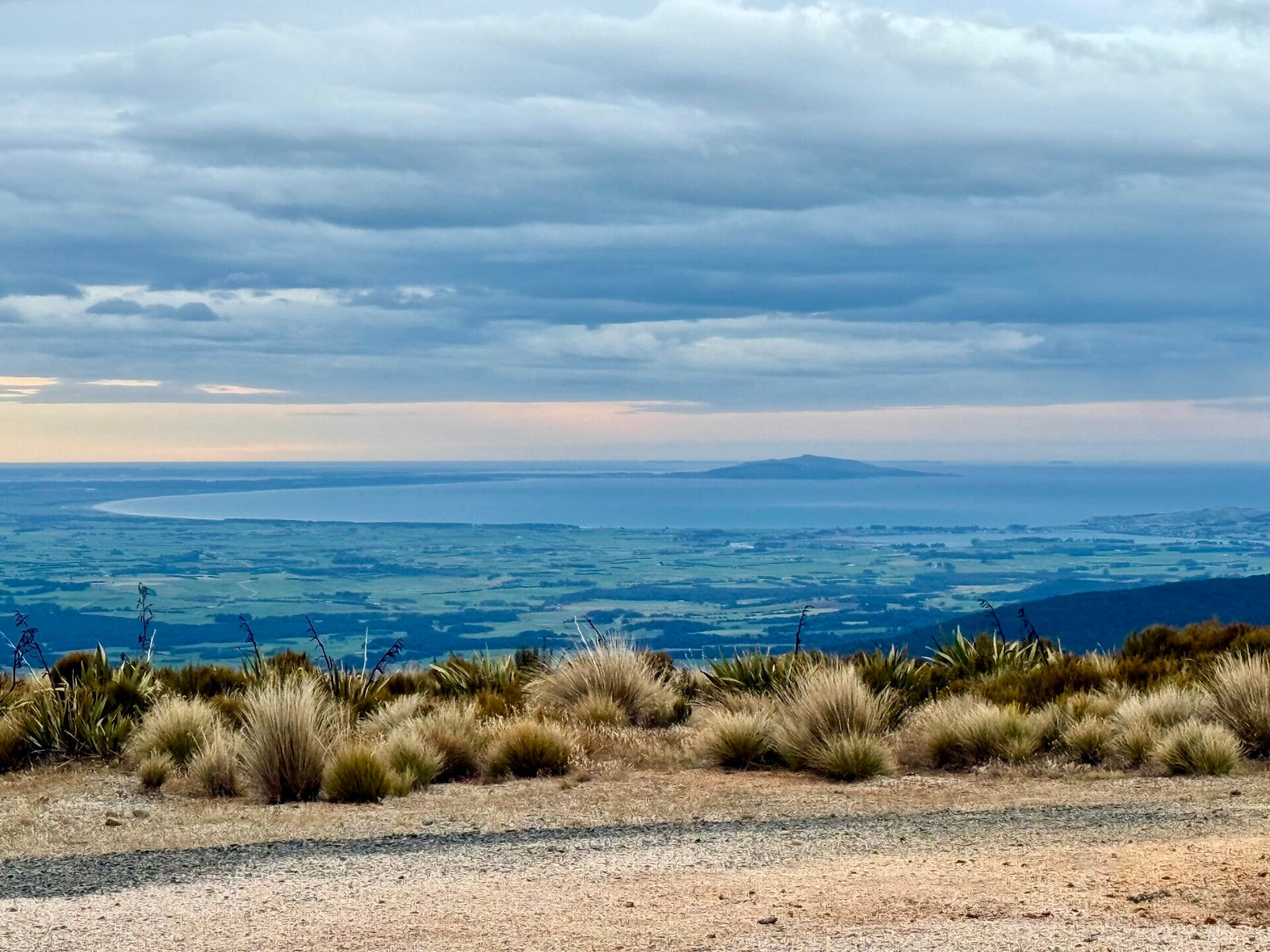
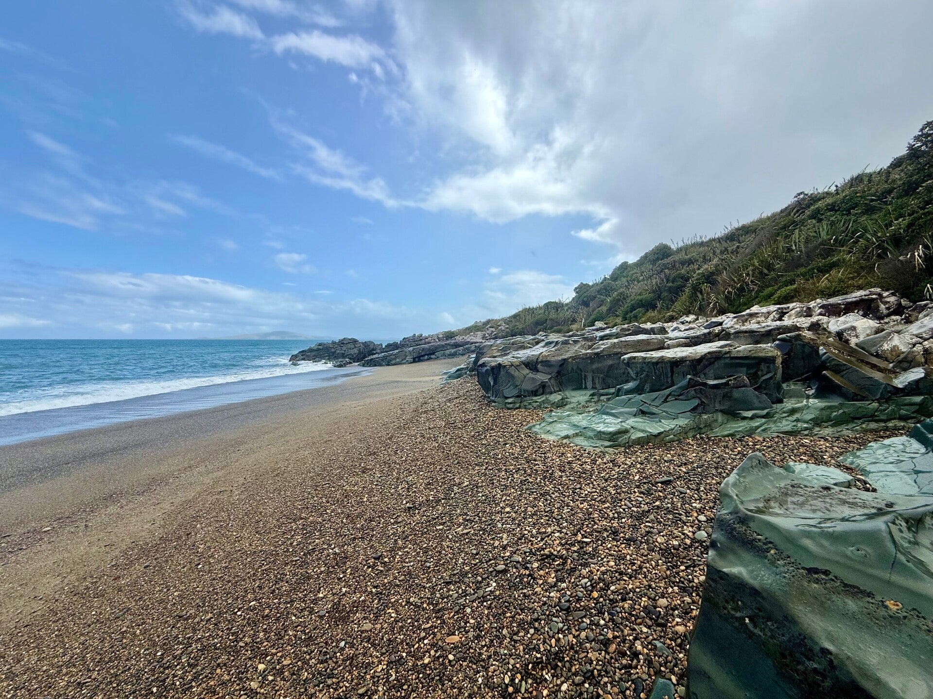
After three hours this morning, I finally reach the edge of the forest. It took me about 14 hours over two days to cover some 30 kilometers! I continue along a road for a few more kilometers and then I reach the ocean! We hadn't seen it since the Queen Charlotte Trail, 1200 kilometers further north, at the very northern tip of the South Island. I can see the foothills of Stewart Island in the distance. Beyond it lies the vast ocean, and 2600 kilometers further south, Antarctica!
I walk another 10 kilometers or so along the beach and reach the village of Riverton where we spend the night. Two more days of walking and the trek will be over!
Photos from March 07 to 09, 2026


Photos from March 10 to 11, 2026


Photos from March 12 to 13, 2026


Add comment
Comments